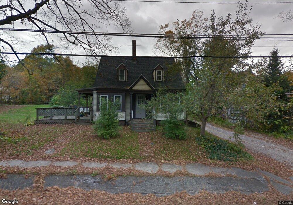
29 Maple St Monmouth, ME 04259
Estimated Value: $288,420 - $397,000
3
Beds
2
Baths
1,959
Sq Ft
$181/Sq Ft
Est. Value
About This Home
This home is located at 29 Maple St, Monmouth, ME 04259 and is currently estimated at $355,355, approximately $181 per square foot. 29 Maple St is a home located in Kennebec County with nearby schools including Hall-Dale Elementary School, Marcia Buker School, and Dresden Elementary School.
Create a Home Valuation Report for This Property
The Home Valuation Report is an in-depth analysis detailing your home's value as well as a comparison with similar homes in the area
Home Values in the Area
Average Home Value in this Area
Tax History Compared to Growth
Tax History
| Year | Tax Paid | Tax Assessment Tax Assessment Total Assessment is a certain percentage of the fair market value that is determined by local assessors to be the total taxable value of land and additions on the property. | Land | Improvement |
|---|---|---|---|---|
| 2024 | $3,491 | $170,700 | $31,900 | $138,800 |
| 2023 | $3,090 | $170,700 | $31,900 | $138,800 |
| 2022 | $2,894 | $148,400 | $27,700 | $120,700 |
| 2021 | $2,790 | $148,400 | $27,700 | $120,700 |
| 2020 | $3,333 | $148,400 | $27,700 | $120,700 |
| 2018 | $2,604 | $148,400 | $27,700 | $120,700 |
| 2017 | $2,604 | $148,400 | $27,700 | $120,700 |
| 2016 | $2,866 | $173,200 | $27,700 | $145,500 |
| 2015 | $2,702 | $173,200 | $27,700 | $145,500 |
| 2013 | $2,520 | $173,200 | $27,700 | $145,500 |
Source: Public Records
Map
Nearby Homes
- 745 Main St
- 18 Gray Mill Rd
- 723 Main St
- 256 Blue Rd
- 297 Norris Hill Rd
- 3 Ridge Rd
- 15 Blue Rock Rd Unit 26
- 15 Blue Rock Rd Unit 24
- 15 Blue Rock Rd Unit 34
- 51 Sandy Dr
- 33 Sandy Dr
- 35002 Waugan Rd
- 25 Hansons Wood Rd
- 200 Back St
- 61 Highland Terrace
- 57 Neal Ln
- 11 Neal Ln
- 147 N Main St
- 83 Larry Dr
- 34 Gerber Ln