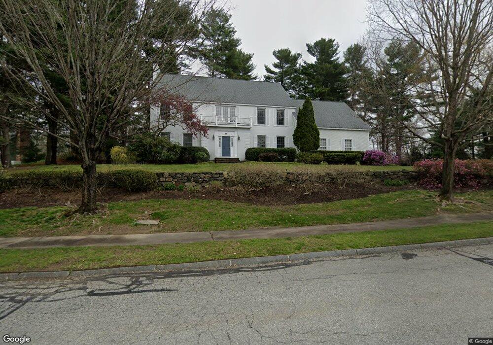
29 Mattison Dr Concord, MA 01742
Estimated Value: $2,067,982 - $4,195,000
4
Beds
4
Baths
4,185
Sq Ft
$668/Sq Ft
Est. Value
About This Home
This home is located at 29 Mattison Dr, Concord, MA 01742 and is currently estimated at $2,793,996, approximately $667 per square foot. 29 Mattison Dr is a home located in Middlesex County with nearby schools including Willard School, Concord Middle School, and Concord Carlisle High School.
Ownership History
Date
Name
Owned For
Owner Type
Purchase Details
Closed on
Nov 10, 2015
Sold by
Kobos Michael H and Kobos Katherine H
Bought by
29 Mattison Drive Rt and Kobos Mcihael H
Current Estimated Value
Purchase Details
Closed on
Feb 28, 1997
Sold by
Contino Robert A and Contino Elizabeth
Bought by
Kobos Michael H and Kobos Katherine H
Create a Home Valuation Report for This Property
The Home Valuation Report is an in-depth analysis detailing your home's value as well as a comparison with similar homes in the area
Home Values in the Area
Average Home Value in this Area
Purchase History
| Date | Buyer | Sale Price | Title Company |
|---|---|---|---|
| 29 Mattison Drive Rt | -- | -- | |
| Kobos Michael H | $890,000 | -- |
Source: Public Records
Mortgage History
| Date | Status | Borrower | Loan Amount |
|---|---|---|---|
| Previous Owner | Kobos Michael H | $550,000 | |
| Previous Owner | Kobos Michael H | $550,000 | |
| Previous Owner | Kobos Michael H | $400,000 |
Source: Public Records
Tax History
| Year | Tax Paid | Tax Assessment Tax Assessment Total Assessment is a certain percentage of the fair market value that is determined by local assessors to be the total taxable value of land and additions on the property. | Land | Improvement |
|---|---|---|---|---|
| 2025 | $257 | $1,939,400 | $578,700 | $1,360,700 |
| 2024 | $25,464 | $1,939,400 | $578,700 | $1,360,700 |
| 2023 | $23,607 | $1,821,500 | $526,000 | $1,295,500 |
| 2022 | $21,485 | $1,455,600 | $375,100 | $1,080,500 |
| 2021 | $21,466 | $1,458,300 | $409,300 | $1,049,000 |
| 2020 | $21,134 | $1,485,200 | $409,300 | $1,075,900 |
| 2019 | $19,506 | $1,374,600 | $380,600 | $994,000 |
| 2018 | $19,339 | $1,353,300 | $372,900 | $980,400 |
| 2017 | $18,793 | $1,335,700 | $355,300 | $980,400 |
| 2016 | $19,527 | $1,402,800 | $395,300 | $1,007,500 |
| 2015 | $17,830 | $1,247,700 | $366,200 | $881,500 |
Source: Public Records
Map
Nearby Homes
- 89 Mattison Dr
- 132 Williams Rd
- 850 Old Road to 9 Acre Corner
- 497 Old Road to 9 Acre Corner
- 367 Powder Mill Rd
- 56 Seymour St
- 32 Bolton St
- 29 King Ln
- 47 Bridgecourt Ln
- 40 Rookery Ln Unit 5
- 72 Rookery Ln Unit 3
- 1201 Old Marlboro Rd
- 55 Staffordshire Ln Unit B
- 51 Staffordshire Ln
- 111 Central St
- 53 Prairie St
- 21 Concord Greene Unit 8
- 16 Concord Greene Unit 5
- 56 Rookery Ln Unit 4
- 70 McCallar Ln
- 6 Mattison Dr
- 0 Mattison Dr Lot 8
- 11 Mattison Dr
- 53 Mattison Dr
- 393 Mattison Dr
- 64 Mattison Dr
- 65 Mattison Dr
- 363 Mattison Dr
- 356 Mattison Dr
- 321 Williams Rd
- 230 Williams Rd
- 341 Mattison Dr
- Lot 6 Mattison Dr
- 22-B Mattison Dr
- 212 Williams Rd
- 105 Mattison Dr
- 326 Mattison Dr
- 326 Mattison Dr Unit 326
- 110 Mattison Dr
- 110 Mattison Dr Unit 110
Your Personal Tour Guide
Ask me questions while you tour the home.