
Seller's Agent in 2025
Joe Daigle
Joe Daigle Realty, LLC
(603) 345-1136
4 in this area
57 Total Sales
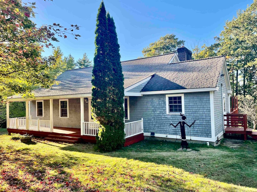
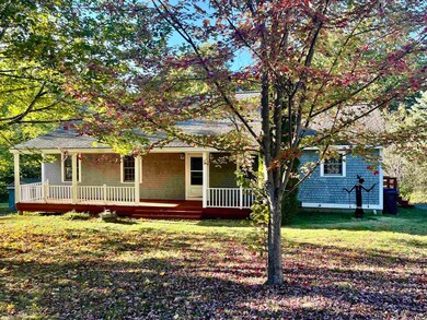
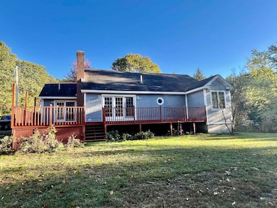
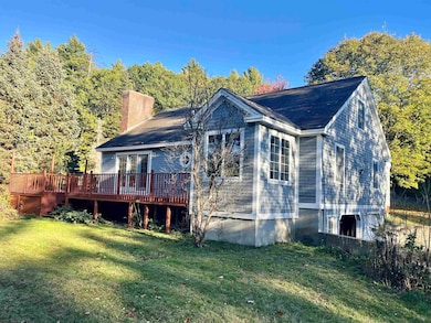
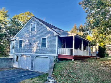
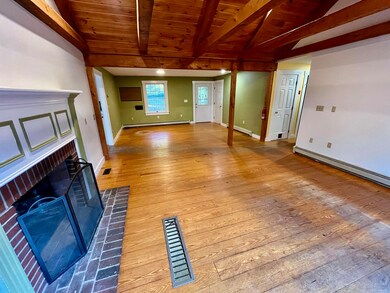
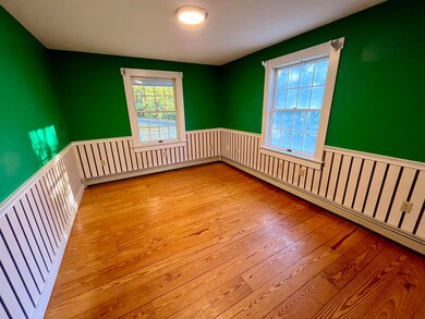
Fantastic cape in country setting abundant with fruit trees and flowering bushes. Open concept living room/dining room area features dramatic beam cathedral ceiling with fireplace and wood floors. Eat-in kitchen has sliders to the deck. Master bedroom has ensuite. The 2nd floor has a large, finished room for crafts or a 4th bedroom plus an ample storage area. There is a 2-car garage under and plenty of storage space in the basement. Quick closing possible.
Last Agent to Sell the Property
Joe Daigle Realty, LLC License #061469 Listed on: 10/10/2025
| Date | Type | Sale Price | Title Company |
|---|---|---|---|
| Warranty Deed | $575,000 | -- | |
| Quit Claim Deed | -- | -- | |
| Quit Claim Deed | -- | -- | |
| Warranty Deed | $190,000 | -- | |
| Warranty Deed | $190,000 | -- |
| Date | Status | Loan Amount | Loan Type |
|---|---|---|---|
| Open | $460,000 | New Conventional | |
| Previous Owner | $49,562 | Unknown | |
| Previous Owner | $60,113 | Unknown | |
| Previous Owner | $152,000 | Purchase Money Mortgage | |
| Previous Owner | $180,500 | Purchase Money Mortgage |
| Date | Event | Price | List to Sale | Price per Sq Ft |
|---|---|---|---|---|
| 11/19/2025 11/19/25 | Sold | $575,000 | 0.0% | $305 / Sq Ft |
| 10/20/2025 10/20/25 | Pending | -- | -- | -- |
| 10/10/2025 10/10/25 | For Sale | $575,000 | -- | $305 / Sq Ft |
| Year | Tax Paid | Tax Assessment Tax Assessment Total Assessment is a certain percentage of the fair market value that is determined by local assessors to be the total taxable value of land and additions on the property. | Land | Improvement |
|---|---|---|---|---|
| 2025 | $8,768 | $419,900 | $179,000 | $240,900 |
| 2024 | $8,583 | $419,900 | $179,000 | $240,900 |
| 2023 | $7,919 | $419,900 | $179,000 | $240,900 |
| 2022 | $7,309 | $277,800 | $117,100 | $160,700 |
| 2021 | $6,895 | $277,800 | $117,100 | $160,700 |
| 2020 | $6,895 | $277,800 | $117,100 | $160,700 |
| 2019 | $6,828 | $277,800 | $117,100 | $160,700 |
| 2018 | $5,167 | $277,800 | $117,100 | $160,700 |
| 2017 | $6,460 | $235,600 | $96,200 | $139,400 |
| 2016 | $6,227 | $235,600 | $96,200 | $139,400 |
| 2015 | $6,187 | $219,700 | $82,300 | $137,400 |
| 2014 | $6,086 | $225,400 | $82,300 | $143,100 |
Seller's Agent in 2025
Joe Daigle
Joe Daigle Realty, LLC
(603) 345-1136
4 in this area
57 Total Sales
Buyer's Agent in 2025
Caroline Verow
Keller Williams Realty-Metropolitan
(603) 860-5633
4 in this area
116 Total Sales
Source: PrimeMLS
MLS Number: 5065408
APN: GOFF-000004-000097-000004
Disclaimer: Certain information contained herein is derived from information provided by parties other than Homes.com. All information provided is deemed reliable, but is not guaranteed to be accurate and should be independently verified.
![]() Copyright 2026 PrimeMLS, Inc. All rights reserved. This information is deemed reliable, but not guaranteed. The data relating to real estate displayed on this display comes in part from the IDX Program of PrimeMLS. The information being provided is for consumers’ personal, non-commercial use and may not be used for any purpose other than to identify prospective properties consumers may be interested in purchasing.
Copyright 2026 PrimeMLS, Inc. All rights reserved. This information is deemed reliable, but not guaranteed. The data relating to real estate displayed on this display comes in part from the IDX Program of PrimeMLS. The information being provided is for consumers’ personal, non-commercial use and may not be used for any purpose other than to identify prospective properties consumers may be interested in purchasing.
Ask me questions while you tour the home.