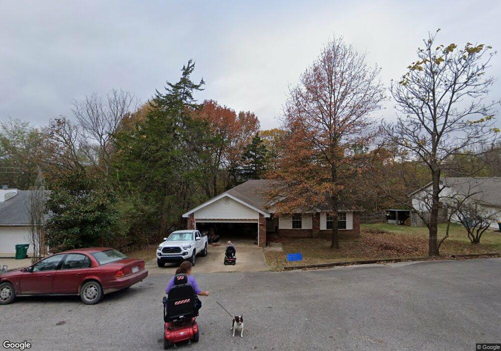
29 N Cedar Ave West Fork, AR 72774
Estimated Value: $237,000 - $292,000
3
Beds
2
Baths
1,285
Sq Ft
$198/Sq Ft
Est. Value
About This Home
This home is located at 29 N Cedar Ave, West Fork, AR 72774 and is currently estimated at $254,706, approximately $198 per square foot. 29 N Cedar Ave is a home located in Washington County with nearby schools including West Fork Elementary School, West Fork Middle School, and West Fork High School.
Ownership History
Date
Name
Owned For
Owner Type
Purchase Details
Closed on
Oct 20, 2020
Sold by
Fulkerson Fred D
Bought by
Fulkerson Fred D and Gower Karen
Current Estimated Value
Purchase Details
Closed on
Sep 27, 2005
Sold by
Dng Enterprises Llc
Bought by
Fulkerson Fred
Purchase Details
Closed on
Apr 15, 1996
Bought by
D&D Ventures, Inc
Purchase Details
Closed on
Jan 12, 1993
Bought by
Gibson David E
Purchase Details
Closed on
Sep 16, 1989
Bought by
Sargent Thomas W
Purchase Details
Closed on
Aug 15, 1985
Bought by
Davis Clyde Thomas
Create a Home Valuation Report for This Property
The Home Valuation Report is an in-depth analysis detailing your home's value as well as a comparison with similar homes in the area
Home Values in the Area
Average Home Value in this Area
Purchase History
| Date | Buyer | Sale Price | Title Company |
|---|---|---|---|
| Fulkerson Fred D | -- | None Listed On Document | |
| Fulkerson Fred | $122,000 | Waco Title Company | |
| D&D Ventures, Inc | $65,000 | -- | |
| Gibson David E | $54,000 | -- | |
| Sargent Thomas W | -- | -- | |
| Davis Clyde Thomas | $29,000 | -- |
Source: Public Records
Tax History
| Year | Tax Paid | Tax Assessment Tax Assessment Total Assessment is a certain percentage of the fair market value that is determined by local assessors to be the total taxable value of land and additions on the property. | Land | Improvement |
|---|---|---|---|---|
| 2025 | $517 | $44,330 | $7,000 | $37,330 |
| 2024 | $615 | $44,330 | $7,000 | $37,330 |
| 2023 | $696 | $44,330 | $7,000 | $37,330 |
| 2022 | $746 | $26,750 | $4,000 | $22,750 |
| 2021 | $746 | $26,750 | $4,000 | $22,750 |
| 2020 | $746 | $26,750 | $4,000 | $22,750 |
| 2019 | $731 | $20,830 | $3,000 | $17,830 |
| 2018 | $756 | $20,830 | $3,000 | $17,830 |
| 2017 | $725 | $20,830 | $3,000 | $17,830 |
| 2016 | $725 | $20,830 | $3,000 | $17,830 |
| 2015 | $725 | $20,830 | $3,000 | $17,830 |
| 2014 | $707 | $20,490 | $4,000 | $16,490 |
Source: Public Records
Map
Nearby Homes
- 67 S Red Oak Ave
- TBD Mineral Springs Rd
- 163 Wheeler St
- 0000 Highway 170
- 185 Wheeler St
- 224 Maple Ave
- TBD Butterfield Ave
- 222 Rivendale Dr
- 12145 Flowers Rd
- 0 W Smith St Unit 1334508
- 365 W Smith St
- 353 W Smith St
- 327 W Smith St
- 385 W Smith St
- 338 Hidden Creek Place
- 260 Culp Trail
- 696 E Thornstone Ave
- 846 James Place
- 815 James Place
- 21 Cedar Ave
- 33 N Cedar Ave
- 33 Cedar Place
- 19 Cedar Ave
- 0 Cedar Ave Unit 347796
- 0 Cedar St Unit 280869
- 0 Cedar St Unit 280874
- 0 Cedar Ave Unit 347792
- 0 Cedar Ave Unit 347788
- 0 Cedar Ave Unit 347794
- 0 Cedar St Unit 280868
- 0 Cedar St Unit 280872
- 0 Cedar St Unit 280870
- 0 Cedar St Unit 280871
- 0 Cedar St Unit 280875
- 0 Cedar St Unit 280873
- 0 Cedar Ave Unit 290409
- 0 Cedar Ave Unit 290401
- 0 Cedar Ave Unit 290402
- 0 Cedar Ave Unit 290400
Your Personal Tour Guide
Ask me questions while you tour the home.