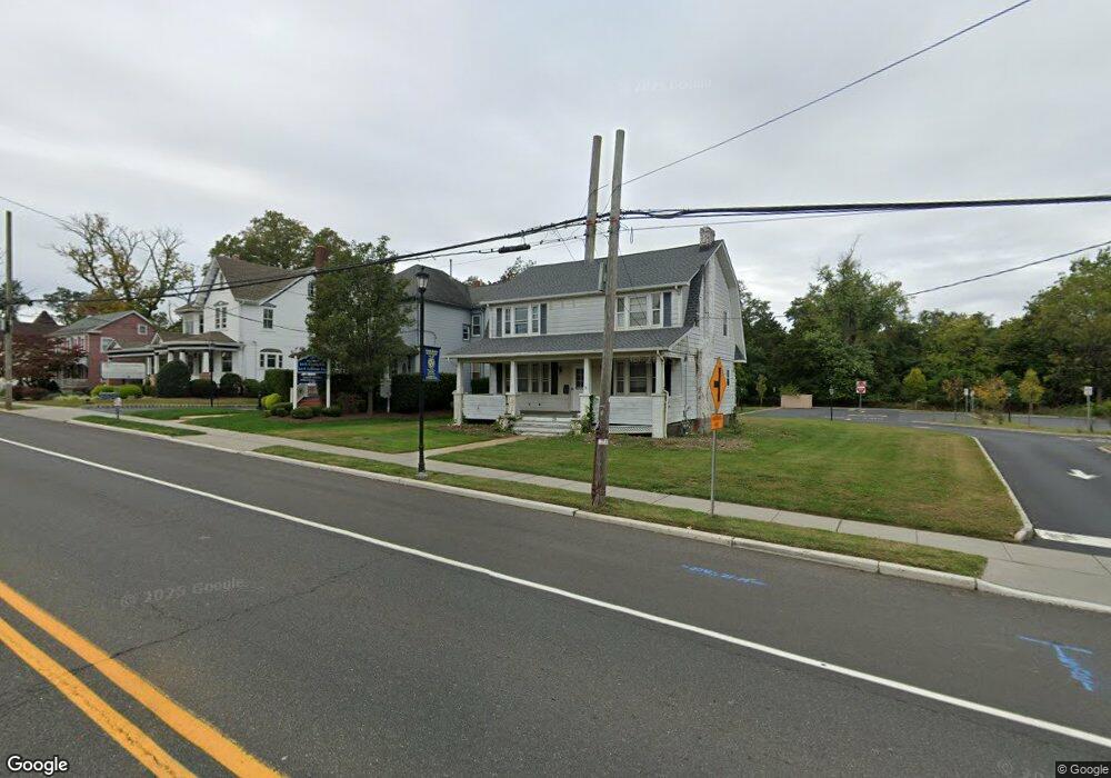
29 N Main St Marlboro, NJ 07746
Estimated Value: $367,000
3
Beds
2
Baths
4,864
Sq Ft
$75/Sq Ft
Est. Value
About This Home
This home is located at 29 N Main St, Marlboro, NJ 07746 and is currently priced at $367,000, approximately $75 per square foot. 29 N Main St is a home located in Monmouth County with nearby schools including Marlboro Elementary School, Marlboro Middle School, and Marlboro High School.
Ownership History
Date
Name
Owned For
Owner Type
Purchase Details
Closed on
Jan 13, 2023
Sold by
Carissimo Vito
Bought by
Xeni Management Llc
Current Estimated Value
Home Financials for this Owner
Home Financials are based on the most recent Mortgage that was taken out on this home.
Original Mortgage
$1,000,000
Outstanding Balance
$967,407
Interest Rate
6.31%
Mortgage Type
New Conventional
Purchase Details
Closed on
Mar 10, 2004
Sold by
Hardy Frances
Bought by
Carissimo Vito and Carissimo Rosemarie
Create a Home Valuation Report for This Property
The Home Valuation Report is an in-depth analysis detailing your home's value as well as a comparison with similar homes in the area
Home Values in the Area
Average Home Value in this Area
Purchase History
| Date | Buyer | Sale Price | Title Company |
|---|---|---|---|
| Xeni Management Llc | $1,375,000 | Quality Title & Abstract | |
| Carissimo Vito | $350,000 | -- |
Source: Public Records
Mortgage History
| Date | Status | Borrower | Loan Amount |
|---|---|---|---|
| Open | Xeni Management Llc | $1,000,000 |
Source: Public Records
Tax History Compared to Growth
Tax History
| Year | Tax Paid | Tax Assessment Tax Assessment Total Assessment is a certain percentage of the fair market value that is determined by local assessors to be the total taxable value of land and additions on the property. | Land | Improvement |
|---|---|---|---|---|
| 2023 | $7,652 | $0 | $0 | $0 |
| 2022 | $7,652 | $325,600 | $204,000 | $121,600 |
| 2021 | $7,489 | $325,600 | $204,000 | $121,600 |
| 2020 | $7,486 | $325,600 | $204,000 | $121,600 |
| 2019 | $7,489 | $325,600 | $204,000 | $121,600 |
| 2018 | $7,362 | $325,600 | $204,000 | $121,600 |
| 2017 | $7,219 | $325,600 | $204,000 | $121,600 |
| 2016 | $7,189 | $325,600 | $204,000 | $121,600 |
| 2015 | $7,014 | $322,500 | $204,000 | $118,500 |
| 2014 | $7,728 | $351,600 | $246,500 | $105,100 |
Source: Public Records
Map
Nearby Homes
- 5 Buck Ln
- 20 N Main St
- 203 Shore Ct
- 1304 Shore Ct
- 202 Shore Ct
- 29 School Rd W
- 16 Jacata Rd
- 67 School Rd E
- 69 School Rd W
- 62 Steeplechase Dr
- 53 Barn Swallow Blvd
- 11 Liberty Rd
- 23 Woodpecker Way
- 680 - 21.04 County Road 520
- 680 - 21.1 County Road 520
- 680 - 21.21 County Road 520
- 680 County Road 520
- 680 - 21.15 County Road 520
- 680 - 21.19 County Road 520
- 680 - 21.11 County Road 520
- 27 N Main St
- 33 N Main St
- 23 N Main St
- 36 N Main St
- 34 N Main St
- 35 Hudson St
- 38 N Main St
- 21 N Main St
- 30 N Main St
- 28 N Main St Unit 201
- 28 N Main St Unit 200
- 28 N Main St Unit 101
- 28 N Main St Unit 100
- 28 N Main St
- 19 N Main St
- 31 Hudson St
- 10 Hobart St
- 197 Nathan Dr Unit 138
- 103 Knightsbridge Ln
- 362 Route 9 Hwy Unit 218