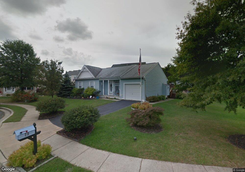
29 Old Field Ct Middle River, MD 21220
Estimated Value: $245,000 - $449,000
Studio
2
Baths
1,172
Sq Ft
$285/Sq Ft
Est. Value
About This Home
This home is located at 29 Old Field Ct, Middle River, MD 21220 and is currently estimated at $333,473, approximately $284 per square foot. 29 Old Field Ct is a home located in Baltimore County with nearby schools including Vincent Farm Elementary, Middle River Middle School, and Kenwood High.
Ownership History
Date
Name
Owned For
Owner Type
Purchase Details
Closed on
Nov 1, 2024
Sold by
Reichenbach Mary
Bought by
Lee Michael and Lee Brooke
Current Estimated Value
Home Financials for this Owner
Home Financials are based on the most recent Mortgage that was taken out on this home.
Original Mortgage
$234,025
Outstanding Balance
$231,946
Interest Rate
6.72%
Mortgage Type
FHA
Estimated Equity
$101,527
Purchase Details
Closed on
Jun 11, 1997
Sold by
Rohe Farm Lane Dev Inc
Bought by
Reichenbach Clair W and Reichenbach Mary T
Create a Home Valuation Report for This Property
The Home Valuation Report is an in-depth analysis detailing your home's value as well as a comparison with similar homes in the area
Home Values in the Area
Average Home Value in this Area
Purchase History
| Date | Buyer | Sale Price | Title Company |
|---|---|---|---|
| Lee Michael | $250,000 | Fidelity National Title | |
| Reichenbach Clair W | $146,839 | -- |
Source: Public Records
Mortgage History
| Date | Status | Borrower | Loan Amount |
|---|---|---|---|
| Open | Lee Michael | $234,025 |
Source: Public Records
Tax History
| Year | Tax Paid | Tax Assessment Tax Assessment Total Assessment is a certain percentage of the fair market value that is determined by local assessors to be the total taxable value of land and additions on the property. | Land | Improvement |
|---|---|---|---|---|
| 2025 | $4,756 | $293,800 | -- | -- |
| 2024 | $4,756 | $269,100 | $0 | $0 |
| 2023 | $2,002 | $244,400 | $104,000 | $140,400 |
| 2022 | $4,038 | $233,867 | $0 | $0 |
| 2021 | $2,466 | $223,333 | $0 | $0 |
| 2020 | $2,466 | $212,800 | $104,000 | $108,800 |
| 2019 | $2,285 | $212,800 | $104,000 | $108,800 |
| 2018 | $2,107 | $212,800 | $104,000 | $108,800 |
| 2017 | $3,477 | $214,700 | $0 | $0 |
| 2016 | $3,163 | $212,667 | $0 | $0 |
| 2015 | $3,163 | $210,633 | $0 | $0 |
| 2014 | $3,163 | $208,600 | $0 | $0 |
Source: Public Records
Map
Nearby Homes
- 0 Stokers Ln
- 1108 Muddy Branch Ct
- 1116 Muddy Branch Ct
- 1118 Muddy Branch Ct
- 1114 Muddy Branch Ct
- 1113 Muddy Branch Ct
- 10002 Campbell Blvd
- 1202 Otter Point Ct
- 1201 Otter Point Ct
- 10018 Sandy Run Rd
- 10114 Blansford Way
- 917 Gladway Rd
- 1211 Reames Rd
- 0 Bird River Rd Unit MDBC2136640
- 1032 Ramble Run Rd
- 12129 Buttonwood Ln
- 1315 Sleepy Hollow Ln
- 0 Wampler Rd Unit MDBC2153670
- 0 Wampler Rd Unit MDBC2107084
- 1145 Bengies Rd
- 27 Old Field Ct
- 31 Old Field Ct
- 995 Rohe Farm Ln
- 997 Rohe Farm Ln
- 993 Rohe Farm Ln
- 22 Old Field Ct
- 24 Old Field Ct
- 22 Oldfield Ct
- 25 Oldfield Ct
- 33 Oldfield Ct
- 999 Rohe Farm Ln
- 25 Old Field Ct
- 33 Old Field Ct
- 26 Oldfield Ct
- 20 Old Field Ct
- 20 Oldfield Ct
- 991 Rohe Farm Ln
- 26 Old Field Ct
- 1001 Meadow Glen Rd
- 1001 Rohe Farm Ln
Your Personal Tour Guide
Ask me questions while you tour the home.