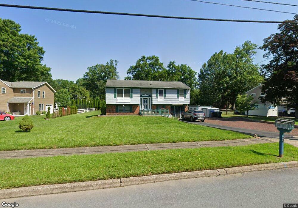
29 Pawnee Rd Doylestown, PA 18901
Estimated Value: $374,000 - $531,000
4
Beds
2
Baths
1,032
Sq Ft
$453/Sq Ft
Est. Value
About This Home
This home is located at 29 Pawnee Rd, Doylestown, PA 18901 and is currently estimated at $467,753, approximately $453 per square foot. 29 Pawnee Rd is a home located in Bucks County with nearby schools including Pine Run Elementary School, Tohickon Middle School, and Central Bucks High School-West.
Ownership History
Date
Name
Owned For
Owner Type
Purchase Details
Closed on
Jul 18, 2022
Sold by
Casaleno Albert A and Casaleno Cheryl
Bought by
Casaleno Cheryl
Current Estimated Value
Home Financials for this Owner
Home Financials are based on the most recent Mortgage that was taken out on this home.
Original Mortgage
$275,000
Outstanding Balance
$263,127
Interest Rate
5.78%
Mortgage Type
New Conventional
Estimated Equity
$204,627
Purchase Details
Closed on
Jul 13, 2003
Sold by
Drevers Todd F
Bought by
Casaleno Albert A and Casaleno Cheryl
Home Financials for this Owner
Home Financials are based on the most recent Mortgage that was taken out on this home.
Original Mortgage
$199,200
Interest Rate
10.05%
Mortgage Type
Purchase Money Mortgage
Create a Home Valuation Report for This Property
The Home Valuation Report is an in-depth analysis detailing your home's value as well as a comparison with similar homes in the area
Home Values in the Area
Average Home Value in this Area
Purchase History
| Date | Buyer | Sale Price | Title Company |
|---|---|---|---|
| Casaleno Cheryl | -- | New Title Company Name | |
| Casaleno Albert A | $249,000 | Fidelity National Title Insu |
Source: Public Records
Mortgage History
| Date | Status | Borrower | Loan Amount |
|---|---|---|---|
| Open | Casaleno Cheryl | $275,000 | |
| Previous Owner | Casaleno Albert A | $199,200 |
Source: Public Records
Tax History
| Year | Tax Paid | Tax Assessment Tax Assessment Total Assessment is a certain percentage of the fair market value that is determined by local assessors to be the total taxable value of land and additions on the property. | Land | Improvement |
|---|---|---|---|---|
| 2025 | $5,155 | $25,600 | $6,680 | $18,920 |
| 2024 | $5,155 | $25,600 | $6,680 | $18,920 |
| 2023 | $4,796 | $25,600 | $6,680 | $18,920 |
| 2022 | $4,692 | $25,600 | $6,680 | $18,920 |
| 2021 | $4,606 | $25,600 | $6,680 | $18,920 |
| 2020 | $4,606 | $25,600 | $6,680 | $18,920 |
| 2019 | $4,504 | $25,600 | $6,680 | $18,920 |
| 2018 | $4,504 | $25,600 | $6,680 | $18,920 |
| 2017 | $4,472 | $25,600 | $6,680 | $18,920 |
| 2016 | $4,472 | $25,600 | $6,680 | $18,920 |
| 2015 | -- | $25,600 | $6,680 | $18,920 |
| 2014 | -- | $25,600 | $6,680 | $18,920 |
Source: Public Records
Map
Nearby Homes
- 94 Sioux Rd
- 77 Lenape Dr
- 11 W Butler Ave
- 7 W Butler Ave
- Lot 9 Butler
- 10 W Butler Ave
- 8 E Butler Ave
- 12 Carousel Cir
- 240 Green Valley Way
- 44 Ferry Rd
- 130 Jameson Way Unit 12 WARWICK END
- 128 Jameson Way Unit 11 WARWICK INTERIOR
- 124 Jameson Way Unit 9 WARWICK INTERIOR
- 126 Jameson Way Unit 10 WARWICK INTERIOR
- 122 Jameson Way Unit 8 STRATFORD INTERIOR
- 34 Warren Dr Unit 16
- 30 Warren Dr Unit 14
- 120 Jameson Way Unit 7 WARWICK END
- 60 Becker Dr Unit 27
- 62 Becker Dr Unit 28
- 39 Pawnee Rd
- 19 Pawnee Rd
- 49 Pawnee Rd
- 9 Pawnee Rd
- 176 N Tamenend Ave
- 180 N Tamenend Ave
- 30 Pawnee Rd
- 20 Pawnee Rd
- 40 Pawnee Rd
- 59 Pawnee Rd
- 50 Pawnee Rd
- 10 Pawnee Rd
- 60 Pawnee Rd
- 190 N Tamenend Ave
- 71 Pawnee Rd
- 165 N Tamenend Ave
- 260 N Tamenend Ave
- 270 N Tamenend Ave
- 12 Algonquin Rd
- 212 N Tamenend Ave
Your Personal Tour Guide
Ask me questions while you tour the home.