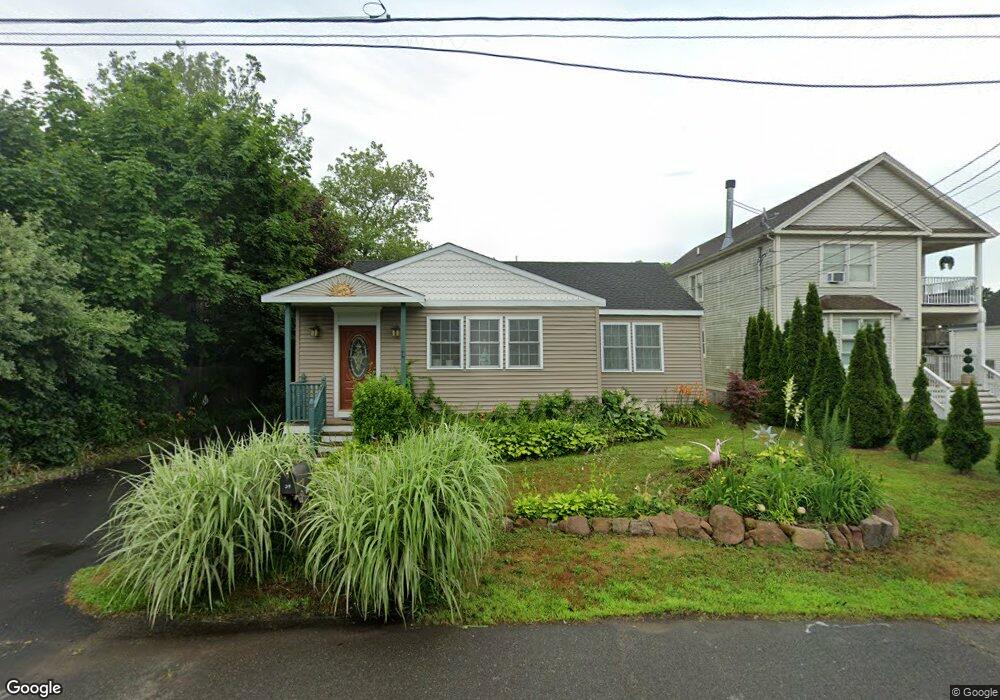
29 Phillip St East Haven, CT 06512
Estimated Value: $213,000 - $358,000
3
Beds
1
Bath
1,000
Sq Ft
$281/Sq Ft
Est. Value
About This Home
This home is located at 29 Phillip St, East Haven, CT 06512 and is currently estimated at $280,682, approximately $280 per square foot. 29 Phillip St is a home located in New Haven County with nearby schools including East Haven High School and Pathway School.
Ownership History
Date
Name
Owned For
Owner Type
Purchase Details
Closed on
Aug 17, 2010
Sold by
Department Of Housing & Urban Dev
Bought by
Yort Steven C
Current Estimated Value
Home Financials for this Owner
Home Financials are based on the most recent Mortgage that was taken out on this home.
Original Mortgage
$60,000
Outstanding Balance
$39,846
Interest Rate
4.63%
Estimated Equity
$240,836
Purchase Details
Closed on
Jun 18, 2010
Sold by
Wells Fargo Bk
Bought by
Department Of Housing & Urban Dev
Home Financials for this Owner
Home Financials are based on the most recent Mortgage that was taken out on this home.
Original Mortgage
$60,000
Outstanding Balance
$39,846
Interest Rate
4.63%
Estimated Equity
$240,836
Purchase Details
Closed on
Jun 26, 2009
Sold by
Kallert Anthony W
Bought by
Wells Fargo Bank Na
Purchase Details
Closed on
Dec 1, 2003
Sold by
Carehia Adolfo A
Bought by
Kallert Anthony W
Home Financials for this Owner
Home Financials are based on the most recent Mortgage that was taken out on this home.
Original Mortgage
$146,100
Interest Rate
6.09%
Create a Home Valuation Report for This Property
The Home Valuation Report is an in-depth analysis detailing your home's value as well as a comparison with similar homes in the area
Home Values in the Area
Average Home Value in this Area
Purchase History
| Date | Buyer | Sale Price | Title Company |
|---|---|---|---|
| Yort Steven C | $100,000 | -- | |
| Department Of Housing & Urban Dev | -- | -- | |
| Wells Fargo Bank Na | -- | -- | |
| Kallert Anthony W | $134,000 | -- |
Source: Public Records
Mortgage History
| Date | Status | Borrower | Loan Amount |
|---|---|---|---|
| Open | Kallert Anthony W | $60,000 | |
| Previous Owner | Kallert Anthony W | $146,100 |
Source: Public Records
Tax History Compared to Growth
Tax History
| Year | Tax Paid | Tax Assessment Tax Assessment Total Assessment is a certain percentage of the fair market value that is determined by local assessors to be the total taxable value of land and additions on the property. | Land | Improvement |
|---|---|---|---|---|
| 2025 | $4,405 | $131,740 | $73,990 | $57,750 |
| 2024 | $4,405 | $131,740 | $73,990 | $57,750 |
| 2023 | $4,110 | $131,740 | $73,990 | $57,750 |
| 2022 | $4,110 | $131,740 | $73,990 | $57,750 |
| 2021 | $4,052 | $118,320 | $73,990 | $44,330 |
| 2020 | $4,052 | $118,320 | $73,990 | $44,330 |
| 2019 | $3,836 | $118,320 | $73,990 | $44,330 |
| 2018 | $3,839 | $118,320 | $73,990 | $44,330 |
| 2017 | $3,733 | $118,320 | $73,990 | $44,330 |
| 2016 | $3,784 | $119,940 | $73,990 | $45,950 |
| 2015 | $3,784 | $119,940 | $73,990 | $45,950 |
| 2014 | $3,844 | $119,940 | $73,990 | $45,950 |
Source: Public Records
Map
Nearby Homes
- 248 Cosey Beach Ave
- 266 Cosey Beach Ave
- 262 & 264 Cosey Beach Ave
- 560 Silver Sands Rd Unit 2502
- 102 Henry St
- 372 Cosey Beach Ave
- 47 1st Ave
- 60 Coleman St Unit 16
- 26 Austin Ave
- 223 Coe Ave
- 4 Cambridge Ct
- 2 Jamaica Ct
- 14 Jamaica Ct
- 2 Mansfield Grove Rd Unit 166
- 2 Mansfield Grove Rd Unit 374
- 2 Mansfield Grove Rd Unit 362
- 2 Mansfield Grove Rd Unit 266
- 1 Mansfield Grove Rd Unit 306
- 1 Mansfield Grove Rd Unit 205
- 166 Beach Ave