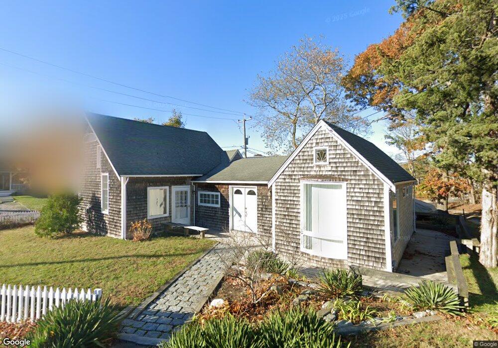
29 Pocasset Ave Vineyard Haven, MA 02568
Oak Bluffs NeighborhoodEstimated Value: $1,001,245 - $1,226,000
2
Beds
1
Bath
1,263
Sq Ft
$846/Sq Ft
Est. Value
About This Home
This home is located at 29 Pocasset Ave, Vineyard Haven, MA 02568 and is currently estimated at $1,068,811, approximately $846 per square foot. 29 Pocasset Ave is a home with nearby schools including Oak Bluffs Elementary School and Martha's Vineyard Regional High School.
Ownership History
Date
Name
Owned For
Owner Type
Purchase Details
Closed on
Oct 31, 2014
Sold by
Pocassett Avenue Rt
Bought by
D K Thornton Owens Ret
Current Estimated Value
Purchase Details
Closed on
Aug 17, 2011
Sold by
D K Thomas-Owens Ret
Bought by
Pocasset Avenue Rt
Purchase Details
Closed on
Jan 28, 2011
Sold by
Owens Dannetta K T
Bought by
Owens Rt Dannetta K and Owens Dannetta K T
Purchase Details
Closed on
Jan 15, 2009
Sold by
Owens Kenneth
Bought by
Thornton-Owens Dannetta K
Purchase Details
Closed on
May 14, 2001
Sold by
Kinne Aaron W
Bought by
Owen Kenneth and Owen Dannetta K
Create a Home Valuation Report for This Property
The Home Valuation Report is an in-depth analysis detailing your home's value as well as a comparison with similar homes in the area
Home Values in the Area
Average Home Value in this Area
Purchase History
| Date | Buyer | Sale Price | Title Company |
|---|---|---|---|
| D K Thornton Owens Ret | -- | -- | |
| Pocasset Avenue Rt | -- | -- | |
| Owens Rt Dannetta K | -- | -- | |
| Thornton-Owens Dannetta K | -- | -- | |
| Owen Kenneth | $222,000 | -- |
Source: Public Records
Tax History Compared to Growth
Tax History
| Year | Tax Paid | Tax Assessment Tax Assessment Total Assessment is a certain percentage of the fair market value that is determined by local assessors to be the total taxable value of land and additions on the property. | Land | Improvement |
|---|---|---|---|---|
| 2025 | $4,683 | $927,400 | $589,600 | $337,800 |
| 2024 | $4,656 | $890,200 | $535,800 | $354,400 |
| 2023 | $4,840 | $916,600 | $520,600 | $396,000 |
| 2022 | $4,685 | $690,000 | $392,100 | $297,900 |
| 2021 | $4,129 | $560,300 | $330,600 | $229,700 |
| 2020 | $3,925 | $527,500 | $314,800 | $212,700 |
| 2019 | $3,716 | $483,200 | $274,600 | $208,600 |
| 2018 | $3,581 | $457,300 | $248,000 | $209,300 |
| 2017 | $3,441 | $422,200 | $235,100 | $187,100 |
| 2016 | $3,277 | $404,100 | $242,400 | $161,700 |
| 2015 | $3,120 | $392,000 | $242,400 | $149,600 |
| 2014 | $3,152 | $403,600 | $248,200 | $155,400 |
Source: Public Records
Map
Nearby Homes
- 34 Massasoit Ave
- 1 Cottage Park
- 113 Dukes County Ave Unit Multi-Family
- 0 Massasoit Ave
- 181 Circuit Ave
- 50 Canonicus Ave
- 26 Winthrop Ave
- 24 School St
- 2 Lincoln Ave
- 46 Kennebec Ave
- 0 Heather Ln Unit 11 43465
- 10 Siloam Ave
- 30 Franklin Ave
- 4 Canonicus Ave
- 8 Hitchings Cir
- 9 Brunswick Ave
- 26 Hampson Ave
- 25 Hampson Ave
- 23 Laurel Ave
- 25 Windy Hill Rd
- 23 Uncas Ave
- 26 Pocasset Ave
- 26 Pocasset Ave
- 21 Uncas Ave
- 35 Pocasset Ave
- 27 Wamsutta Ave
- 35 Pocasset Ave
- 35 Wamsutta Ave
- 35 Wamsutta Ave
- 18 Hiawatha Ave
- 16 Hiawatha Ave
- 23 Wamsutta Ave
- 14 Hiawatha Ave
- 37 Pocasset Ave
- 37 Pocasset Ave
- 36 Pocasset Ave
- 20 Pocasset Ave
- 37 Nashawena Park
- 20 Pocasset Ave
- 12 Hiawatha Ave