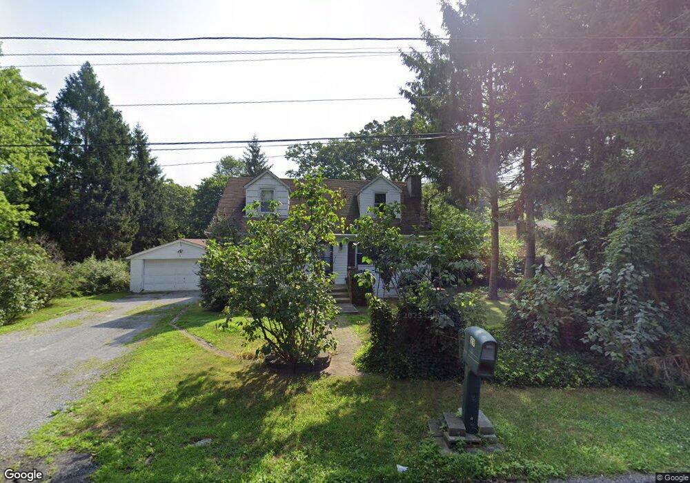
29 Poospatuck Ln Mastic, NY 11950
Estimated Value: $490,000 - $503,000
4
Beds
1
Bath
1,418
Sq Ft
$349/Sq Ft
Est. Value
About This Home
This home is located at 29 Poospatuck Ln, Mastic, NY 11950 and is currently estimated at $495,534, approximately $349 per square foot. 29 Poospatuck Ln is a home located in Suffolk County with nearby schools including Nathaniel Woodhull Elementary School, William Floyd Middle School, and William Floyd High School.
Ownership History
Date
Name
Owned For
Owner Type
Purchase Details
Closed on
Aug 18, 2011
Sold by
Bank Of New York Mellon
Bought by
Yablonski Brian
Current Estimated Value
Purchase Details
Closed on
Sep 1, 2010
Sold by
Breud Albert Adam and Howell Misseri Joanne
Bought by
Bank Of New York Mellon
Purchase Details
Closed on
Sep 16, 2002
Sold by
Sherman Arnold S and Sherman Arlene
Bought by
Misseri Joanne
Home Financials for this Owner
Home Financials are based on the most recent Mortgage that was taken out on this home.
Original Mortgage
$170,000
Interest Rate
5.98%
Mortgage Type
Stand Alone First
Purchase Details
Closed on
Jun 13, 2000
Sold by
Sheats James M
Bought by
Sherman Arnold S and Sherman Arlene
Home Financials for this Owner
Home Financials are based on the most recent Mortgage that was taken out on this home.
Original Mortgage
$70,000
Interest Rate
8.03%
Create a Home Valuation Report for This Property
The Home Valuation Report is an in-depth analysis detailing your home's value as well as a comparison with similar homes in the area
Home Values in the Area
Average Home Value in this Area
Purchase History
We collect this data history from publicly available records. To have your information removed, we recommend requesting removal directly through your county’s website.
| Date | Buyer | Sale Price | Title Company |
|---|---|---|---|
| Yablonski Brian | $95,380 | -- | |
| Bank Of New York Mellon | $127,500 | -- | |
| Misseri Joanne | $120,000 | The Judicial Title Insurance | |
| Sherman Arnold S | $87,500 | -- |
Source: Public Records
Mortgage History
We collect this data history from publicly available records. To have your information removed, we recommend requesting removal directly through your county’s website.
| Date | Status | Borrower | Loan Amount |
|---|---|---|---|
| Previous Owner | Misseri Joanne | $170,000 | |
| Previous Owner | Sherman Arnold S | $70,000 |
Source: Public Records
Tax History
| Year | Tax Paid | Tax Assessment Tax Assessment Total Assessment is a certain percentage of the fair market value that is determined by local assessors to be the total taxable value of land and additions on the property. | Land | Improvement |
|---|---|---|---|---|
| 2024 | $7,102 | $1,750 | $200 | $1,550 |
| 2023 | $7,102 | $1,750 | $200 | $1,550 |
| 2022 | $7,890 | $1,750 | $200 | $1,550 |
| 2021 | $7,890 | $1,750 | $200 | $1,550 |
| 2020 | $8,058 | $1,750 | $200 | $1,550 |
| 2019 | $8,058 | $0 | $0 | $0 |
| 2018 | $7,750 | $1,750 | $200 | $1,550 |
| 2017 | $7,750 | $1,750 | $200 | $1,550 |
| 2016 | $7,751 | $1,750 | $200 | $1,550 |
| 2015 | -- | $1,750 | $200 | $1,550 |
| 2014 | -- | $1,750 | $200 | $1,550 |
Source: Public Records
Map
Nearby Homes
- VL Jeanatta Ave
- 3 Ocean Ave
- 23 Jeanatta Ave
- 41 Babylon St
- 175 Main Ave
- 159 Main Ave
- 136B Hampton Ave
- 0 Neptune Ave
- 116 Hampton Ave
- 120 Somerset Ave
- 78 Eleanor Ave
- 92 Southaven Ave
- 106 Eleanor Ave
- 113 Overlook Dr
- 157 Hawthorne St
- VL(36) Mastic Blvd
- VL Mastic Blvd
- 154 Meadowmere Ave
- 88 Patchogue Ave
- 92 Hawthorne St
- 3 Overlook Dr
- 5 Overlook Dr
- 25 Poospatuck Ln
- 32 Poospatuck Ln
- 30 Poospatuck Ln
- 28 Poospatuck Ln
- 11 Overlook Dr
- 6 Overlook Dr
- 29 Pitts Ave
- 26 Poospatuck Ln
- 114 Riviera Dr
- 15 Overlook Dr
- 12 Overlook Dr
- 25 Pitts Ave
- 112 Riviera Dr
- 2 Wills Ave
- 110 Riviera Dr
- 6 Wills Ave
- 45 Poospatuck Ln
- 16 Poospatuck Ln
Your Personal Tour Guide
Ask me questions while you tour the home.