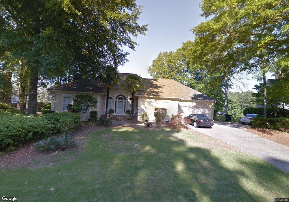
29 Rapids Ct North Augusta, SC 29841
Estimated Value: $442,000 - $555,000
Studio
4
Baths
2,747
Sq Ft
$179/Sq Ft
Est. Value
About This Home
This home is located at 29 Rapids Ct, North Augusta, SC 29841 and is currently estimated at $491,426, approximately $178 per square foot. 29 Rapids Ct is a home located in Aiken County with nearby schools including Hammond Hill Elementary School, Paul Knox Middle School, and North Augusta High School.
Ownership History
Date
Name
Owned For
Owner Type
Purchase Details
Closed on
Feb 4, 2014
Sold by
Stripling Craig S and Stripling Kimberly E
Bought by
Ladow Victor Daniel and Ladow Sylvia A
Current Estimated Value
Home Financials for this Owner
Home Financials are based on the most recent Mortgage that was taken out on this home.
Original Mortgage
$257,310
Outstanding Balance
$194,871
Interest Rate
4.55%
Mortgage Type
New Conventional
Estimated Equity
$296,555
Purchase Details
Closed on
Mar 24, 2003
Sold by
Foster William C and Foster Lois J
Bought by
Stripling Craig S and Stripling Kimberly E
Create a Home Valuation Report for This Property
The Home Valuation Report is an in-depth analysis detailing your home's value as well as a comparison with similar homes in the area
Purchase History
| Date | Buyer | Sale Price | Title Company |
|---|---|---|---|
| Ladow Victor Daniel | $285,900 | -- | |
| Stripling Craig S | $222,500 | -- |
Source: Public Records
Mortgage History
| Date | Status | Borrower | Loan Amount |
|---|---|---|---|
| Open | Ladow Victor Daniel | $257,310 |
Source: Public Records
Tax History
| Year | Tax Paid | Tax Assessment Tax Assessment Total Assessment is a certain percentage of the fair market value that is determined by local assessors to be the total taxable value of land and additions on the property. | Land | Improvement |
|---|---|---|---|---|
| 2025 | $1,269 | $12,670 | -- | -- |
| 2023 | $1,271 | $12,670 | $2,600 | $251,710 |
| 2022 | $1,237 | $12,670 | $0 | $0 |
| 2021 | $1,239 | $12,670 | $0 | $0 |
| 2020 | $1,147 | $11,560 | $0 | $0 |
| 2019 | $1,147 | $11,560 | $0 | $0 |
| 2018 | $1,149 | $11,560 | $2,000 | $9,560 |
| 2017 | $1,091 | $0 | $0 | $0 |
| 2016 | $1,092 | $0 | $0 | $0 |
| 2015 | $1,125 | $0 | $0 | $0 |
| 2014 | $1,117 | $0 | $0 | $0 |
| 2013 | -- | $0 | $0 | $0 |
Source: Public Records
Map
Nearby Homes
- 864 River Bluff Rd
- 2 Shadowmoor Ct
- 248 Osprey Point
- 982 Campbellton Dr
- 984 Campbellton Dr
- 951 Campbellton Dr
- 359 Osprey Point
- 1005 Campbellton Dr
- 45 Wildmeade Ct
- 1413 Wapoo Dr
- 710 W Martintown Rd
- 793 Big Pine Rd
- 1 River Oak Dr
- 3 River Oak Dr
- 4 River Oak Dr
- 138 Hammond Place Cir
- 817 Merriwether Dr
- 2438 Deodara Dr
- 715 Hammond Dr
- 704 Brooks Dr
Your Personal Tour Guide
Ask me questions while you tour the home.