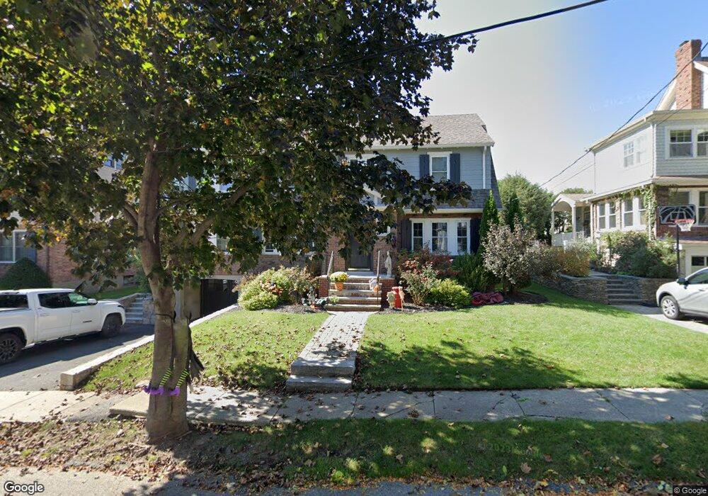
29 Richardson Rd Belmont, MA 02478
Belmont Center NeighborhoodEstimated Value: $1,566,000 - $1,919,000
3
Beds
2
Baths
2,006
Sq Ft
$870/Sq Ft
Est. Value
About This Home
This home is located at 29 Richardson Rd, Belmont, MA 02478 and is currently estimated at $1,746,087, approximately $870 per square foot. 29 Richardson Rd is a home located in Middlesex County with nearby schools including Mary Lee Burbank Elementary School, Winthrop L Chenery Middle School, and Belmont High School.
Ownership History
Date
Name
Owned For
Owner Type
Purchase Details
Closed on
Jul 19, 2018
Sold by
Cummings Michael A and Cummings Heather W
Bought by
Heather W Cummings Ret
Current Estimated Value
Purchase Details
Closed on
Aug 26, 2011
Sold by
Patrick A Mcgrath Irt and Mcgrath Patrick A
Bought by
Cummings Michael A and Cummings Heather W
Home Financials for this Owner
Home Financials are based on the most recent Mortgage that was taken out on this home.
Original Mortgage
$523,750
Interest Rate
4.53%
Mortgage Type
Purchase Money Mortgage
Purchase Details
Closed on
Oct 15, 2008
Sold by
Mcgrath Nt and Mcgrath Patrick A
Bought by
Patrick A Mcgrath Irt and Mcgrath Patrick A
Create a Home Valuation Report for This Property
The Home Valuation Report is an in-depth analysis detailing your home's value as well as a comparison with similar homes in the area
Home Values in the Area
Average Home Value in this Area
Purchase History
| Date | Buyer | Sale Price | Title Company |
|---|---|---|---|
| Heather W Cummings Ret | -- | -- | |
| Cummings Michael A | $620,000 | -- | |
| Patrick A Mcgrath Irt | -- | -- |
Source: Public Records
Mortgage History
| Date | Status | Borrower | Loan Amount |
|---|---|---|---|
| Previous Owner | Cummings Michael A | $523,750 |
Source: Public Records
Tax History Compared to Growth
Tax History
| Year | Tax Paid | Tax Assessment Tax Assessment Total Assessment is a certain percentage of the fair market value that is determined by local assessors to be the total taxable value of land and additions on the property. | Land | Improvement |
|---|---|---|---|---|
| 2025 | $18,065 | $1,586,000 | $792,000 | $794,000 |
| 2024 | $17,033 | $1,613,000 | $987,000 | $626,000 |
| 2023 | $16,073 | $1,430,000 | $861,000 | $569,000 |
| 2022 | $14,783 | $1,339,000 | $809,000 | $530,000 |
| 2021 | $7,603 | $1,281,000 | $843,000 | $438,000 |
| 2020 | $13,640 | $1,240,000 | $826,000 | $414,000 |
| 2019 | $11,577 | $992,000 | $614,000 | $378,000 |
| 2018 | $10,728 | $883,000 | $558,000 | $325,000 |
| 2017 | $10,622 | $837,000 | $512,000 | $325,000 |
| 2016 | $10,199 | $812,000 | $512,000 | $300,000 |
| 2015 | $9,353 | $725,000 | $426,000 | $299,000 |
Source: Public Records
Map
Nearby Homes
- 128 Watson Rd
- 79 Livermore Rd
- 36 Madison St
- 190 Goden St
- 118 Blanchard Rd
- 41 Concord Ave
- 4 Griswold St
- 48 Hamilton Rd
- 68 Payson Rd
- 59 Hamilton Rd
- 38 Myrtle St
- 73 Trowbridge St Unit 73B
- 73 Trowbridge St Unit 73A
- 16 Fairmont St
- 263 Common St
- 93 Griswold St Unit 93
- 95 Griswold St Unit 95
- 1 Spinney Terrace
- 67-69 Berwick St
- 333 Common St
- 35 Richardson Rd
- 23 Richardson Rd
- 16 Sharpe Rd
- 22 Sharpe Rd
- 17 Richardson Rd
- 17 Richardson Rd Unit 17
- 41 Richardson Rd
- 30 Richardson Rd
- 10 Sharpe Rd
- 36 Richardson Rd
- 26 Sharpe Rd
- 24 Richardson Rd
- 42 Richardson Rd
- 262 Washington St
- 18 Richardson Rd
- 47 Richardson Rd
- 254 Washington St
- 36 Sharpe Rd
- 48 Richardson Rd
- 141 Watson Rd