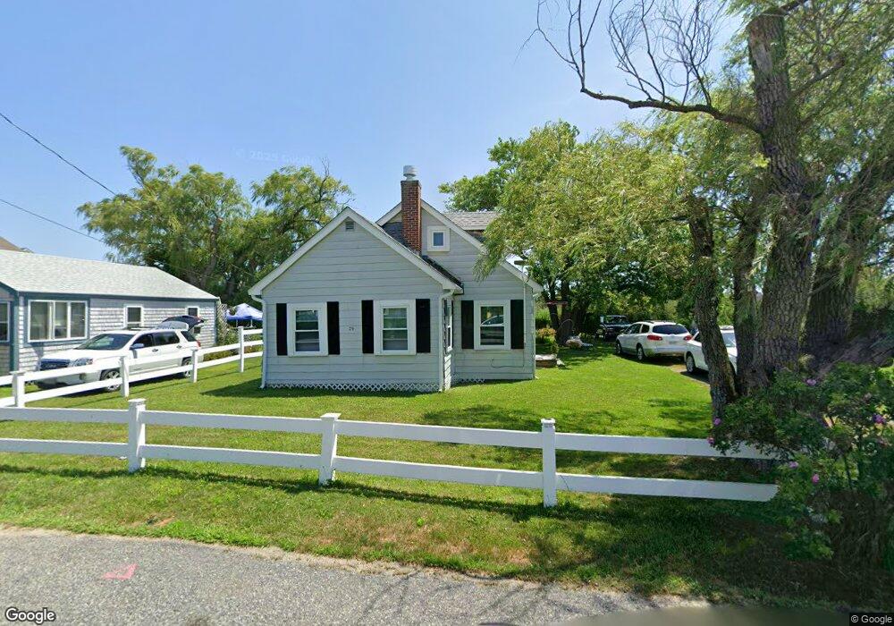
29 Roosevelt Rd Marshfield, MA 02050
Ocean Bluff-Brant Rock NeighborhoodEstimated Value: $537,783 - $617,000
3
Beds
1
Bath
1,243
Sq Ft
$453/Sq Ft
Est. Value
About This Home
This home is located at 29 Roosevelt Rd, Marshfield, MA 02050 and is currently estimated at $563,446, approximately $453 per square foot. 29 Roosevelt Rd is a home located in Plymouth County with nearby schools including Daniel Webster, Furnace Brook Middle School, and Marshfield High School.
Ownership History
Date
Name
Owned For
Owner Type
Purchase Details
Closed on
May 3, 2010
Sold by
Catino Ft and Richer Andrea L
Bought by
Buckley Charles F and Buckley Judith M
Current Estimated Value
Purchase Details
Closed on
Sep 10, 2007
Sold by
Catino Michael P and Richer Andrea L
Bought by
Richer Tr Andrea L and Catino Michael P
Create a Home Valuation Report for This Property
The Home Valuation Report is an in-depth analysis detailing your home's value as well as a comparison with similar homes in the area
Home Values in the Area
Average Home Value in this Area
Purchase History
| Date | Buyer | Sale Price | Title Company |
|---|---|---|---|
| Buckley Charles F | $227,000 | -- | |
| Richer Tr Andrea L | -- | -- |
Source: Public Records
Mortgage History
| Date | Status | Borrower | Loan Amount |
|---|---|---|---|
| Previous Owner | Richer Tr Andrea L | $50,000 | |
| Previous Owner | Richer Tr Andrea L | $30,000 | |
| Previous Owner | Richer Tr Andrea L | $50,000 | |
| Previous Owner | Richer Tr Andrea L | $35,000 |
Source: Public Records
Tax History
| Year | Tax Paid | Tax Assessment Tax Assessment Total Assessment is a certain percentage of the fair market value that is determined by local assessors to be the total taxable value of land and additions on the property. | Land | Improvement |
|---|---|---|---|---|
| 2025 | $3,939 | $397,900 | $310,500 | $87,400 |
| 2024 | $3,944 | $379,600 | $291,100 | $88,500 |
| 2023 | $3,778 | $335,300 | $262,000 | $73,300 |
| 2022 | $3,778 | $291,700 | $223,200 | $68,500 |
| 2021 | $3,625 | $274,800 | $213,500 | $61,300 |
| 2020 | $3,227 | $242,100 | $184,400 | $57,700 |
| 2019 | $3,191 | $238,500 | $184,400 | $54,100 |
| 2018 | $3,189 | $238,500 | $184,400 | $54,100 |
| 2017 | $3,044 | $221,900 | $174,700 | $47,200 |
| 2016 | $2,945 | $212,200 | $165,000 | $47,200 |
| 2015 | $2,820 | $212,200 | $165,000 | $47,200 |
| 2014 | $2,847 | $214,200 | $165,000 | $49,200 |
Source: Public Records
Map
Nearby Homes
- 27 Roosevelt Rd
- 35 Roosevelt Rd
- 25 Roosevelt Rd
- 30 Roosevelt Rd
- 30 Roosevelt Rd Unit 1
- 24 Roosevelt Rd
- 34 Roosevelt Rd
- 22 Roosevelt Rd
- 22 Roosevelt Rd Unit 1
- 399 Plymouth Ave
- 16 Pershing Rd
- 15 Roosevelt Rd
- 18 Roosevelt Rd
- 5 Mcarthur Ln
- 10 Dinitto Dr
- 397 Plymouth Ave
- 2 Mcarthur Ln
- 11 Pershing Rd
- 2 Johnson Terrace
- 14 Roosevelt Rd
Your Personal Tour Guide
Ask me questions while you tour the home.