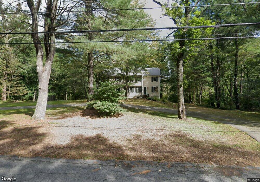
29 Russett Hill Rd Sherborn, MA 01770
Estimated Value: $1,434,000 - $1,599,000
5
Beds
3
Baths
3,727
Sq Ft
$407/Sq Ft
Est. Value
About This Home
This home is located at 29 Russett Hill Rd, Sherborn, MA 01770 and is currently estimated at $1,515,751, approximately $406 per square foot. 29 Russett Hill Rd is a home located in Middlesex County with nearby schools including Pine Hill Elementary School, Dover-Sherborn Regional Middle School, and Dover-Sherborn Regional High School.
Ownership History
Date
Name
Owned For
Owner Type
Purchase Details
Closed on
Jun 3, 1991
Sold by
Hughes Anthony C and Hughes Kathleen D
Bought by
Harvey Robert T
Current Estimated Value
Home Financials for this Owner
Home Financials are based on the most recent Mortgage that was taken out on this home.
Original Mortgage
$200,000
Interest Rate
9.35%
Mortgage Type
Purchase Money Mortgage
Create a Home Valuation Report for This Property
The Home Valuation Report is an in-depth analysis detailing your home's value as well as a comparison with similar homes in the area
Home Values in the Area
Average Home Value in this Area
Purchase History
| Date | Buyer | Sale Price | Title Company |
|---|---|---|---|
| Harvey Robert T | $372,500 | -- |
Source: Public Records
Mortgage History
| Date | Status | Borrower | Loan Amount |
|---|---|---|---|
| Closed | Harvey Robert T | $31,000 | |
| Closed | Harvey Robert T | $200,000 | |
| Previous Owner | Harvey Robert T | $175,000 |
Source: Public Records
Tax History Compared to Growth
Tax History
| Year | Tax Paid | Tax Assessment Tax Assessment Total Assessment is a certain percentage of the fair market value that is determined by local assessors to be the total taxable value of land and additions on the property. | Land | Improvement |
|---|---|---|---|---|
| 2025 | $23,093 | $1,392,800 | $470,400 | $922,400 |
| 2024 | $21,289 | $1,256,000 | $461,700 | $794,300 |
| 2023 | $18,986 | $1,054,200 | $461,700 | $592,500 |
| 2022 | $17,551 | $922,300 | $450,200 | $472,100 |
| 2021 | $17,375 | $885,100 | $450,200 | $434,900 |
| 2020 | $17,224 | $885,100 | $450,200 | $434,900 |
| 2019 | $17,254 | $879,400 | $450,200 | $429,200 |
| 2018 | $0 | $865,100 | $450,200 | $414,900 |
| 2017 | $16,405 | $801,800 | $444,400 | $357,400 |
| 2016 | $15,722 | $764,300 | $415,600 | $348,700 |
| 2015 | $15,273 | $751,600 | $404,000 | $347,600 |
| 2014 | $14,757 | $725,500 | $392,500 | $333,000 |
Source: Public Records
Map
Nearby Homes
- 2 Surrey Ln
- 4 Green Ln
- 14 Sewall Brook Ln
- 20 Nason Hill Rd
- 18 Wildwood Dr
- 6 Brook St
- 65 Farm Road Lot 6
- 220 S Main St
- 54 Spywood Rd
- 38 Bullard St
- 27 Spywood Rd
- 32 Lake St
- 21 Spywood Rd
- 151 Mohawk Path
- 00000 S Main St and Bullard St
- 105 N Main St
- 121 Bullard St
- 81 Brush Hill Rd
- 30 Powderhorn Ln
- 131 Jennings Rd
- 33 Russett Hill Rd
- 25 Russett Hill Rd
- 32 Russett Hill Rd
- 21 Russett Hill Rd
- 36 Russett Hill Rd
- 24 Russett Hill Rd
- 44 Russett Hill Rd
- 17 Russett Hill Rd
- 20 Russett Hill Rd
- 14 Russett Hill Rd
- 15 Russett Hill Rd
- 47 Russett Hill Rd
- 10 Russett Hill Rd
- 9 Russett Hill Rd
- 32 Deerfield Rd
- 56 Russett Hill Rd
- 5 Russett Hill Rd
- 31 Deerfield Rd
- 6 Russett Hill Rd
- 19 Greenwood St