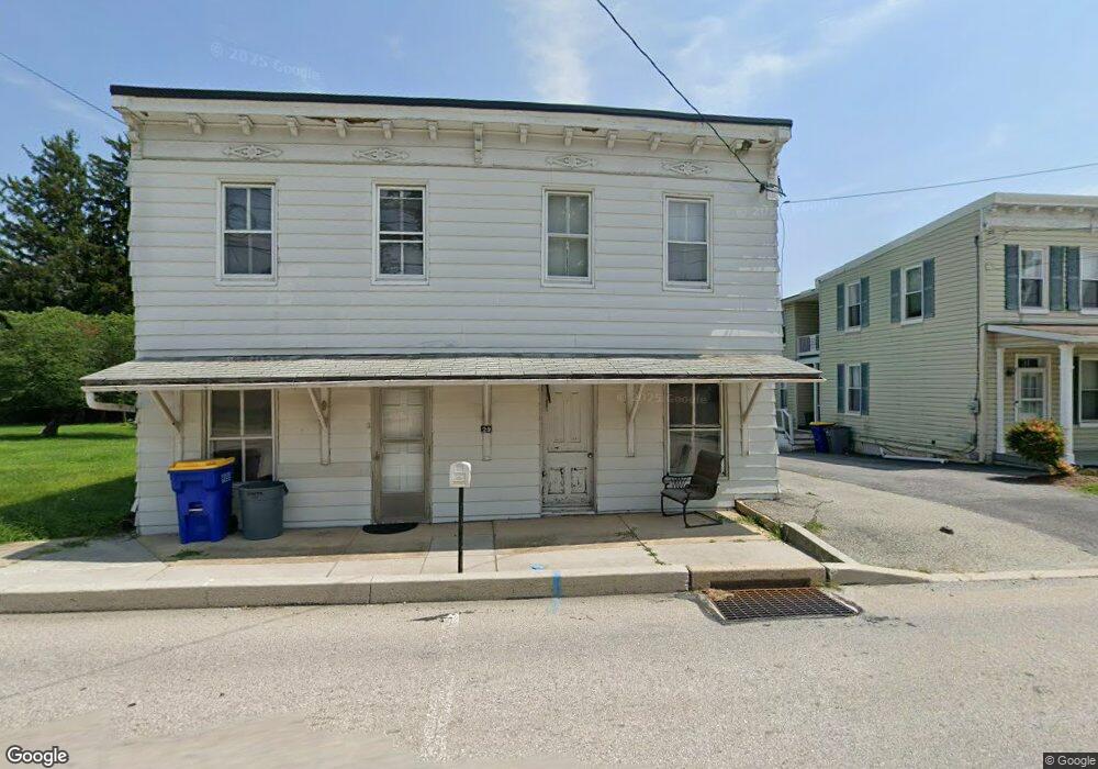
29 S Main St Stewartstown, PA 17363
Estimated Value: $155,000 - $279,000
2
Beds
1
Bath
1,360
Sq Ft
$148/Sq Ft
Est. Value
About This Home
This home is located at 29 S Main St, Stewartstown, PA 17363 and is currently estimated at $201,149, approximately $147 per square foot. 29 S Main St is a home located in York County with nearby schools including South Eastern Intermediate School, South Eastern Middle School, and Kennard-Dale High School.
Ownership History
Date
Name
Owned For
Owner Type
Purchase Details
Closed on
Aug 5, 2016
Sold by
Daniel James Brian and Daniel Kristina M
Bought by
Daniel Joseph B
Current Estimated Value
Home Financials for this Owner
Home Financials are based on the most recent Mortgage that was taken out on this home.
Original Mortgage
$64,000
Outstanding Balance
$51,196
Interest Rate
3.56%
Mortgage Type
New Conventional
Estimated Equity
$149,953
Purchase Details
Closed on
Mar 30, 2016
Sold by
Brannon Margaret R and Last Will And Testament Of Joy
Bought by
Daniel James Brian
Create a Home Valuation Report for This Property
The Home Valuation Report is an in-depth analysis detailing your home's value as well as a comparison with similar homes in the area
Home Values in the Area
Average Home Value in this Area
Purchase History
| Date | Buyer | Sale Price | Title Company |
|---|---|---|---|
| Daniel Joseph B | $80,000 | None Available | |
| Daniel James Brian | $55,000 | None Available |
Source: Public Records
Mortgage History
| Date | Status | Borrower | Loan Amount |
|---|---|---|---|
| Open | Daniel Joseph B | $64,000 |
Source: Public Records
Tax History Compared to Growth
Tax History
| Year | Tax Paid | Tax Assessment Tax Assessment Total Assessment is a certain percentage of the fair market value that is determined by local assessors to be the total taxable value of land and additions on the property. | Land | Improvement |
|---|---|---|---|---|
| 2025 | $2,774 | $86,690 | $29,470 | $57,220 |
| 2024 | $2,774 | $86,690 | $29,470 | $57,220 |
| 2023 | $2,774 | $86,690 | $29,470 | $57,220 |
| 2022 | $2,774 | $86,690 | $29,470 | $57,220 |
| 2021 | $2,687 | $86,690 | $29,470 | $57,220 |
| 2020 | $2,687 | $86,690 | $29,470 | $57,220 |
| 2019 | $2,679 | $86,690 | $29,470 | $57,220 |
| 2018 | $2,679 | $86,690 | $29,470 | $57,220 |
| 2017 | $2,679 | $86,690 | $29,470 | $57,220 |
| 2016 | $0 | $86,690 | $29,470 | $57,220 |
| 2015 | -- | $86,690 | $29,470 | $57,220 |
| 2014 | -- | $86,690 | $29,470 | $57,220 |
Source: Public Records
Map
Nearby Homes
- 2 S Main St
- 13 Baneberry St
- 1208 Crestview Ln Unit 1208
- 231 Cool Spring Ln
- 4341 Forbes Dr
- 120 Charles Ave
- 140 Lantern Ln
- 24 Scarborough Fare
- 17756 Barrens Rd N
- 10 Black Oak Ct
- 150 Patterson Dr Unit 47
- 160 Patterson Dr Unit 48
- 170 Patterson Dr Unit 49
- 180 Patterson Dr Unit 50
- 18010 Dave Anne Cir
- 200 Patterson Dr Unit 52
- 119 Edie Cir
- 515 Log House Rd Unit 119
- 525 Log House Rd Unit 118
- 17796 Iron Bridge Rd