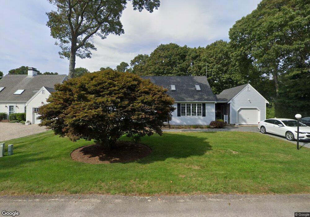
29 Seashell Ln East Falmouth, MA 02536
East Falmouth NeighborhoodEstimated Value: $810,000 - $1,034,000
3
Beds
2
Baths
1,320
Sq Ft
$677/Sq Ft
Est. Value
About This Home
This home is located at 29 Seashell Ln, East Falmouth, MA 02536 and is currently estimated at $894,158, approximately $677 per square foot. 29 Seashell Ln is a home located in Barnstable County with nearby schools including East Falmouth Elementary School, Lawrence School, and Morse Pond School.
Ownership History
Date
Name
Owned For
Owner Type
Purchase Details
Closed on
Jul 13, 2017
Sold by
Burke Michael K
Bought by
Michael K Burke T K and Michael Burke
Current Estimated Value
Purchase Details
Closed on
Sep 3, 1997
Sold by
Seashell Ln T and Seashell Hennessey
Bought by
Burke Michael K
Home Financials for this Owner
Home Financials are based on the most recent Mortgage that was taken out on this home.
Original Mortgage
$124,800
Interest Rate
7.36%
Mortgage Type
Purchase Money Mortgage
Create a Home Valuation Report for This Property
The Home Valuation Report is an in-depth analysis detailing your home's value as well as a comparison with similar homes in the area
Home Values in the Area
Average Home Value in this Area
Purchase History
| Date | Buyer | Sale Price | Title Company |
|---|---|---|---|
| Michael K Burke T K | -- | -- | |
| Burke Michael K | $156,000 | -- |
Source: Public Records
Mortgage History
| Date | Status | Borrower | Loan Amount |
|---|---|---|---|
| Previous Owner | Burke Michael K | $124,800 |
Source: Public Records
Tax History Compared to Growth
Tax History
| Year | Tax Paid | Tax Assessment Tax Assessment Total Assessment is a certain percentage of the fair market value that is determined by local assessors to be the total taxable value of land and additions on the property. | Land | Improvement |
|---|---|---|---|---|
| 2025 | $4,600 | $783,600 | $411,200 | $372,400 |
| 2024 | $4,479 | $713,200 | $373,800 | $339,400 |
| 2023 | $4,084 | $590,200 | $299,100 | $291,100 |
| 2022 | $3,880 | $482,000 | $247,600 | $234,400 |
| 2021 | $3,781 | $444,800 | $236,900 | $207,900 |
| 2020 | $3,555 | $413,900 | $215,300 | $198,600 |
| 2019 | $3,504 | $409,300 | $215,300 | $194,000 |
| 2018 | $3,406 | $396,100 | $215,300 | $180,800 |
| 2017 | $3,322 | $389,500 | $215,300 | $174,200 |
| 2016 | $3,260 | $389,500 | $215,300 | $174,200 |
| 2015 | $3,190 | $389,500 | $215,300 | $174,200 |
| 2014 | $3,168 | $388,700 | $215,400 | $173,300 |
Source: Public Records
Map
Nearby Homes
- 21 Captain Davis Ln
- 52 Bacon Farm Rd
- 472 & 474 Davisville Rd
- 58 Striper Ln
- 1 Cuttysark Rd
- 16 Edgewood Dr
- 30 Weatherglass Ln
- 23 N Bournes Pond Rd
- 23 N Bournes Pond Rd
- Lot 2 Pine Grove Ave
- 9 Theroux Dr
- 53 Eel River Rd
- 49 Rivers End Rd
- 214 Menauhant Rd
- 14 Avalon Dr
- 0 Tobey Ln
- 87 Acapesket Rd Unit 3B
- 87 Acapesket Rd Unit 3A
- 106 Beach St
- 65 Cypress St
- 23 Seashell Ln
- 33 Seashell Ln
- 0 Seashell Ln
- 19 Seashell Ln
- 32 Seashell Ln
- 28 Seashell Ln
- 26 Seashell Ln
- 36 Seashell Ln
- 24 Seashell Ln
- 18 Seashell Ln
- 43 Seashell Ln
- 40 Seashell Ln
- 49 Seashell Ln
- 46 Seashell Ln
- 51 Seashell Ln
- 21 Partridge Ln
- 371 Davisville Rd
- 381 Davisville Rd
- 31 Partridge Ln
- 11 Partridge Ln