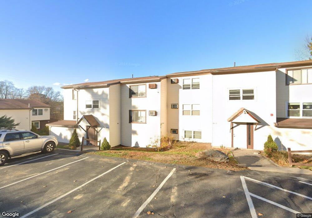
29 Senee Ct Amesbury, MA 01913
Estimated Value: $217,000 - $235,357
1
Bed
1
Bath
730
Sq Ft
$308/Sq Ft
Est. Value
About This Home
This home is located at 29 Senee Ct, Amesbury, MA 01913 and is currently estimated at $224,589, approximately $307 per square foot. 29 Senee Ct is a home located in Essex County with nearby schools including Amesbury High School and Amesbury Seventh-Day Adventist School.
Ownership History
Date
Name
Owned For
Owner Type
Purchase Details
Closed on
Jan 8, 2010
Sold by
Delong Zedeka and Polodian Zedeka
Bought by
Michaels Meg
Current Estimated Value
Purchase Details
Closed on
Oct 22, 2004
Sold by
Limauro Christopher and Fulciniti Saverio P
Bought by
Delong Zedeka M
Home Financials for this Owner
Home Financials are based on the most recent Mortgage that was taken out on this home.
Original Mortgage
$86,800
Interest Rate
5.85%
Mortgage Type
Purchase Money Mortgage
Purchase Details
Closed on
Jun 30, 2004
Sold by
Amato John J
Bought by
Limauro Christopher L and Fulciniti Saverio
Home Financials for this Owner
Home Financials are based on the most recent Mortgage that was taken out on this home.
Original Mortgage
$58,800
Interest Rate
6.3%
Mortgage Type
Purchase Money Mortgage
Create a Home Valuation Report for This Property
The Home Valuation Report is an in-depth analysis detailing your home's value as well as a comparison with similar homes in the area
Home Values in the Area
Average Home Value in this Area
Purchase History
| Date | Buyer | Sale Price | Title Company |
|---|---|---|---|
| Michaels Meg | $40,000 | -- | |
| Delong Zedeka M | $108,500 | -- | |
| Limauro Christopher L | $84,000 | -- |
Source: Public Records
Mortgage History
| Date | Status | Borrower | Loan Amount |
|---|---|---|---|
| Previous Owner | Limauro Christopher L | $86,800 | |
| Previous Owner | Limauro Christopher L | $21,700 | |
| Previous Owner | Limauro Christopher L | $58,800 |
Source: Public Records
Tax History
| Year | Tax Paid | Tax Assessment Tax Assessment Total Assessment is a certain percentage of the fair market value that is determined by local assessors to be the total taxable value of land and additions on the property. | Land | Improvement |
|---|---|---|---|---|
| 2025 | $2,907 | $190,000 | $0 | $190,000 |
| 2024 | $2,598 | $166,100 | $0 | $166,100 |
| 2023 | $2,080 | $127,300 | $0 | $127,300 |
| 2022 | $2,013 | $113,800 | $0 | $113,800 |
| 2021 | $1,761 | $96,500 | $0 | $96,500 |
| 2020 | $1,677 | $97,600 | $0 | $97,600 |
| 2019 | $1,888 | $102,800 | $0 | $102,800 |
| 2018 | $1,952 | $102,800 | $0 | $102,800 |
| 2017 | $1,402 | $70,300 | $0 | $70,300 |
| 2016 | $1,304 | $64,300 | $0 | $64,300 |
Source: Public Records
Map
Nearby Homes
- 6 Adams Ct
- 20 Mason Ct
- 14 Mason Ct Unit 14
- 25 Whittier Meadows Dr
- 48 Whittier Meadows Dr
- 48 Orchard St
- 7 Harrison Eaton Ln
- 35 Orchard St
- 1 Brown Ave Unit 1-25
- 37 Powow St
- 149 Market St
- 11 1/2 Sanborn Terrace
- 102R Kimball Rd
- 105 Market St Unit B
- 101 Market St Unit B
- 12 School St Unit 2
- 25 Cedar St Unit 7
- 4 Clark St
- 1 Hillside Ave Unit 3
- 97 Elm St
Your Personal Tour Guide
Ask me questions while you tour the home.