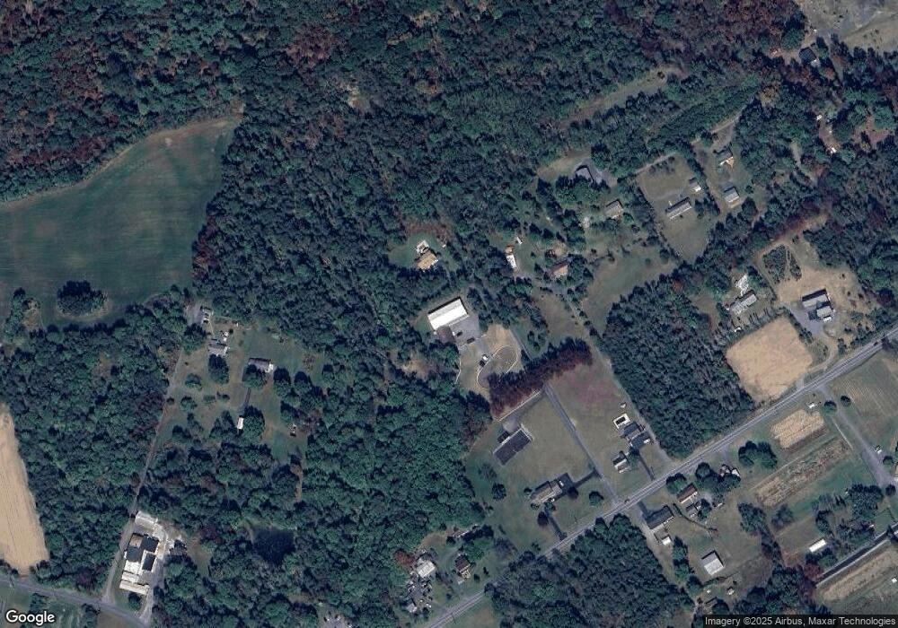
29 Summit Ln Auburn, PA 17922
Estimated Value: $199,000 - $451,896
6
Beds
5
Baths
2,952
Sq Ft
$103/Sq Ft
Est. Value
About This Home
This home is located at 29 Summit Ln, Auburn, PA 17922 and is currently estimated at $304,724, approximately $103 per square foot. 29 Summit Ln is a home located in Schuylkill County with nearby schools including Blue Mountain High School.
Ownership History
Date
Name
Owned For
Owner Type
Purchase Details
Closed on
Aug 24, 2022
Sold by
Walters Richard N and Walters Jessica N
Bought by
Walters Richard and Walters Jessica N
Current Estimated Value
Purchase Details
Closed on
Oct 20, 2020
Sold by
D & R Stables Llc
Bought by
Walters Richard and Walters Jessica N
Home Financials for this Owner
Home Financials are based on the most recent Mortgage that was taken out on this home.
Original Mortgage
$140,000
Interest Rate
2.8%
Mortgage Type
VA
Purchase Details
Closed on
Aug 9, 2016
Sold by
C T P Realty Inc
Bought by
D & R Stables Llc
Home Financials for this Owner
Home Financials are based on the most recent Mortgage that was taken out on this home.
Original Mortgage
$170,000
Interest Rate
3.48%
Mortgage Type
Future Advance Clause Open End Mortgage
Purchase Details
Closed on
Feb 11, 2015
Sold by
C T P Realty Inc
Bought by
C T P Realty Inc
Create a Home Valuation Report for This Property
The Home Valuation Report is an in-depth analysis detailing your home's value as well as a comparison with similar homes in the area
Home Values in the Area
Average Home Value in this Area
Purchase History
| Date | Buyer | Sale Price | Title Company |
|---|---|---|---|
| Walters Richard | -- | None Listed On Document | |
| Walters Richard | $140,000 | Boston National Ttl Agcy Llc | |
| D & R Stables Llc | $235,000 | None Available | |
| C T P Realty Inc | -- | None Available | |
| Herb Linda | -- | None Available |
Source: Public Records
Mortgage History
| Date | Status | Borrower | Loan Amount |
|---|---|---|---|
| Previous Owner | Walters Richard | $140,000 | |
| Previous Owner | D & R Stables Llc | $170,000 |
Source: Public Records
Tax History Compared to Growth
Tax History
| Year | Tax Paid | Tax Assessment Tax Assessment Total Assessment is a certain percentage of the fair market value that is determined by local assessors to be the total taxable value of land and additions on the property. | Land | Improvement |
|---|---|---|---|---|
| 2025 | $6,727 | $101,995 | $14,915 | $87,080 |
| 2024 | $6,243 | $101,995 | $14,915 | $87,080 |
| 2023 | $6,243 | $101,995 | $14,915 | $87,080 |
| 2022 | $6,233 | $101,840 | $14,760 | $87,080 |
| 2021 | $6,135 | $101,840 | $14,760 | $87,080 |
| 2020 | $5,946 | $101,840 | $14,760 | $87,080 |
| 2018 | $5,727 | $101,840 | $14,760 | $87,080 |
| 2017 | $5,625 | $101,840 | $14,760 | $87,080 |
| 2015 | -- | $101,840 | $14,760 | $87,080 |
| 2011 | -- | $101,830 | $0 | $0 |
Source: Public Records
Map
Nearby Homes
- 415 Market St
- 9 Sculps Hill Rd
- 0 Maple Blvd
- 0 Deer Trail Rd
- O/A Deer Trail Rd
- 336 Lake Front Dr
- 0 Green Tree Dr
- 1193 Centre Turnpike
- 521 Lake Front Dr
- 1024 Centre Turnpike
- 405 Village Rd
- 401 Village Rd
- 2101 Village Rd
- 1051 Shiloh Rd Unit J3
- 33/47 Hollenbush Ln
- 100 Dayspring Dr Unit A
- 300 Cornerstone Dr Unit J2
- 900 Dayspring Dr Unit L
- Allegheny Plan at Brick Hill Ridge - Singles
- Alberti Ranch Plan at Brick Hill Ridge - Singles
- 35 Summit Ln
- 2139 Market St
- 30 Wessners Ln
- 2123 Market St
- 63 Pit Ln
- 2133 Market St
- 31 Wessners Ln
- 2109 Market St
- 2101 Market St
- 59 Pit Ln
- 0 Market St Unit 6712707
- 0 Market St Unit PASK126660
- 0 Market St Unit 607114
- 2134 Market St
- 2155 Market St
- 2144 Market St
- 113 Fort Lebanon Rd
- 2100 Market St
- 24 Pit Ln
- 135 Fort Lebanon Rd
