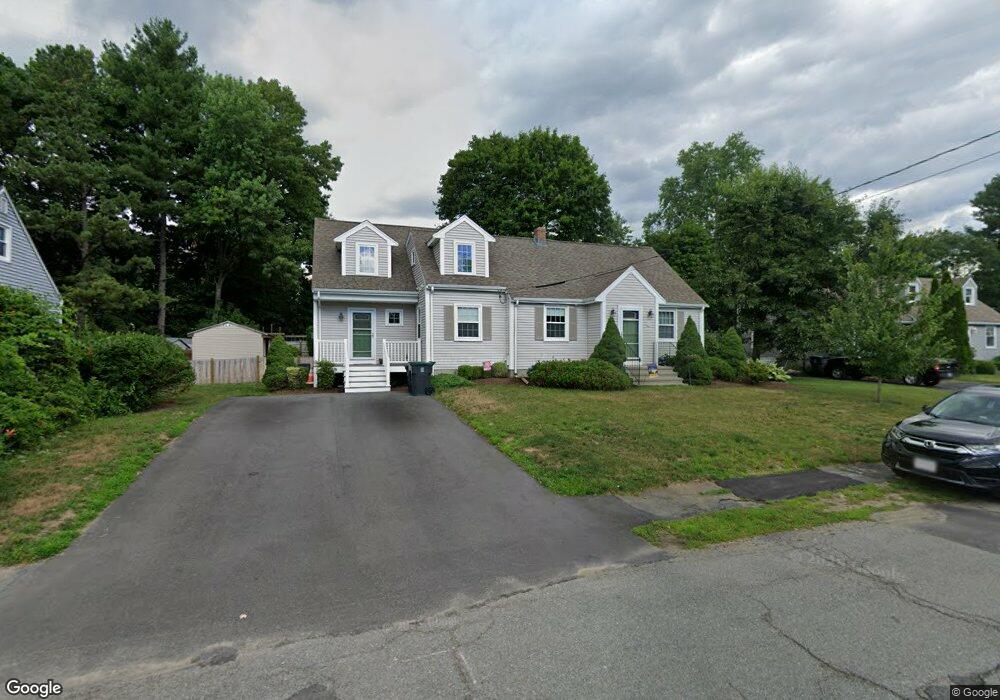
29 Sylvester Rd Natick, MA 01760
Estimated Value: $925,000 - $1,144,000
4
Beds
3
Baths
2,365
Sq Ft
$434/Sq Ft
Est. Value
About This Home
This home is located at 29 Sylvester Rd, Natick, MA 01760 and is currently estimated at $1,027,309, approximately $434 per square foot. 29 Sylvester Rd is a home located in Middlesex County with nearby schools including Natick High School, J F Kennedy Middle School, and Johnson Elementary School.
Ownership History
Date
Name
Owned For
Owner Type
Purchase Details
Closed on
Dec 1, 1992
Sold by
Murray Thomas J and Murray Mary E
Bought by
Hannon James P and Hannon Joan Q
Current Estimated Value
Home Financials for this Owner
Home Financials are based on the most recent Mortgage that was taken out on this home.
Original Mortgage
$138,000
Interest Rate
8.06%
Mortgage Type
Purchase Money Mortgage
Create a Home Valuation Report for This Property
The Home Valuation Report is an in-depth analysis detailing your home's value as well as a comparison with similar homes in the area
Home Values in the Area
Average Home Value in this Area
Purchase History
| Date | Buyer | Sale Price | Title Company |
|---|---|---|---|
| Hannon James P | $154,000 | -- |
Source: Public Records
Mortgage History
| Date | Status | Borrower | Loan Amount |
|---|---|---|---|
| Closed | Hannon James P | $138,000 |
Source: Public Records
Tax History
| Year | Tax Paid | Tax Assessment Tax Assessment Total Assessment is a certain percentage of the fair market value that is determined by local assessors to be the total taxable value of land and additions on the property. | Land | Improvement |
|---|---|---|---|---|
| 2025 | $9,329 | $780,000 | $426,300 | $353,700 |
| 2024 | $8,947 | $729,800 | $401,200 | $328,600 |
| 2023 | $8,820 | $697,800 | $386,000 | $311,800 |
| 2022 | $8,510 | $637,900 | $350,800 | $287,100 |
| 2021 | $5,735 | $599,200 | $330,800 | $268,400 |
| 2020 | $7,951 | $584,200 | $315,800 | $268,400 |
| 2019 | $5,186 | $584,200 | $315,800 | $268,400 |
| 2018 | $7,204 | $552,000 | $300,700 | $251,300 |
| 2017 | $6,781 | $502,700 | $255,900 | $246,800 |
| 2016 | $6,505 | $479,400 | $234,900 | $244,500 |
| 2015 | $6,338 | $458,600 | $234,900 | $223,700 |
Source: Public Records
Map
Nearby Homes
- 28 Sylvester Rd
- 1 Fern St
- 79 Speen St
- 5 Lanes End
- 46 Silver Hill Ln Unit 1
- 36 Silver Hill Ln Unit 21
- 3 Silver Hill Ln Unit 6
- 26 Wellesley Ave Unit B
- 1 Post Oak Ln Unit 19
- 34 Walden Dr Unit 5
- 8 Walden Dr Unit 13
- 16 West St
- 62 Oakland St
- 57 Village Brook Ln Unit 5
- 52 Village Brook Ln Unit 14
- 15 Village Way Unit 8
- 27 Stillman St
- 25 Forest Ave
- 89 W Central St
- 44 Village Hill Ln
Your Personal Tour Guide
Ask me questions while you tour the home.