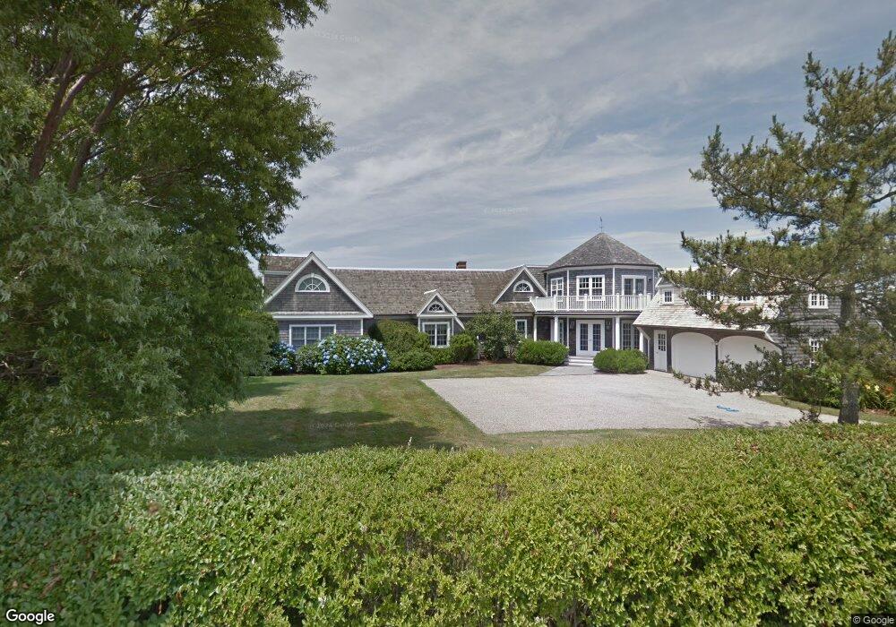
29 Taylors Ln S Little Compton, RI 02837
Estimated Value: $3,630,000 - $5,995,000
3
Beds
5
Baths
6,259
Sq Ft
$770/Sq Ft
Est. Value
About This Home
This home is located at 29 Taylors Ln S, Little Compton, RI 02837 and is currently estimated at $4,822,129, approximately $770 per square foot. 29 Taylors Ln S is a home located in Newport County with nearby schools including Wilbur & McMahon School.
Ownership History
Date
Name
Owned For
Owner Type
Purchase Details
Closed on
Nov 14, 2023
Sold by
Barbara C Howell Ri Qprt C and Barbara Howell
Bought by
Howell Henry W and Howell Olivia W
Current Estimated Value
Purchase Details
Closed on
Dec 10, 2012
Sold by
Howell Barbara C
Bought by
Qprt Barbara C Howell
Purchase Details
Closed on
Jun 30, 1998
Sold by
Faerber Sarah Jane
Bought by
Bell Nelson C and Bell Anne
Home Financials for this Owner
Home Financials are based on the most recent Mortgage that was taken out on this home.
Original Mortgage
$578,000
Interest Rate
7.09%
Create a Home Valuation Report for This Property
The Home Valuation Report is an in-depth analysis detailing your home's value as well as a comparison with similar homes in the area
Home Values in the Area
Average Home Value in this Area
Purchase History
| Date | Buyer | Sale Price | Title Company |
|---|---|---|---|
| Howell Henry W | -- | None Available | |
| Qprt Barbara C Howell | -- | -- | |
| Barbara C Howell Qprt C | -- | -- | |
| Bell Nelson C | $733,000 | -- | |
| Bell Nelson C | $733,000 | -- |
Source: Public Records
Mortgage History
| Date | Status | Borrower | Loan Amount |
|---|---|---|---|
| Previous Owner | Bell Nelson C | $815,000 | |
| Previous Owner | Bell Nelson C | $578,000 |
Source: Public Records
Tax History Compared to Growth
Tax History
| Year | Tax Paid | Tax Assessment Tax Assessment Total Assessment is a certain percentage of the fair market value that is determined by local assessors to be the total taxable value of land and additions on the property. | Land | Improvement |
|---|---|---|---|---|
| 2025 | $24,814 | $5,180,300 | $3,398,200 | $1,782,100 |
| 2024 | $23,412 | $4,608,600 | $2,954,600 | $1,654,000 |
| 2023 | $22,859 | $4,608,600 | $2,954,600 | $1,654,000 |
| 2022 | $22,582 | $4,608,600 | $2,954,600 | $1,654,000 |
| 2021 | $23,773 | $3,936,000 | $2,383,400 | $1,552,600 |
| 2020 | $23,577 | $3,936,000 | $2,383,400 | $1,552,600 |
| 2019 | $22,478 | $3,790,600 | $2,383,400 | $1,407,200 |
| 2018 | $19,735 | $3,311,200 | $1,906,700 | $1,404,500 |
| 2016 | $18,775 | $3,311,200 | $1,906,700 | $1,404,500 |
| 2015 | $18,454 | $3,209,400 | $1,866,000 | $1,343,400 |
| 2014 | $18,101 | $3,209,400 | $1,866,000 | $1,343,400 |
Source: Public Records
Map
Nearby Homes
- 31 Taylors Ln S
- 27 Taylors Ln S
- 28 Taylors Ln S
- 39 Taylors Ln S
- 23 Taylors Ln S
- 24 Taylors Ln S
- 7 Old Bull Ln
- 19 Taylors Ln S
- 46 Taylors Ln S
- 22 Taylors Ln
- 10 Old Bull Ln
- 18 Old Bull Ln
- 17 Old Bull Ln
- 22 Taylors Ln S
- 20 Taylors Ln S
- 15 Taylors Ln S
- 8B Taylors Ln S
- 8B Taylors Ln S Unit n/a
- 20 Old Bull Ln
- 6 Taylors Ln S