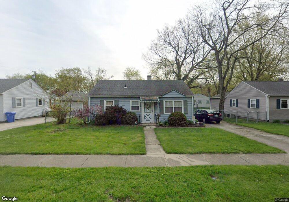
29 Walnut Pkwy Crown Point, IN 46307
Estimated Value: $168,000 - $206,000
3
Beds
1
Bath
825
Sq Ft
$234/Sq Ft
Est. Value
About This Home
This home is located at 29 Walnut Pkwy, Crown Point, IN 46307 and is currently estimated at $193,333, approximately $234 per square foot. 29 Walnut Pkwy is a home located in Lake County with nearby schools including Lake Street Elementary School, Robert Taft Middle School, and Crown Point High School.
Ownership History
Date
Name
Owned For
Owner Type
Purchase Details
Closed on
Feb 12, 2020
Sold by
Sons Of Realty Llc
Bought by
Sor Properties Llc
Current Estimated Value
Home Financials for this Owner
Home Financials are based on the most recent Mortgage that was taken out on this home.
Original Mortgage
$424,950
Outstanding Balance
$377,118
Interest Rate
3.72%
Mortgage Type
Commercial
Estimated Equity
-$183,785
Purchase Details
Closed on
Apr 1, 2016
Sold by
Federal National Mortgage Association
Bought by
Veronica Wood and Veronica Gibson
Create a Home Valuation Report for This Property
The Home Valuation Report is an in-depth analysis detailing your home's value as well as a comparison with similar homes in the area
Home Values in the Area
Average Home Value in this Area
Purchase History
| Date | Buyer | Sale Price | Title Company |
|---|---|---|---|
| Sor Properties Llc | -- | Northwest Indiana Title | |
| Veronica Wood | $75,100 | None Available |
Source: Public Records
Mortgage History
| Date | Status | Borrower | Loan Amount |
|---|---|---|---|
| Open | Sor Properties Llc | $424,950 |
Source: Public Records
Tax History Compared to Growth
Tax History
| Year | Tax Paid | Tax Assessment Tax Assessment Total Assessment is a certain percentage of the fair market value that is determined by local assessors to be the total taxable value of land and additions on the property. | Land | Improvement |
|---|---|---|---|---|
| 2024 | $2,633 | $104,000 | $30,700 | $73,300 |
| 2023 | $2,051 | $95,800 | $30,700 | $65,100 |
| 2022 | $2,051 | $92,800 | $30,700 | $62,100 |
| 2021 | $2,009 | $90,900 | $30,700 | $60,200 |
| 2020 | $2,022 | $91,500 | $30,700 | $60,800 |
| 2019 | $1,943 | $85,900 | $30,700 | $55,200 |
| 2018 | $2,168 | $83,300 | $30,700 | $52,600 |
| 2017 | $2,104 | $79,800 | $30,700 | $49,100 |
| 2016 | $558 | $79,700 | $30,700 | $49,000 |
| 2014 | $500 | $80,400 | $30,700 | $49,700 |
| 2013 | $527 | $81,700 | $30,700 | $51,000 |
Source: Public Records
Map
Nearby Homes
- 1 Walnut Pkwy
- 629 W South St
- 316 W South St
- 290 S Chase Dr
- 114 S Chase Dr
- 512 W Joliet St
- 0 W Joliet St
- 321 Bluebird Ave
- 334 Ellendale Pkwy
- 301 Hoffman St
- 221 N West St
- 306 Holton Ridge
- 312 Fairfield Dr
- 138 N Grant St
- 511 N West St
- 269 Maxwell St
- 531 E Joliet St
- 266 Maxwell St
- 621 Pratt St
- 640 Eleanor Rose Ct