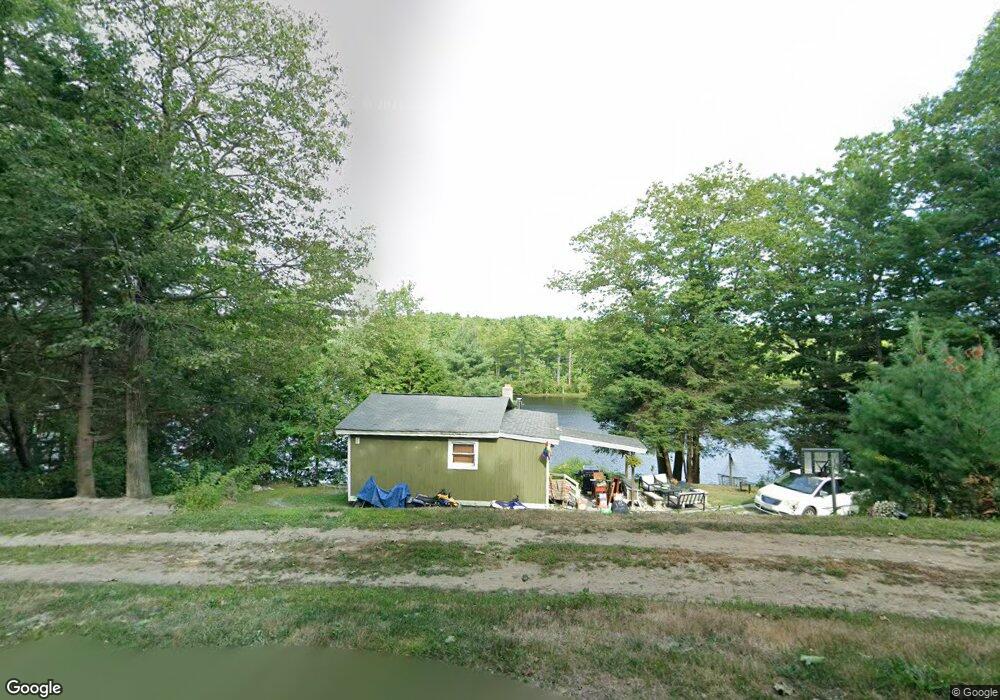
29 Watatic Pond Rd Ashburnham, MA 01430
Estimated Value: $267,000 - $353,000
2
Beds
1
Bath
600
Sq Ft
$521/Sq Ft
Est. Value
About This Home
This home is located at 29 Watatic Pond Rd, Ashburnham, MA 01430 and is currently estimated at $312,482, approximately $520 per square foot. 29 Watatic Pond Rd is a home located in Worcester County with nearby schools including Oakmont Regional High School.
Ownership History
Date
Name
Owned For
Owner Type
Purchase Details
Closed on
Sep 25, 1998
Sold by
Fisher Patrick J and Fisher Donna M
Bought by
Ojala Christopher S
Current Estimated Value
Home Financials for this Owner
Home Financials are based on the most recent Mortgage that was taken out on this home.
Original Mortgage
$43,700
Outstanding Balance
$9,543
Interest Rate
6.87%
Mortgage Type
Purchase Money Mortgage
Estimated Equity
$302,939
Purchase Details
Closed on
Mar 2, 1994
Sold by
Foster Harry A and Foster Robert
Bought by
Fisher Patrick and Fisher Donna M
Create a Home Valuation Report for This Property
The Home Valuation Report is an in-depth analysis detailing your home's value as well as a comparison with similar homes in the area
Home Values in the Area
Average Home Value in this Area
Purchase History
| Date | Buyer | Sale Price | Title Company |
|---|---|---|---|
| Ojala Christopher S | $47,500 | -- | |
| Ojala Christopher S | $47,500 | -- | |
| Fisher Patrick | $9,000 | -- | |
| Fisher Patrick | $9,000 | -- |
Source: Public Records
Mortgage History
| Date | Status | Borrower | Loan Amount |
|---|---|---|---|
| Open | Fisher Patrick | $43,700 | |
| Closed | Fisher Patrick | $43,700 | |
| Closed | Fisher Patrick | $2,300 |
Source: Public Records
Tax History Compared to Growth
Tax History
| Year | Tax Paid | Tax Assessment Tax Assessment Total Assessment is a certain percentage of the fair market value that is determined by local assessors to be the total taxable value of land and additions on the property. | Land | Improvement |
|---|---|---|---|---|
| 2025 | $3,665 | $246,500 | $136,200 | $110,300 |
| 2024 | $3,698 | $234,800 | $136,200 | $98,600 |
| 2023 | $3,674 | $222,000 | $136,200 | $85,800 |
| 2022 | $3,459 | $183,200 | $118,700 | $64,500 |
| 2021 | $3,510 | $170,800 | $118,700 | $52,100 |
| 2020 | $3,433 | $170,800 | $118,700 | $52,100 |
| 2019 | $111 | $157,400 | $111,900 | $45,500 |
| 2018 | $114 | $149,500 | $106,500 | $43,000 |
| 2017 | $3,186 | $138,700 | $101,200 | $37,500 |
| 2016 | $3,105 | $136,500 | $99,200 | $37,300 |
| 2015 | $3,041 | $136,500 | $99,200 | $37,300 |
Source: Public Records
Map
Nearby Homes
- 0 Ashby Rd
- 2409 W State Rd
- 66 Wellington Rd
- 44 Rindge State Rd
- 0 Rindge Turnpike
- 0 Holt Rd
- 28 Hay Rd
- 999 Jones Hill Rd
- 118 Spring Hill Rd
- 152 Ashby Rd
- 270 Page Hill Rd Unit 4
- 0 Lake Haven Ln
- 66 New Ipswich Rd
- 18 Westbrook Dr
- 0 Rindge State Rd
- Lot 3 W State Rd
- 3 Brook Rd
- 123 Harris Rd
- 27 Westbrook Dr
- 10 Frost Rd
- 33 Watatic Pond Rd
- 36 Watatic Pond Rd
- 25 Watatic Pond Rd
- 37 Watatic Pond Rd
- 25 Little Watatic Pond Rd
- 26 Watatic Pond Rd
- 28 Watatic Pond Rd
- 39 Watatic Pond Rd
- 40 Watatic Pond Rd
- 18 Watatic Pond Rd
- 47 Watatic Pond Rd
- 17 Watatic Pond Rd
- 11 Little Watatic Pond Rd
- 14 Watatic Pond Rd
- 338 Rindge Turnpike
- 11 Watatic Pond Rd
- 11 Watatic Pond Rd Unit 1
- 8 Watatic Pond Rd
- 4 Little Watatic Pond Rd
- 9 Little Watatic Pond Rd