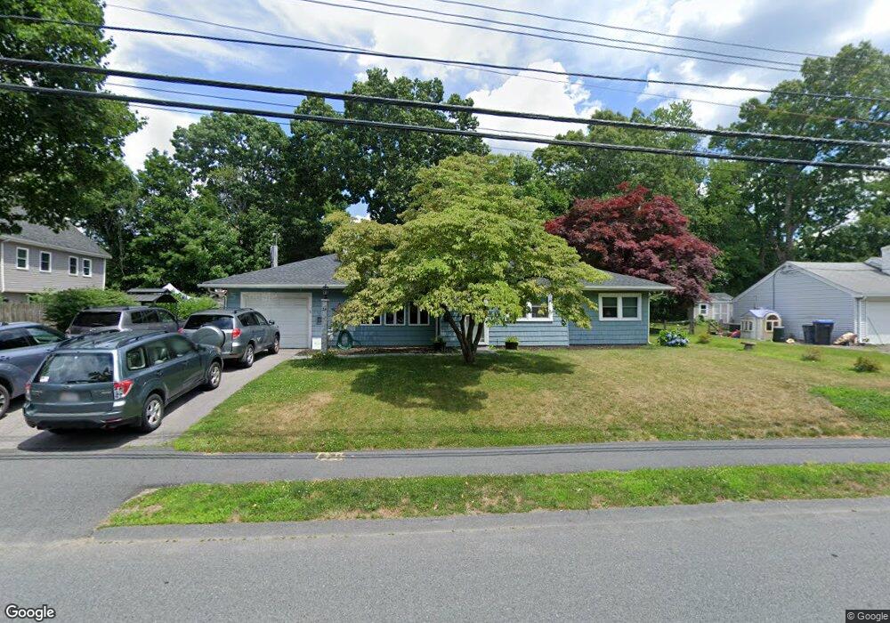
29 Wethersfield Rd Natick, MA 01760
Estimated Value: $839,000 - $994,000
4
Beds
2
Baths
1,890
Sq Ft
$481/Sq Ft
Est. Value
About This Home
This home is located at 29 Wethersfield Rd, Natick, MA 01760 and is currently estimated at $909,291, approximately $481 per square foot. 29 Wethersfield Rd is a home located in Middlesex County with nearby schools including Natick High School, Bennett-Hemenway (Ben-Hem) Elementary School, and Wilson Middle School.
Ownership History
Date
Name
Owned For
Owner Type
Purchase Details
Closed on
Mar 8, 2013
Sold by
Menzi Hans W
Bought by
Menzi Hans W and Menzi Angela D
Current Estimated Value
Purchase Details
Closed on
Oct 24, 2008
Sold by
Norman Arthur J and Norman Wendy M
Bought by
Menzi Hans W
Home Financials for this Owner
Home Financials are based on the most recent Mortgage that was taken out on this home.
Original Mortgage
$334,125
Interest Rate
5.94%
Mortgage Type
Purchase Money Mortgage
Purchase Details
Closed on
Oct 16, 1998
Sold by
Melanson Doherty S
Bought by
Norman Wendy M and Norman Arthur J
Home Financials for this Owner
Home Financials are based on the most recent Mortgage that was taken out on this home.
Original Mortgage
$153,600
Interest Rate
6.8%
Mortgage Type
Purchase Money Mortgage
Create a Home Valuation Report for This Property
The Home Valuation Report is an in-depth analysis detailing your home's value as well as a comparison with similar homes in the area
Home Values in the Area
Average Home Value in this Area
Purchase History
| Date | Buyer | Sale Price | Title Company |
|---|---|---|---|
| Menzi Hans W | -- | -- | |
| Menzi Hans W | $350,000 | -- | |
| Norman Wendy M | $192,000 | -- |
Source: Public Records
Mortgage History
| Date | Status | Borrower | Loan Amount |
|---|---|---|---|
| Previous Owner | Norman Wendy M | $329,974 | |
| Previous Owner | Menzi Hans W | $334,125 | |
| Previous Owner | Norman Wendy M | $153,600 |
Source: Public Records
Tax History
| Year | Tax Paid | Tax Assessment Tax Assessment Total Assessment is a certain percentage of the fair market value that is determined by local assessors to be the total taxable value of land and additions on the property. | Land | Improvement |
|---|---|---|---|---|
| 2025 | $8,341 | $697,400 | $450,100 | $247,300 |
| 2024 | $7,790 | $635,400 | $425,100 | $210,300 |
| 2023 | $7,588 | $600,300 | $400,100 | $200,200 |
| 2022 | $6,171 | $462,600 | $365,100 | $97,500 |
| 2021 | $6,141 | $451,200 | $345,100 | $106,100 |
| 2020 | $6,178 | $453,900 | $330,100 | $123,800 |
| 2019 | $5,769 | $453,900 | $330,100 | $123,800 |
| 2018 | $5,322 | $407,800 | $300,000 | $107,800 |
| 2017 | $5,155 | $382,100 | $265,100 | $117,000 |
| 2016 | $4,910 | $361,800 | $250,100 | $111,700 |
| 2015 | $4,856 | $351,400 | $250,100 | $101,300 |
Source: Public Records
Map
Nearby Homes
- 27 Wethersfield Rd
- 31 Wethersfield Rd
- 31 Wethersfield Rd Unit 31
- 31 Wethersfield Rd
- 31 Wethersfield Rd Unit 1
- 1 Terrane Ave
- 28 Wethersfield Rd
- 3 Appleton Rd
- 30 Wethersfield Rd
- 25 Wethersfield Rd
- 12 Yorkshire Dr
- 2 Appleton Rd
- 32 Wethersfield Rd
- 3 Terrane Ave
- 2 Terrane Ave
- 23 Wethersfield Rd
- 2 Emerson St
- 34 Wethersfield Rd
- 10 Yorkshire Dr
- 35 Wethersfield Rd
Your Personal Tour Guide
Ask me questions while you tour the home.