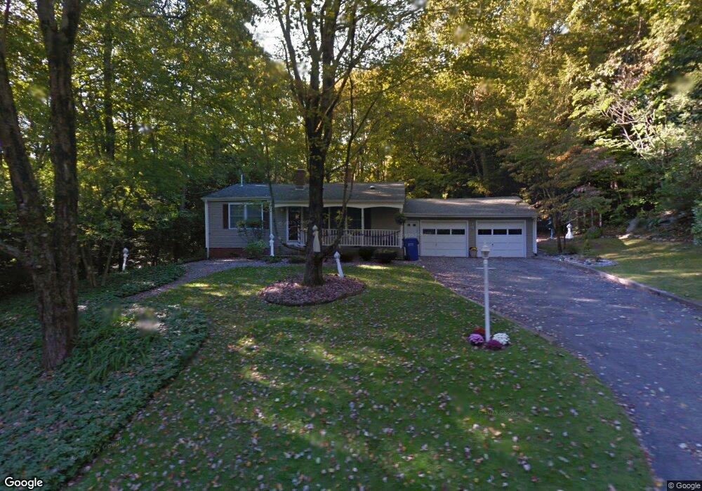
29 Woodland Dr Harwinton, CT 06791
Estimated Value: $302,000 - $393,000
3
Beds
1
Bath
1,064
Sq Ft
$323/Sq Ft
Est. Value
About This Home
This home is located at 29 Woodland Dr, Harwinton, CT 06791 and is currently estimated at $343,892, approximately $323 per square foot. 29 Woodland Dr is a home located in Litchfield County with nearby schools including Harwinton Consolidated School, Har-Bur Middle School, and Lewis S. Mills High School.
Ownership History
Date
Name
Owned For
Owner Type
Purchase Details
Closed on
Apr 10, 2002
Sold by
Robertson Catherine A
Bought by
Carosella Mark J and Carosella Kelly A
Current Estimated Value
Purchase Details
Closed on
Nov 28, 1994
Sold by
Reinhart Florence Est
Bought by
Robertson Michael J and Robertson Catherine A
Create a Home Valuation Report for This Property
The Home Valuation Report is an in-depth analysis detailing your home's value as well as a comparison with similar homes in the area
Home Values in the Area
Average Home Value in this Area
Purchase History
| Date | Buyer | Sale Price | Title Company |
|---|---|---|---|
| Carosella Mark J | $158,500 | -- | |
| Carosella Mark J | $158,500 | -- | |
| Robertson Michael J | $121,000 | -- | |
| Robertson Michael J | $121,000 | -- |
Source: Public Records
Mortgage History
| Date | Status | Borrower | Loan Amount |
|---|---|---|---|
| Open | Robertson Michael J | $35,000 | |
| Open | Robertson Michael J | $135,000 | |
| Closed | Robertson Michael J | $130,000 |
Source: Public Records
Tax History Compared to Growth
Tax History
| Year | Tax Paid | Tax Assessment Tax Assessment Total Assessment is a certain percentage of the fair market value that is determined by local assessors to be the total taxable value of land and additions on the property. | Land | Improvement |
|---|---|---|---|---|
| 2025 | $3,905 | $169,770 | $57,130 | $112,640 |
| 2024 | $3,888 | $169,770 | $57,130 | $112,640 |
| 2023 | $3,694 | $126,490 | $40,810 | $85,680 |
| 2022 | $3,605 | $126,490 | $40,810 | $85,680 |
| 2021 | $3,630 | $126,490 | $40,810 | $85,680 |
| 2020 | $3,542 | $126,490 | $40,810 | $85,680 |
| 2019 | $3,523 | $125,810 | $40,810 | $85,000 |
| 2018 | $3,419 | $122,100 | $43,110 | $78,990 |
| 2017 | $3,394 | $122,100 | $43,110 | $78,990 |
| 2016 | $3,394 | $122,100 | $43,110 | $78,990 |
| 2015 | $3,333 | $122,100 | $43,110 | $78,990 |
| 2014 | $3,284 | $122,100 | $43,110 | $78,990 |
Source: Public Records
Map
Nearby Homes
- 164 Birge Park Rd
- 74 Pine Ridge Dr
- 73 Shirley Rd
- 21 Oak Meadow Ln
- 51 Bradford Rd
- 111 Oxbow Dr
- 69 Sunrise Dr
- 21 South Rd
- 144 Morningside Dr
- 33 Dawn Ave
- 410 Circle Dr
- 325 Circle Dr
- 175 Ramstein Rd
- 29 Hannah Way
- 141 Highfield Dr
- 157 Edgewood Dr
- 178 Edgewood Dr
- 595 Torringford St
- 29 Branch Rd
- 100 Nutmeg Dr
- 21 Woodland Dr
- 28 Woodland Dr
- 34 Woodland Dr
- 38 Woodland Dr
- 22 Woodland Dr
- 15 Woodland Dr
- 37 Woodland Dr
- 14 Woodland Dr
- 24 Beechwood Dr
- 43 Woodland Dr
- 20 Beechwood Dr
- 30 Beechwood Dr
- 50 Woodland Dr
- 27 Beechwood Dr
- 40 Beechwood Dr
- 204 Lead Mine Brook Rd
- 34 Beechwood Dr
- 14 Beechwood Dr
- 23 Beechwood Dr
- 49 Woodland Dr