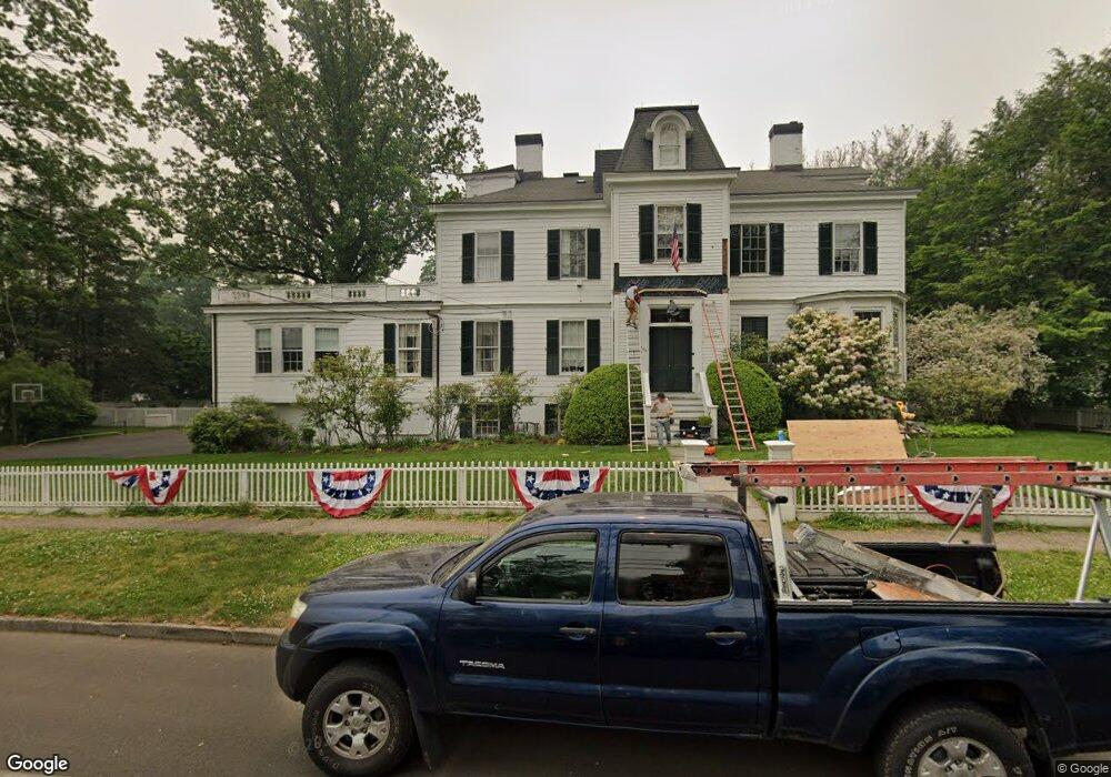
290 Beach Rd Fairfield, CT 06824
Fairfield Beach NeighborhoodEstimated Value: $2,620,000 - $4,280,000
4
Beds
7
Baths
5,829
Sq Ft
$653/Sq Ft
Est. Value
About This Home
This home is located at 290 Beach Rd, Fairfield, CT 06824 and is currently estimated at $3,807,114, approximately $653 per square foot. 290 Beach Rd is a home located in Fairfield County with nearby schools including Roger Sherman Elementary School, Roger Ludlowe Middle School, and Fairfield Ludlowe High School.
Ownership History
Date
Name
Owned For
Owner Type
Purchase Details
Closed on
Nov 8, 1993
Sold by
Lovekin Louise G
Bought by
Callahan Daniel H and Callahan Lisa W
Current Estimated Value
Home Financials for this Owner
Home Financials are based on the most recent Mortgage that was taken out on this home.
Original Mortgage
$464,000
Interest Rate
6.83%
Mortgage Type
Unknown
Create a Home Valuation Report for This Property
The Home Valuation Report is an in-depth analysis detailing your home's value as well as a comparison with similar homes in the area
Home Values in the Area
Average Home Value in this Area
Purchase History
| Date | Buyer | Sale Price | Title Company |
|---|---|---|---|
| Callahan Daniel H | $580,000 | -- | |
| Callahan Daniel H | $580,000 | -- |
Source: Public Records
Mortgage History
| Date | Status | Borrower | Loan Amount |
|---|---|---|---|
| Open | Callahan Daniel H | $1,000,000 | |
| Closed | Callahan Daniel H | $660,000 | |
| Closed | Callahan Daniel H | $660,000 | |
| Closed | Callahan Daniel H | $464,000 |
Source: Public Records
Tax History
| Year | Tax Paid | Tax Assessment Tax Assessment Total Assessment is a certain percentage of the fair market value that is determined by local assessors to be the total taxable value of land and additions on the property. | Land | Improvement |
|---|---|---|---|---|
| 2025 | $45,477 | $1,601,880 | $595,700 | $1,006,180 |
| 2024 | $44,692 | $1,601,880 | $595,700 | $1,006,180 |
| 2023 | $44,068 | $1,601,880 | $595,700 | $1,006,180 |
| 2022 | $42,531 | $1,561,350 | $595,700 | $965,650 |
| 2021 | $42,125 | $1,561,350 | $595,700 | $965,650 |
| 2020 | $46,260 | $1,726,760 | $605,010 | $1,121,750 |
| 2019 | $46,260 | $1,726,760 | $605,010 | $1,121,750 |
| 2018 | $42,720 | $1,620,640 | $605,010 | $1,015,630 |
| 2017 | $41,845 | $1,620,640 | $605,010 | $1,015,630 |
| 2016 | $41,245 | $1,620,640 | $605,010 | $1,015,630 |
| 2015 | $42,385 | $1,709,750 | $702,940 | $1,006,810 |
| 2014 | $41,718 | $1,709,750 | $702,940 | $1,006,810 |
Source: Public Records
Map
Nearby Homes
- 378 Penfield Rd
- 394 Penfield Rd
- 126 Lalley Blvd
- 855 Riverside Dr
- 345 Reef Rd Unit B6
- 345 Reef Rd Unit C9
- 598 S Benson Rd
- 98 Cambridge St
- 187 Catherine Terrace
- 245 Unquowa Rd Unit 2
- 245 Unquowa Rd Unit 82
- 245 Unquowa Rd Unit 6
- 88 Veres St
- 110 Pratt St
- 783 Reef Rd
- 117 Forest Ave
- 20 Ermine St
- 127 Paul Place
- 65 Thorpe St Unit 65
- 164 Wakeman Rd
- 340 Beach Rd
- 303 Beach Rd
- 364 Beach Rd
- 289 Beach Rd
- 349 Beach Rd
- 249 Beach Rd
- 239 Beach Rd
- 20 Sunnieholme Dr
- 300 Sunnieholme Dr
- 205 Beach Rd
- 348 Sunnieholme Dr
- 278 Sunnieholme Dr
- 543 Old Post Rd
- 920 Old Post Rd
- 50 Sunnieholme Dr
- 556 Old Post Rd
- 515 Old Post Rd
- 264 Sunnieholme Dr
- 690 Old Post Rd
- 105 Sunnieholme Dr
Your Personal Tour Guide
Ask me questions while you tour the home.