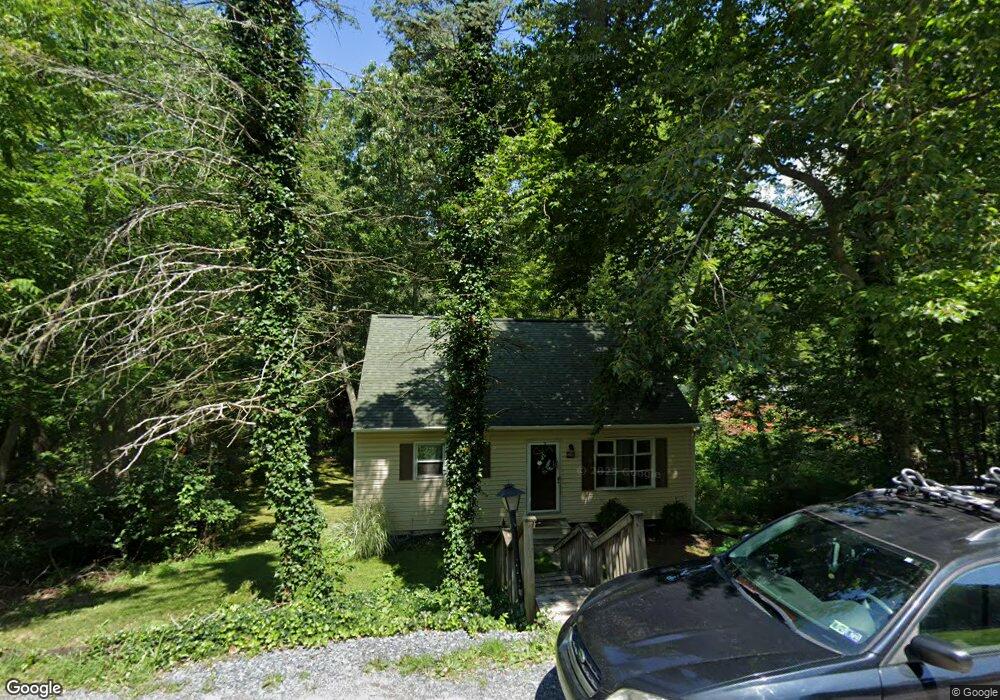
290 Cartref Rd Etters, PA 17319
Estimated Value: $235,947 - $300,000
3
Beds
2
Baths
1,344
Sq Ft
$202/Sq Ft
Est. Value
About This Home
This home is located at 290 Cartref Rd, Etters, PA 17319 and is currently estimated at $271,487, approximately $201 per square foot. 290 Cartref Rd is a home located in York County with nearby schools including Red Mill Elementary School, Crossroads Middle School, and Red Land Senior High School.
Ownership History
Date
Name
Owned For
Owner Type
Purchase Details
Closed on
Mar 6, 2008
Sold by
Federal National Mortgage Association
Bought by
Kerpan Matthew E and Kerpan Kristen L
Current Estimated Value
Home Financials for this Owner
Home Financials are based on the most recent Mortgage that was taken out on this home.
Original Mortgage
$118,960
Outstanding Balance
$74,190
Interest Rate
5.76%
Mortgage Type
FHA
Estimated Equity
$197,297
Purchase Details
Closed on
Oct 5, 2006
Sold by
Hedin Richard J and Hedin Jennifer L
Bought by
Federal National Mortgage Association
Create a Home Valuation Report for This Property
The Home Valuation Report is an in-depth analysis detailing your home's value as well as a comparison with similar homes in the area
Home Values in the Area
Average Home Value in this Area
Purchase History
| Date | Buyer | Sale Price | Title Company |
|---|---|---|---|
| Kerpan Matthew E | $119,900 | None Available | |
| Federal National Mortgage Association | $2,101 | None Available |
Source: Public Records
Mortgage History
| Date | Status | Borrower | Loan Amount |
|---|---|---|---|
| Open | Kerpan Matthew E | $118,960 |
Source: Public Records
Tax History
| Year | Tax Paid | Tax Assessment Tax Assessment Total Assessment is a certain percentage of the fair market value that is determined by local assessors to be the total taxable value of land and additions on the property. | Land | Improvement |
|---|---|---|---|---|
| 2025 | $3,125 | $112,810 | $35,910 | $76,900 |
| 2024 | $4,085 | $112,810 | $35,910 | $76,900 |
| 2023 | $2,793 | $112,810 | $35,910 | $76,900 |
| 2022 | $2,785 | $112,810 | $35,910 | $76,900 |
| 2021 | $2,625 | $112,810 | $35,910 | $76,900 |
| 2020 | $2,594 | $112,810 | $35,910 | $76,900 |
| 2019 | $2,527 | $112,810 | $35,910 | $76,900 |
| 2018 | $2,507 | $112,810 | $35,910 | $76,900 |
| 2017 | $2,440 | $112,810 | $35,910 | $76,900 |
| 2016 | $0 | $112,810 | $35,910 | $76,900 |
| 2015 | -- | $112,810 | $35,910 | $76,900 |
| 2014 | -- | $112,810 | $35,910 | $76,900 |
Source: Public Records
Map
Nearby Homes
- 230 Fairway Dr
- 10 Fargreen Ct Unit 1E
- 5 Locust Cir
- Lot 48 Scarlet Oak Dr
- Lot 29 Scarlet Oak Dr
- Lot 50 Scarlet Oak Dr
- Lot 49 Scarlet Oak Dr
- Lot 47 Scarlet Oak Dr
- Lot 46 Scarlet Oak Dr
- Lot 45 Scarlet Oak Dr
- 209 Church Rd
- 158 Juniper Dr
- 60 Vista Cir
- 65 Ridgeview Dr
- 85 Vista Cir
- Lot 80 Vista Cir
- 2 Russian Olive Dr
- 143 White Dogwood Dr
- 40 Stevens Rd
- 6 Persian Lilac Dr
- 300 Cartref Rd
- 160 Mulligan Dr
- 120 Sam Snead Cir
- 140 Sam Snead Cir
- 130 Sam Snead Cir
- 285 Cartref Rd
- 150 Sam Snead Cir
- 275 Cartref Rd
- 265 Cartref Rd
- 285 Cartef Rd
- 295 Cartref Rd
- 280 Cartref Rd
- 145 Mulligan Dr
- 155 Mulligan Dr
- 160 Sam Snead Cir
- 315 Cartref Rd
- 320 Cartref Rd
- 110 Sam Snead Cir
- 170 Sam Snead Cir
- 115 Sam Snead Cir
Your Personal Tour Guide
Ask me questions while you tour the home.