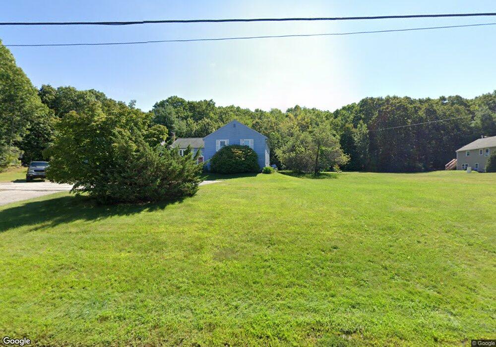
290 Cowell Rd Wrentham, MA 02093
Estimated Value: $396,000 - $510,000
3
Beds
3
Baths
1,872
Sq Ft
$233/Sq Ft
Est. Value
About This Home
This home is located at 290 Cowell Rd, Wrentham, MA 02093 and is currently estimated at $436,649, approximately $233 per square foot. 290 Cowell Rd is a home located in Norfolk County with nearby schools including Delaney Elementary School and Charles E Roderick.
Ownership History
Date
Name
Owned For
Owner Type
Purchase Details
Closed on
Dec 20, 2022
Sold by
Anderson Robert M and Anderson Kerri A
Bought by
Williams Kerry A
Current Estimated Value
Home Financials for this Owner
Home Financials are based on the most recent Mortgage that was taken out on this home.
Original Mortgage
$160,000
Outstanding Balance
$154,877
Interest Rate
6.95%
Mortgage Type
Purchase Money Mortgage
Estimated Equity
$281,772
Purchase Details
Closed on
Sep 28, 2011
Sold by
Goldman-Pascucci Jodi L
Bought by
Anderson Robert M
Home Financials for this Owner
Home Financials are based on the most recent Mortgage that was taken out on this home.
Original Mortgage
$170,984
Interest Rate
4.15%
Mortgage Type
Purchase Money Mortgage
Purchase Details
Closed on
Nov 16, 2004
Sold by
Wotton Heather
Bought by
Goldman-Pascucci Jodi L
Home Financials for this Owner
Home Financials are based on the most recent Mortgage that was taken out on this home.
Original Mortgage
$229,500
Interest Rate
5.75%
Mortgage Type
Purchase Money Mortgage
Purchase Details
Closed on
Feb 18, 2003
Sold by
Jobert Bradford J and Jobert Janet D
Bought by
Sweeney Anne M and Sweeney William D
Purchase Details
Closed on
Feb 14, 1997
Sold by
Tocci Tr Francesco C
Bought by
Omalia Brenda Lee
Purchase Details
Closed on
Aug 24, 1993
Sold by
Hyde Jeffrey G and Hyde Stephanie A
Bought by
Leland Rt
Purchase Details
Closed on
Jan 16, 1987
Sold by
Volpicelli Joseph A
Bought by
Hyde Jeffrey G
Create a Home Valuation Report for This Property
The Home Valuation Report is an in-depth analysis detailing your home's value as well as a comparison with similar homes in the area
Home Values in the Area
Average Home Value in this Area
Purchase History
| Date | Buyer | Sale Price | Title Company |
|---|---|---|---|
| Williams Kerry A | $360,000 | None Available | |
| Anderson Robert M | $165,000 | -- | |
| Anderson Robert M | $165,000 | -- | |
| Goldman-Pascucci Jodi L | $255,000 | -- | |
| Goldman-Pascucci Jodi L | $255,000 | -- | |
| Sweeney Anne M | $215,000 | -- | |
| Sweeney Anne M | $215,000 | -- | |
| Omalia Brenda Lee | $108,000 | -- | |
| Leland Rt | $96,000 | -- | |
| Hyde Jeffrey G | $135,900 | -- |
Source: Public Records
Mortgage History
| Date | Status | Borrower | Loan Amount |
|---|---|---|---|
| Open | Williams Kerry A | $160,000 | |
| Previous Owner | Anderson Robert M | $170,984 | |
| Previous Owner | Goldman-Pascucci Jodi L | $229,500 |
Source: Public Records
Tax History Compared to Growth
Tax History
| Year | Tax Paid | Tax Assessment Tax Assessment Total Assessment is a certain percentage of the fair market value that is determined by local assessors to be the total taxable value of land and additions on the property. | Land | Improvement |
|---|---|---|---|---|
| 2025 | $3,981 | $343,500 | $0 | $343,500 |
| 2024 | $3,882 | $323,500 | $0 | $323,500 |
| 2023 | $4,172 | $330,600 | $0 | $330,600 |
| 2022 | $3,828 | $280,000 | $0 | $280,000 |
| 2021 | $3,651 | $259,500 | $0 | $259,500 |
| 2020 | $3,560 | $249,800 | $0 | $249,800 |
| 2019 | $3,310 | $234,400 | $0 | $234,400 |
| 2018 | $3,301 | $231,800 | $0 | $231,800 |
| 2017 | $3,179 | $223,100 | $0 | $223,100 |
| 2016 | $3,067 | $214,800 | $0 | $214,800 |
| 2015 | $2,933 | $195,800 | $0 | $195,800 |
| 2014 | $2,998 | $195,800 | $0 | $195,800 |
Source: Public Records
Map
Nearby Homes
- 362 East St
- 65 Pond St
- 120 Hawes St
- 319 Taunton St
- 483 Thurston St
- 1 Lorraine Metcalf Dr
- 10 Nature View Dr
- 15 Nature View Dr
- 270 Dedham St
- 11 Earle Stewart Ln
- 131 Creek St Unit 7
- Lot 1 - Blueberry 2 Car Plan at King Philip Estates
- Lot 8 - Blueberry 2 Car Plan at King Philip Estates
- Lot 5 - Hughes 2 car Plan at King Philip Estates
- Lot 6 - Blueberry 3 Car Plan at King Philip Estates
- Lot 2 - Camden 2 Car Plan at King Philip Estates
- Lot 7 - Cedar Plan at King Philip Estates
- Lot 4 - Hemingway 2 Car Plan at King Philip Estates
- Lot 3 - Blueberry 2 Car Plan at King Philip Estates
- Lot 3 - 14 Earle Stewart Ln
- 270 Cowell Rd
- 280 Cowell Rd
- 270 Cowell Rd Unit 270
- 260 Cowell Rd
- 240 Cowell Rd
- 250 Cowell Rd
- 275 Cowell Rd
- 285 Cowell Rd
- 295 Cowell Rd
- 295 Cowell Rd Unit 3
- 285 Cowell Rd Unit B
- 310 Cowell Rd
- 300 Cowell Rd
- 320 Cowell Rd
- 255 Cowell Rd
- 245 Cowell Rd
- 255 Cowell Rd Unit b
- 265 Cowell Rd
- 210 Cowell Rd
- 230 Cowell Rd