Estimated Value: $523,000 - $594,000
5
Beds
3
Baths
2,470
Sq Ft
$226/Sq Ft
Est. Value
About This Home
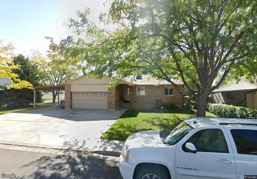
This home is located at 290 E 1100 N, Lehi, UT 84043 and is currently estimated at $557,904, approximately $225 per square foot. 290 E 1100 N is a home located in Utah County with nearby schools including Sego Lily Elementary School, Lehi Junior High School, and Skyridge High School.
Ownership History
Date
Name
Owned For
Owner Type
Purchase Details
Closed on
Jul 3, 2025
Sold by
Braley Kordel T and Braley Heather C
Bought by
Heather And Kordel Braley Living Trust and Braley
Current Estimated Value
Purchase Details
Closed on
Jun 8, 2004
Sold by
Sexton Glen G and Sexton Connie L
Bought by
Sexton Glen G
Purchase Details
Closed on
Jul 14, 1999
Sold by
Denton Glade V and Denton Cheri A
Bought by
Sexton Glen G and Sexton Connie L
Home Financials for this Owner
Home Financials are based on the most recent Mortgage that was taken out on this home.
Original Mortgage
$147,250
Interest Rate
7.4%
Purchase Details
Closed on
Oct 1, 1997
Sold by
Krebs L Cloyd and Krebs Debbie
Bought by
Denton Glade and Denton Cheri A
Home Financials for this Owner
Home Financials are based on the most recent Mortgage that was taken out on this home.
Original Mortgage
$50,000
Interest Rate
7.44%
Create a Home Valuation Report for This Property
The Home Valuation Report is an in-depth analysis detailing your home's value as well as a comparison with similar homes in the area
Home Values in the Area
Average Home Value in this Area
Purchase History
| Date | Buyer | Sale Price | Title Company |
|---|---|---|---|
| Heather And Kordel Braley Living Trust | -- | None Listed On Document | |
| Sexton Glen G | -- | Meridian Title Company | |
| Sexton Glen G | -- | Century Title | |
| Denton Glade | -- | -- |
Source: Public Records
Mortgage History
| Date | Status | Borrower | Loan Amount |
|---|---|---|---|
| Previous Owner | Sexton Glen G | $147,250 | |
| Previous Owner | Denton Glade | $50,000 |
Source: Public Records
Tax History
| Year | Tax Paid | Tax Assessment Tax Assessment Total Assessment is a certain percentage of the fair market value that is determined by local assessors to be the total taxable value of land and additions on the property. | Land | Improvement |
|---|---|---|---|---|
| 2025 | $2,047 | $274,065 | -- | -- |
| 2024 | $2,047 | $239,580 | $0 | $0 |
| 2023 | $1,880 | $238,865 | $0 | $0 |
| 2022 | $2,145 | $264,275 | $0 | $0 |
| 2021 | $1,923 | $358,200 | $109,900 | $248,300 |
| 2020 | $1,814 | $333,900 | $101,800 | $232,100 |
| 2019 | $1,632 | $312,300 | $101,800 | $210,500 |
| 2018 | $1,557 | $281,600 | $91,200 | $190,400 |
| 2017 | $1,422 | $136,730 | $0 | $0 |
| 2016 | $1,403 | $125,235 | $0 | $0 |
| 2015 | $1,425 | $120,725 | $0 | $0 |
| 2014 | $1,328 | $111,815 | $0 | $0 |
Source: Public Records
Map
Nearby Homes
- 1329 N 100 E Unit 21
- 52 W State St
- 68 W State St
- 1150 N 200 W Unit 6
- 155 W State St Unit TRLR 3
- 197 W Harvest Ln
- 230 W State St
- 807 N Somerset Aly
- 832 N Somerset Aly
- 595 S 600 E
- 890 N Whipple Dr
- 428 E 500 N
- 1370 N Cedar Hollow Blvd
- 1272 N Cedar Hollow Blvd
- 406 W 600 N
- 395 N 100 W
- 281 N Center St
- 1175 E 900 N
- 430 N 470 W Unit 17
- 430 N 470 W Unit 29
Your Personal Tour Guide
Ask me questions while you tour the home.