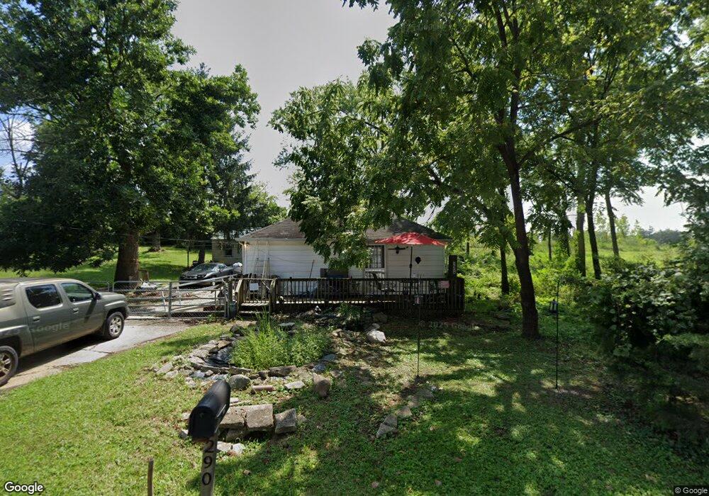
290 Emmit Ave Columbus, OH 43228
Estimated Value: $237,000 - $365,000
Studio
--
Bath
--
Sq Ft
3,833
Sq Ft Lot
About This Home
This home is located at 290 Emmit Ave, Columbus, OH 43228 and is currently estimated at $303,667. 290 Emmit Ave is a home located in Franklin County with nearby schools including Stiles Elementary School, Galloway Ridge Intermediate School, and Norton Middle School.
Ownership History
Date
Name
Owned For
Owner Type
Purchase Details
Closed on
Sep 17, 1996
Sold by
Evans Rebecca A
Bought by
Bentley Scott A
Current Estimated Value
Home Financials for this Owner
Home Financials are based on the most recent Mortgage that was taken out on this home.
Original Mortgage
$53,800
Outstanding Balance
$4,657
Interest Rate
8.29%
Mortgage Type
FHA
Estimated Equity
$299,010
Purchase Details
Closed on
Jun 15, 1994
Sold by
Hollar John R
Bought by
Evans Rebecca A
Home Financials for this Owner
Home Financials are based on the most recent Mortgage that was taken out on this home.
Original Mortgage
$39,100
Interest Rate
8.58%
Mortgage Type
New Conventional
Purchase Details
Closed on
Sep 1, 1984
Create a Home Valuation Report for This Property
The Home Valuation Report is an in-depth analysis detailing your home's value as well as a comparison with similar homes in the area
Home Values in the Area
Average Home Value in this Area
Purchase History
| Date | Buyer | Sale Price | Title Company |
|---|---|---|---|
| Bentley Scott A | $54,900 | -- | |
| Evans Rebecca A | $43,500 | -- | |
| -- | -- | -- |
Source: Public Records
Mortgage History
| Date | Status | Borrower | Loan Amount |
|---|---|---|---|
| Open | Bentley Scott A | $53,800 | |
| Previous Owner | Evans Rebecca A | $39,100 |
Source: Public Records
Tax History Compared to Growth
Tax History
| Year | Tax Paid | Tax Assessment Tax Assessment Total Assessment is a certain percentage of the fair market value that is determined by local assessors to be the total taxable value of land and additions on the property. | Land | Improvement |
|---|---|---|---|---|
| 2024 | $1,134 | $10,470 | $10,470 | -- |
| 2023 | $461 | $10,465 | $10,465 | $0 |
| 2022 | $185 | $1,960 | $1,960 | $0 |
| 2021 | $125 | $1,960 | $1,960 | $0 |
| 2020 | $124 | $1,960 | $1,960 | $0 |
| 2019 | $117 | $1,610 | $1,610 | $0 |
| 2018 | $126 | $1,610 | $1,610 | $0 |
| 2017 | $122 | $1,610 | $1,610 | $0 |
| 2016 | $135 | $1,790 | $1,790 | $0 |
| 2015 | $134 | $1,790 | $1,790 | $0 |
| 2014 | $135 | $1,790 | $1,790 | $0 |
| 2013 | $78 | $2,100 | $2,100 | $0 |
Source: Public Records
Map
Nearby Homes
- 299 Lombard Rd
- 4637 Hilton Ave
- 415 Georgesville Rd
- 264 Woodlawn Ave
- 4696 Tarryton Ct S Unit 7-2D
- 87 Tarryton Ct W Unit 18D
- 4220 Atlanta Dr
- 141 Beacon Run W Unit 26E
- 269 Oxley Rd
- 5006 Old Tree Ave
- 89 Postle Blvd
- 218 Darbyhurst Rd
- 673 Roth Ave
- 4848 Deephollow Dr
- 271 Carilla Ln
- 429 Postle Blvd
- 4190 Salem Dr
- 686 French Dr
- 4589 Annhurst Rd
- 480 Yarmouth Ln