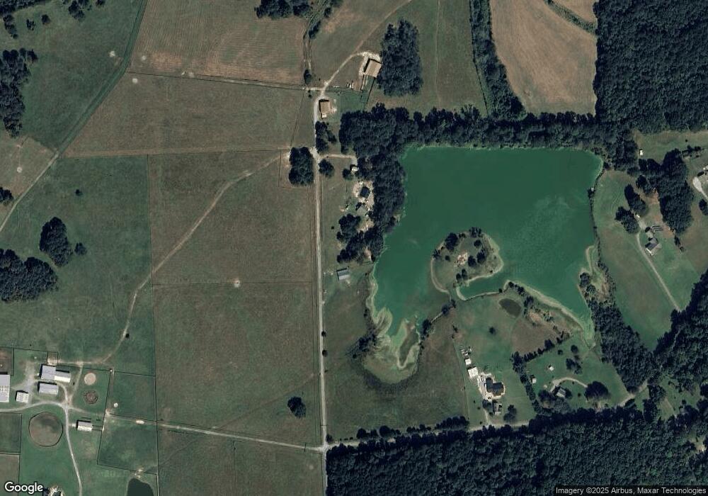
290 Fite Rd Cedartown, GA 30125
Estimated Value: $298,000 - $643,000
2
Beds
2
Baths
1,324
Sq Ft
$320/Sq Ft
Est. Value
About This Home
This home is located at 290 Fite Rd, Cedartown, GA 30125 and is currently estimated at $423,893, approximately $320 per square foot. 290 Fite Rd is a home located in Polk County.
Ownership History
Date
Name
Owned For
Owner Type
Purchase Details
Closed on
Sep 29, 2022
Sold by
Blakeney Roger S
Bought by
Mooney Kirk and Mooney Diana L
Current Estimated Value
Purchase Details
Closed on
Aug 8, 2012
Sold by
Equity Trust Company Custodian Fbo*
Bought by
Blakeney Roger S
Purchase Details
Closed on
Dec 16, 2005
Sold by
Blakeney Roger* and Blakeney Pamela S
Bought by
Blakeney Roger S
Home Financials for this Owner
Home Financials are based on the most recent Mortgage that was taken out on this home.
Original Mortgage
$160,000
Interest Rate
6.28%
Mortgage Type
New Conventional
Purchase Details
Closed on
Sep 12, 2002
Sold by
Blakeney Roger
Bought by
Blakeney Roger and Blakeney Pamela S
Purchase Details
Closed on
Mar 21, 2002
Sold by
Copelan Robert E
Bought by
Blakeney Roger S
Create a Home Valuation Report for This Property
The Home Valuation Report is an in-depth analysis detailing your home's value as well as a comparison with similar homes in the area
Home Values in the Area
Average Home Value in this Area
Purchase History
| Date | Buyer | Sale Price | Title Company |
|---|---|---|---|
| Mooney Kirk | $490,000 | -- | |
| Blakeney Roger S | -- | -- | |
| Blakeney Roger S | -- | -- | |
| Blakeney Roger | -- | -- | |
| Blakeney Roger S | $45,000 | -- |
Source: Public Records
Mortgage History
| Date | Status | Borrower | Loan Amount |
|---|---|---|---|
| Previous Owner | Blakeney Roger S | $160,000 |
Source: Public Records
Tax History Compared to Growth
Tax History
| Year | Tax Paid | Tax Assessment Tax Assessment Total Assessment is a certain percentage of the fair market value that is determined by local assessors to be the total taxable value of land and additions on the property. | Land | Improvement |
|---|---|---|---|---|
| 2024 | $1,916 | $111,959 | $26,948 | $85,011 |
| 2023 | $1,494 | $83,382 | $26,948 | $56,434 |
| 2022 | $1,216 | $65,682 | $17,966 | $47,716 |
| 2021 | $1,229 | $65,682 | $17,966 | $47,716 |
| 2020 | $1,229 | $65,682 | $17,966 | $47,716 |
| 2019 | $1,205 | $46,854 | $17,966 | $28,888 |
| 2018 | $1,210 | $45,897 | $17,966 | $27,931 |
| 2017 | $1,195 | $45,897 | $17,966 | $27,931 |
| 2016 | $1,095 | $42,236 | $16,512 | $25,723 |
| 2015 | $1,102 | $42,383 | $16,512 | $25,870 |
| 2014 | $1,110 | $42,383 | $16,512 | $25,870 |
Source: Public Records
Map
Nearby Homes
- 176 Runyon Loop
- 0 Runyon Loop Unit 10606366
- 0 Runyon Loop Unit 7650113
- 1838 Antioch Rd
- 1912 Hightower Rd
- 160 Tate Rd
- 0 Everett Mtn Rd
- 0 Hightower Rd Unit 10584768
- 0 Hightower Rd Unit 7633002
- 0 Hightower Rd Unit 10584778
- 0 Hightower Rd Unit 7632982
- 0 Youngs Farm Rd Unit 24829378
- 0 Buchanan Hwy Unit 10558945
- 4267 Buchanan Hwy
- 102 acres Youngs Farm Rd
- 4550 Buchanan Hwy
- 45 York Cir
- 600 Grady Rd
- 296 Winkle Rd
- 470 Knight Rd
