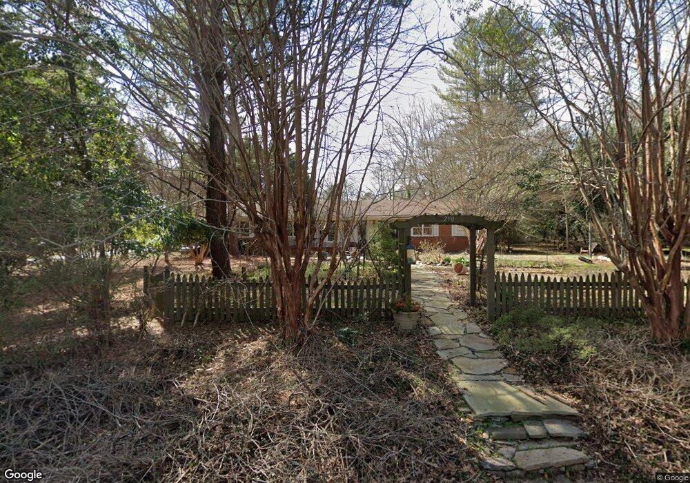
290 Forest Rd Athens, GA 30605
Green - Crestwood NeighborhoodEstimated Value: $309,325 - $348,000
3
Beds
2
Baths
1,911
Sq Ft
$175/Sq Ft
Est. Value
About This Home
This home is located at 290 Forest Rd, Athens, GA 30605 and is currently estimated at $334,081, approximately $174 per square foot. 290 Forest Rd is a home located in Clarke County with nearby schools including Barnett Shoals Elementary School, Hilsman Middle School, and Cedar Shoals High School.
Ownership History
Date
Name
Owned For
Owner Type
Purchase Details
Closed on
Jul 30, 2010
Sold by
Paschal Gehres M and Sincl Edith
Bought by
Jackson Edith S
Current Estimated Value
Purchase Details
Closed on
May 3, 2002
Sold by
Chiles John M and Steven Wiley
Bought by
Paschal Gehres M and Edith Sinclair J
Purchase Details
Closed on
Jul 23, 1999
Sold by
Elliott Norbert and Elliott Gertrudis R
Bought by
Chiles John M and Steven Wiley
Purchase Details
Closed on
Dec 15, 1995
Sold by
Elliott Norbert
Bought by
Elliott Norbert and Ellio Gertrudis R
Purchase Details
Closed on
Aug 7, 1992
Sold by
Towns Albert Roy
Bought by
Mcleroy David Glynn
Purchase Details
Closed on
Jun 27, 1991
Sold by
Towns Ruth B Mrs
Bought by
Towns Albert Roy
Create a Home Valuation Report for This Property
The Home Valuation Report is an in-depth analysis detailing your home's value as well as a comparison with similar homes in the area
Home Values in the Area
Average Home Value in this Area
Purchase History
| Date | Buyer | Sale Price | Title Company |
|---|---|---|---|
| Jackson Edith S | -- | -- | |
| Paschal Gehres M | $118,000 | -- | |
| Chiles John M | $112,500 | -- | |
| Elliott Norbert | -- | -- | |
| Elliott Norbert | $89,900 | -- | |
| Mcleroy David Glynn | $87,500 | -- | |
| Towns Albert Roy | -- | -- |
Source: Public Records
Tax History
| Year | Tax Paid | Tax Assessment Tax Assessment Total Assessment is a certain percentage of the fair market value that is determined by local assessors to be the total taxable value of land and additions on the property. | Land | Improvement |
|---|---|---|---|---|
| 2025 | $1,877 | $114,745 | $14,000 | $100,745 |
| 2024 | $1,877 | $111,824 | $14,000 | $97,824 |
| 2023 | $572 | $104,113 | $14,000 | $90,113 |
| 2022 | $1,876 | $91,070 | $14,000 | $77,070 |
| 2021 | $1,783 | $76,980 | $13,000 | $63,980 |
| 2020 | $1,722 | $72,528 | $13,000 | $59,528 |
| 2019 | $1,675 | $68,018 | $12,000 | $56,018 |
| 2018 | $1,587 | $61,687 | $12,000 | $49,687 |
| 2017 | $1,515 | $56,550 | $12,000 | $44,550 |
| 2016 | $1,474 | $53,580 | $12,000 | $41,580 |
| 2015 | $1,472 | $53,288 | $12,000 | $41,288 |
| 2014 | $1,502 | $54,099 | $12,000 | $42,099 |
Source: Public Records
Map
Nearby Homes
- 331 Greencrest Dr
- 352 Greencrest Dr
- 189 Ashbrook Dr
- 150 Rumson Rd
- 2535 Barnett Shoals Rd
- 140 Ashbrook Dr
- 256 Scandia Cir
- 625 Forest Rd
- 337 Georgetown Dr
- 1305 Cedar Shoals Dr Unit 500
- 100 Ansonborough Ln
- 100 Ansonborough Ln Unit 703
- 100 Ansonborough Ln Unit 403
- 100 Ansonborough Ln Unit 601
- 109 Layla Ct
- 29 N Stratford Dr
- 0 Barnett Shoals Rd Unit Lot 1
- 42 N Stratford Dr
- 135 Spring Lake Dr
- 431 College Cir
- 130 Belmont Ct
- 270 Forest Rd
- 295 Forest Rd
- 293 Forest Rd
- 291 Forest Rd
- 315 Forest Rd
- 140 Belmont Ct
- 330 Forest Rd
- 260 Forest Rd
- 150 Brookwood Dr
- 160 Brookwood Dr
- 135 Belmont Ct
- 289 Forest Rd
- 325 Forest Rd
- 357 Greencrest Dr
- 140 Brookwood Dr
- 160 Belmont Ct
- 240 Forest Rd
- 360 Forest Rd
- 359 Greencrest Dr
Your Personal Tour Guide
Ask me questions while you tour the home.