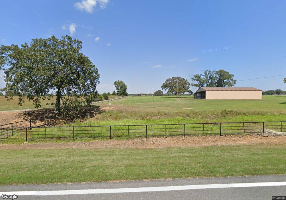
290 Highway 225 W Greenbrier, AR 72058
Estimated Value: $211,000 - $266,000
--
Bed
1
Bath
975
Sq Ft
$243/Sq Ft
Est. Value
About This Home
This home is located at 290 Highway 225 W, Greenbrier, AR 72058 and is currently estimated at $237,030, approximately $243 per square foot. 290 Highway 225 W is a home located in Faulkner County with nearby schools including Greenbrier Wooster Elementary School, Greenbrier Junior High School, and Greenbrier High School.
Ownership History
Date
Name
Owned For
Owner Type
Purchase Details
Closed on
Aug 26, 2005
Bought by
Reynolds Jimmy
Current Estimated Value
Purchase Details
Closed on
Aug 22, 1996
Bought by
Reynolds
Purchase Details
Closed on
May 4, 1994
Bought by
Correction Deed
Purchase Details
Closed on
Oct 4, 1990
Bought by
Correction Deed
Purchase Details
Closed on
Jul 19, 1985
Bought by
Garrison
Create a Home Valuation Report for This Property
The Home Valuation Report is an in-depth analysis detailing your home's value as well as a comparison with similar homes in the area
Home Values in the Area
Average Home Value in this Area
Purchase History
| Date | Buyer | Sale Price | Title Company |
|---|---|---|---|
| Reynolds Jimmy | -- | -- | |
| Reynolds Jimmy | -- | -- | |
| Reynolds | -- | -- | |
| Correction Deed | -- | -- | |
| Correction Deed | -- | -- | |
| Garrison | -- | -- |
Source: Public Records
Tax History Compared to Growth
Tax History
| Year | Tax Paid | Tax Assessment Tax Assessment Total Assessment is a certain percentage of the fair market value that is determined by local assessors to be the total taxable value of land and additions on the property. | Land | Improvement |
|---|---|---|---|---|
| 2025 | $1,292 | $31,560 | $8,580 | $22,980 |
| 2024 | $1,194 | $31,560 | $8,580 | $22,980 |
| 2023 | $1,085 | $22,060 | $7,380 | $14,680 |
| 2022 | $1,094 | $22,060 | $7,380 | $14,680 |
| 2021 | $1,006 | $22,060 | $7,380 | $14,680 |
| 2020 | $920 | $17,840 | $6,100 | $11,740 |
| 2019 | $920 | $17,840 | $6,100 | $11,740 |
| 2018 | $920 | $17,840 | $6,100 | $11,740 |
| 2017 | $920 | $17,840 | $6,100 | $11,740 |
| 2016 | $920 | $17,840 | $6,100 | $11,740 |
| 2015 | $682 | $14,720 | $5,520 | $9,200 |
| 2014 | $724 | $14,720 | $5,520 | $9,200 |
Source: Public Records
Map
Nearby Homes
- 21 Mountain Grove Rd
- 19 Mountain Grove Rd
- 25 Mountain Grove Rd
- 19 Horseshoe Dr
- 49 Ules Watson Dr
- 26 Ules Watson Dr
- 38 Ules Watson Dr
- 22 Ules Watson Dr
- 18 Sky Dr
- 13 Scenic Point
- 18 Sheila Dr
- 12 Bullet Davis Dr
- 195 Green Valley Dr
- 9 Spencer Rd
- 5 Hargrove Rd
- Lot 4 Noble Dr
- 0 Mountain Dr Unit 25037483
- 108 Weston Cir
- 47 Weston Cir
- 0000 Burkett Flat Rd
- 300 Highway 225 W
- 00 Huntington Dr
- 5 Huntington Dr
- 4 Huntington Dr
- 279 Highway 225 W
- 7 Huntington Dr
- 6 Huntington Dr
- 254 Highway 225 W
- 25 Reynolds Dr
- 9 Huntington Dr
- 44 Tally Ho Trail
- 5 Sawrie Rd
- 3 Sawrie Rd
- 16 Maple Ridge
- 13 Huntington Dr
- 12 Sawrie Rd
- 12 Huntington Dr
- 247 Highway 225 W
- 247 Highway 225 W
- 17 Huntington Dr
