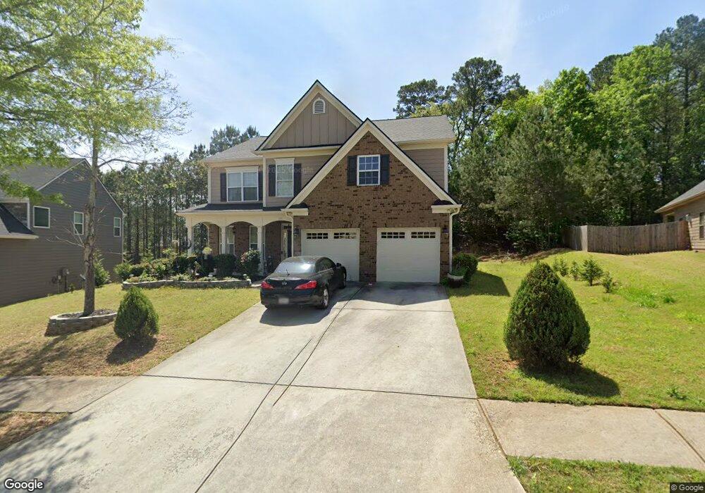
290 Kestrel Cir Covington, GA 30014
Estimated Value: $357,000 - $408,000
Studio
2
Baths
3,168
Sq Ft
$120/Sq Ft
Est. Value
About This Home
This home is located at 290 Kestrel Cir, Covington, GA 30014 and is currently estimated at $380,550, approximately $120 per square foot. 290 Kestrel Cir is a home located in Newton County with nearby schools including East Newton Elementary School, Cousins Middle School, and Eastside High School.
Ownership History
Date
Name
Owned For
Owner Type
Purchase Details
Closed on
Aug 28, 2007
Sold by
D R Horton Inc
Bought by
Telesford Jeysirine
Current Estimated Value
Home Financials for this Owner
Home Financials are based on the most recent Mortgage that was taken out on this home.
Original Mortgage
$182,722
Interest Rate
6.32%
Mortgage Type
New Conventional
Create a Home Valuation Report for This Property
The Home Valuation Report is an in-depth analysis detailing your home's value as well as a comparison with similar homes in the area
Home Values in the Area
Average Home Value in this Area
Purchase History
| Date | Buyer | Sale Price | Title Company |
|---|---|---|---|
| Telesford Jeysirine | $192,400 | -- |
Source: Public Records
Mortgage History
| Date | Status | Borrower | Loan Amount |
|---|---|---|---|
| Previous Owner | Telesford Jeysirine | $182,722 |
Source: Public Records
Tax History
| Year | Tax Paid | Tax Assessment Tax Assessment Total Assessment is a certain percentage of the fair market value that is determined by local assessors to be the total taxable value of land and additions on the property. | Land | Improvement |
|---|---|---|---|---|
| 2025 | $3,794 | $157,200 | $21,600 | $135,600 |
| 2024 | $3,689 | $147,040 | $21,600 | $125,440 |
| 2023 | $3,548 | $132,320 | $10,000 | $122,320 |
| 2022 | $2,883 | $107,840 | $10,000 | $97,840 |
| 2021 | $2,831 | $95,200 | $10,000 | $85,200 |
| 2020 | $2,575 | $79,000 | $10,000 | $69,000 |
| 2019 | $2,569 | $77,680 | $10,000 | $67,680 |
| 2018 | $2,411 | $72,600 | $10,000 | $62,600 |
| 2017 | $2,456 | $73,920 | $11,200 | $62,720 |
| 2016 | $1,842 | $56,040 | $9,000 | $47,040 |
| 2015 | $1,308 | $40,640 | $3,200 | $37,440 |
| 2014 | $1,306 | $40,640 | $0 | $0 |
Source: Public Records
Map
Nearby Homes
- 20 Kestrel Cir
- 370 Granary Walk
- 0 Piper Rd Unit 7693971
- 0 Piper Rd Unit 10659921
- 18 River Walk Farm Pkwy
- 324 Piper Rd
- 13268 Tolstoy Ln
- 25 Scarlett Ct
- 35 Crossbill Trail
- 295 River Walk Farm Pkwy
- 7713 Fawn Cir
- 7713 Fawn Cir Unit 51
- 344 Riverwalk Pkwy
- 0 Briarpatch Dr Unit 10562648
- 323 River Walk Farm
- 391 River Walk Farm Pkwy Unit 11
- 7703 Fawn Cir
- 420 River Walk Farm Pkwy Unit LOT 43
- 312 River Walk Farm
- 669 River Walk Farm Pwy #75
- 300 Kestrel Cir Unit Lot 523
- 300 Kestrel Cir Unit Lot 133
- 280 Kestrel Cir Unit 525
- 20 Bellflower Walk
- 20 Bellflower Walk Unit 519
- 8251 S Dearing Rd
- 270 Kestrel Cir
- 270 Kestrel Cir
- 270 Kestrel Cir Unit 526
- 55 Kestrel Cir
- 65 Kestrel Cir
- 295 Kestrel Cir
- 295 Kestrel Cir Unit 4
- 265 Kestrel Cir Unit 564
- 265 Kestrel Cir
- 45 Kestrel Cir
- 85 Kestrel Cir
- 235 Kestrel Cir Unit 565
- 235 Kestrel Cir
- 260 Kestrel Cir
Your Personal Tour Guide
Ask me questions while you tour the home.