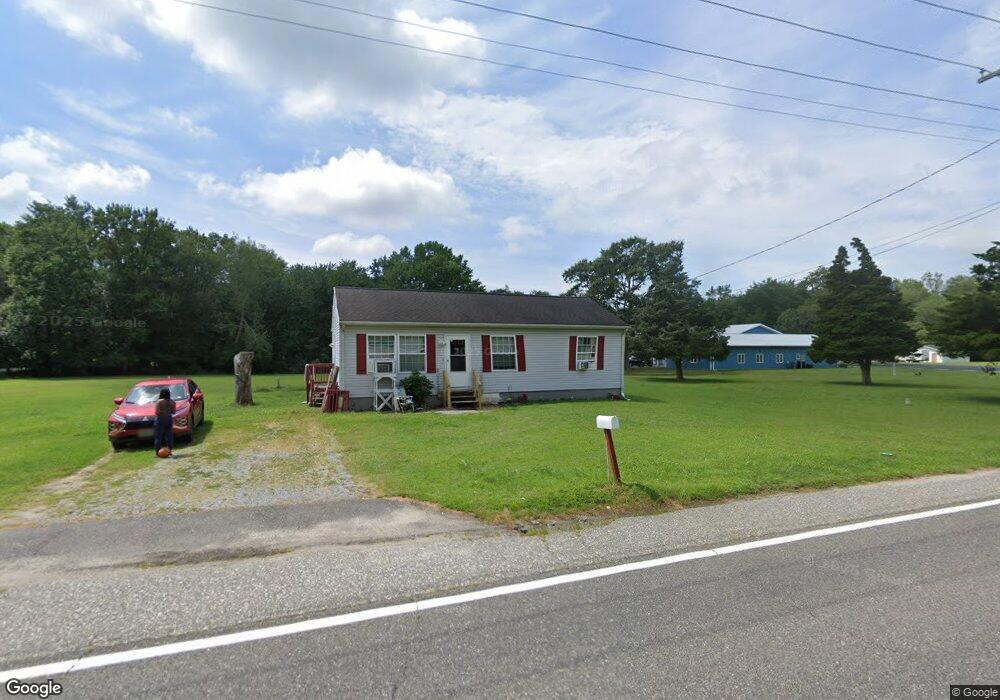
290 Main St Newport, NJ 08345
Estimated Value: $114,000 - $342,000
--
Bed
--
Bath
1,123
Sq Ft
$193/Sq Ft
Est. Value
About This Home
This home is located at 290 Main St, Newport, NJ 08345 and is currently estimated at $216,440, approximately $192 per square foot. 290 Main St is a home located in Cumberland County with nearby schools including Downe Township Elementary School.
Create a Home Valuation Report for This Property
The Home Valuation Report is an in-depth analysis detailing your home's value as well as a comparison with similar homes in the area
Home Values in the Area
Average Home Value in this Area
Tax History Compared to Growth
Tax History
| Year | Tax Paid | Tax Assessment Tax Assessment Total Assessment is a certain percentage of the fair market value that is determined by local assessors to be the total taxable value of land and additions on the property. | Land | Improvement |
|---|---|---|---|---|
| 2025 | $3,371 | $116,900 | $36,000 | $80,900 |
| 2024 | $3,371 | $116,900 | $36,000 | $80,900 |
| 2023 | $3,074 | $116,900 | $36,000 | $80,900 |
| 2022 | $2,997 | $116,900 | $36,000 | $80,900 |
| 2021 | $1,952 | $116,900 | $36,000 | $80,900 |
| 2020 | $2,811 | $116,900 | $36,000 | $80,900 |
| 2019 | $2,765 | $116,900 | $36,000 | $80,900 |
| 2018 | $2,801 | $116,900 | $36,000 | $80,900 |
| 2017 | $2,690 | $116,900 | $36,000 | $80,900 |
| 2016 | $2,688 | $116,900 | $36,000 | $80,900 |
| 2015 | $2,020 | $116,900 | $36,000 | $80,900 |
| 2014 | $1,834 | $116,900 | $36,000 | $80,900 |
Source: Public Records
Map
Nearby Homes
- 13 Hall St
- 0 Relm Ave Unit NJCB2022890
- 0 Keln Ave Unit NJCB2022904
- 281 Fortescue Rd
- 554 Old Beaver Dam Rd
- 442 Shaws Mill Rd
- 184 Landing Rd
- 91 Landis Ave
- 297 Factory Rd
- 467 Hickman Ave Unit 469
- 898 Main St
- 377 Main St
- 12 Lores Ln
- 912 Main St
- 914 Main St
- 73 Maple Ave
- 873 875 Downe Ave
- 0 Lawn Ave Unit NJCB2022888
- 0 Lawn Ave Unit NJCB2022906
- 348 Main St