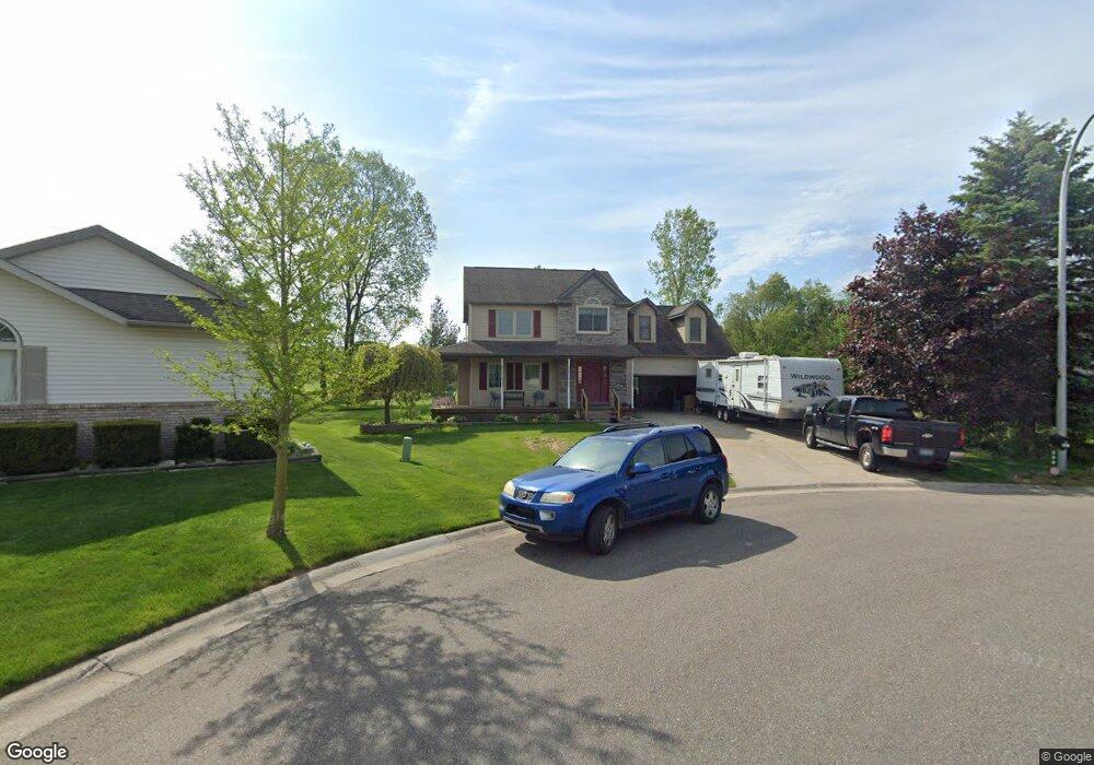
290 Mansfield Dr Lapeer, MI 48446
Estimated Value: $318,000 - $338,540
3
Beds
3
Baths
1,798
Sq Ft
$183/Sq Ft
Est. Value
About This Home
This home is located at 290 Mansfield Dr, Lapeer, MI 48446 and is currently estimated at $328,635, approximately $182 per square foot. 290 Mansfield Dr is a home located in Lapeer County with nearby schools including C.K. Schickler Elementary School, Rolland-Warner Middle School, and Lapeer High School.
Ownership History
Date
Name
Owned For
Owner Type
Purchase Details
Closed on
Jun 30, 1997
Bought by
Barbera Brian T
Current Estimated Value
Purchase Details
Closed on
Nov 12, 1996
Sold by
Papadelis Christopher M
Bought by
Vantage Homes
Purchase Details
Closed on
Jan 9, 1996
Sold by
Rolling Hills Golf and Rolling Coclub I
Bought by
Papadelis Christopher M
Create a Home Valuation Report for This Property
The Home Valuation Report is an in-depth analysis detailing your home's value as well as a comparison with similar homes in the area
Home Values in the Area
Average Home Value in this Area
Purchase History
We collect this data history from publicly available records. To have your information removed, we recommend requesting removal directly through your county’s website.
| Date | Buyer | Sale Price | Title Company |
|---|---|---|---|
| Barbera Brian T | $169,900 | -- | |
| Barbera Brian T | $169,900 | -- | |
| Vantage Homes | $34,000 | -- | |
| Vantage Homes | $34,000 | -- | |
| Papadelis Christopher M | $29,900 | -- |
Source: Public Records
Tax History
| Year | Tax Paid | Tax Assessment Tax Assessment Total Assessment is a certain percentage of the fair market value that is determined by local assessors to be the total taxable value of land and additions on the property. | Land | Improvement |
|---|---|---|---|---|
| 2025 | $2,451 | $152,600 | $0 | $0 |
| 2024 | $1,616 | $145,700 | $0 | $0 |
| 2023 | $1,542 | $125,400 | $0 | $0 |
| 2022 | $2,196 | $111,700 | $0 | $0 |
| 2021 | $2,035 | $104,400 | $0 | $0 |
| 2020 | $2,013 | $96,900 | $0 | $0 |
| 2019 | $2,032 | $99,000 | $0 | $0 |
| 2018 | $1,986 | $87,300 | $87,300 | $0 |
| 2017 | $1,946 | $87,000 | $0 | $0 |
| 2016 | $1,314 | $89,200 | $89,200 | $0 |
| 2015 | -- | $80,200 | $0 | $0 |
| 2014 | -- | $72,500 | $72,500 | $0 |
| 2013 | -- | $64,200 | $64,200 | $0 |
Source: Public Records
Map
Nearby Homes
- 291 Golfside Dr
- VL Whisper Ridge Dr
- 317 Devonshire Dr Unit 9
- 317 Devonshire Dr
- 303 Devonshire Dr Unit 7
- 281 Devonshire Dr
- 305 Devonshire Dr Unit 8
- 305 Devonshire Dr
- 360 Devonshire Dr
- 360 Devonshire Dr Unit 32
- 362 Devonshire Dr
- 374 Devonshire Dr
- 376 Devonshire Dr
- 388 Devonshire Dr
- 390 Devonshire Dr Unit 27
- 390 Devonshire Dr
- 567 Greens Way Blvd
- 634 Eastway Cir
- 3034 W Oregon Rd
- 0 Millville Rd Unit 50156590
- 298 Mansfield Dr
- 282 Mansfield Dr
- 304 Mansfield Dr
- 287 Mansfield Dr
- 295 Mansfield Dr
- 0 Mansfield Dr Unit 218049550
- 0 Mansfield Dr Unit 217053892
- 0 Mansfield Dr Unit R213039749
- 310 Mansfield Dr
- 305 Mansfield Dr
- 318 Mansfield Dr
- 299 Golfside Dr
- 305 Golfside Dr
- 294 Courtneys Place
- 311 Golfside Dr
- 311 Mansfield Dr
- 288 Courtneys Place
- 285 Golfside Dr
- 317 Golfside Dr
- 306 Courtneys Place
Your Personal Tour Guide
Ask me questions while you tour the home.