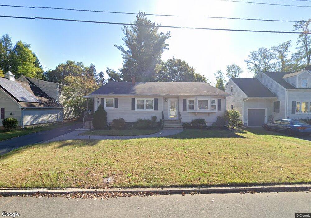
290 Mobus Ave North Plainfield, NJ 07060
Estimated Value: $562,448 - $651,000
--
Bed
--
Bath
2,058
Sq Ft
$296/Sq Ft
Est. Value
About This Home
This home is located at 290 Mobus Ave, North Plainfield, NJ 07060 and is currently estimated at $609,862, approximately $296 per square foot. 290 Mobus Ave is a home located in Somerset County with nearby schools including Somerset Intermediate School, North Plainfield Middle/High School, and North Plainfield Middle School.
Ownership History
Date
Name
Owned For
Owner Type
Purchase Details
Closed on
Aug 15, 2006
Sold by
Wiggins Andre G
Bought by
Brison Sabrina
Current Estimated Value
Home Financials for this Owner
Home Financials are based on the most recent Mortgage that was taken out on this home.
Original Mortgage
$76,600
Outstanding Balance
$46,164
Interest Rate
6.83%
Estimated Equity
$563,698
Purchase Details
Closed on
Dec 18, 1997
Sold by
Burns Norman
Bought by
Wiggins Andre and Wiggins Shelia
Home Financials for this Owner
Home Financials are based on the most recent Mortgage that was taken out on this home.
Original Mortgage
$135,000
Interest Rate
7.09%
Create a Home Valuation Report for This Property
The Home Valuation Report is an in-depth analysis detailing your home's value as well as a comparison with similar homes in the area
Home Values in the Area
Average Home Value in this Area
Purchase History
| Date | Buyer | Sale Price | Title Company |
|---|---|---|---|
| Brison Sabrina | $383,000 | -- | |
| Wiggins Andre | $142,500 | -- |
Source: Public Records
Mortgage History
| Date | Status | Borrower | Loan Amount |
|---|---|---|---|
| Open | Brison Sabrina | $76,600 | |
| Previous Owner | Wiggins Andre | $135,000 |
Source: Public Records
Tax History Compared to Growth
Tax History
| Year | Tax Paid | Tax Assessment Tax Assessment Total Assessment is a certain percentage of the fair market value that is determined by local assessors to be the total taxable value of land and additions on the property. | Land | Improvement |
|---|---|---|---|---|
| 2025 | $12,202 | $280,000 | $100,000 | $180,000 |
| 2024 | $12,202 | $280,000 | $100,000 | $180,000 |
| 2023 | $11,897 | $280,000 | $100,000 | $180,000 |
| 2022 | $11,427 | $280,000 | $100,000 | $180,000 |
| 2021 | $11,281 | $280,000 | $100,000 | $180,000 |
| 2020 | $10,954 | $280,000 | $100,000 | $180,000 |
| 2019 | $10,662 | $280,000 | $100,000 | $180,000 |
| 2018 | $10,436 | $280,000 | $100,000 | $180,000 |
| 2017 | $10,570 | $280,000 | $100,000 | $180,000 |
| 2016 | $10,049 | $280,000 | $100,000 | $180,000 |
| 2015 | $9,624 | $280,000 | $100,000 | $180,000 |
| 2014 | $10,424 | $317,900 | $120,000 | $197,900 |
Source: Public Records
Map
Nearby Homes
- 303 Muriel Ave
- 10 Hurley Ave
- 133 Oneida Ave
- 234 N Jackson Ave
- 95 Farragut Rd
- 327 Manning Ave
- 212 N Jackson Ave
- 144 Belmont Ave
- 361 Richard Way
- 24 Shady Ct
- 154 Sandford Ave
- 240 Belmont Ave
- 401 Us Highway Rt 22 U 26h Unit H
- 935 E Front St Unit C
- 104 Sandford Ave Unit 6
- 401 Route 22 Unit 11G
- 401 U S 22 Unit C
- 401 U S 22 Unit A
- 401 U S 22 Unit E
- 401 U S 22 Unit G
- 286 Mobus Ave
- 300 Mobus Ave
- 190 Lewis St
- 293 Mobus Ave
- 285 Mobus Ave
- 310 Mobus Ave
- 275 Mobus Ave
- 307 Mobus Ave
- 190 Edward Place
- 182 Edward Place Unit 94
- 75 Farragut Place Unit 77
- 292 Muriel Ave Unit 4
- 284 Muriel Ave Unit 90
- 79 Farragut Place
- 300 Muriel Ave
- 1021 Plainfield Ave
- 71 Farragut Place
- 267 Mobus Ave Unit 71
- 269 Mobus Ave
- 316 Mobus Ave Unit 22