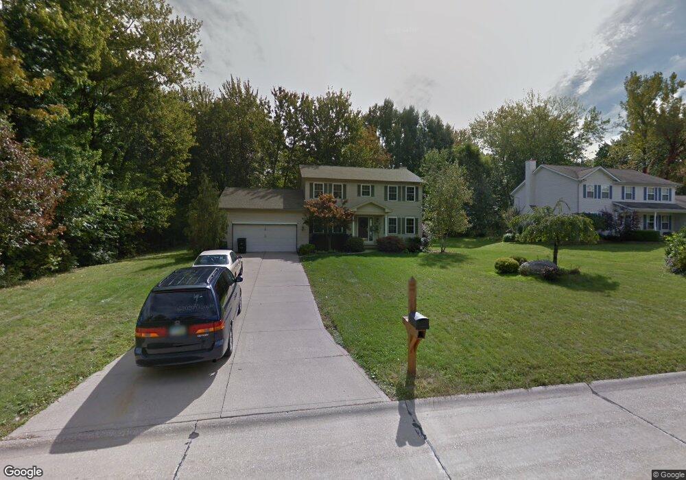
290 Mountainside Dr Painesville, OH 44077
Estimated Value: $345,422 - $378,000
4
Beds
3
Baths
1,174
Sq Ft
$303/Sq Ft
Est. Value
About This Home
This home is located at 290 Mountainside Dr, Painesville, OH 44077 and is currently estimated at $356,106, approximately $303 per square foot. 290 Mountainside Dr is a home located in Lake County with nearby schools including Henry F. Lamuth Middle School, Riverside Junior/Senior High School, and Summit Academy Community School - Painesville.
Ownership History
Date
Name
Owned For
Owner Type
Purchase Details
Closed on
May 23, 2005
Sold by
Ferrar David L and Ferrar Patrizia
Bought by
Hughes Brian M and Hughes Melissa L
Current Estimated Value
Home Financials for this Owner
Home Financials are based on the most recent Mortgage that was taken out on this home.
Original Mortgage
$197,200
Interest Rate
6.07%
Mortgage Type
Purchase Money Mortgage
Purchase Details
Closed on
Jul 11, 2003
Sold by
Klein Michael W and Klein Bonnie M
Bought by
Ferrar David L and Ferrar Patrizia
Home Financials for this Owner
Home Financials are based on the most recent Mortgage that was taken out on this home.
Original Mortgage
$183,600
Interest Rate
5.31%
Mortgage Type
Purchase Money Mortgage
Create a Home Valuation Report for This Property
The Home Valuation Report is an in-depth analysis detailing your home's value as well as a comparison with similar homes in the area
Home Values in the Area
Average Home Value in this Area
Purchase History
| Date | Buyer | Sale Price | Title Company |
|---|---|---|---|
| Hughes Brian M | $232,000 | Enterprise Title | |
| Ferrar David L | $216,000 | Real Living Title Agency Ltd |
Source: Public Records
Mortgage History
| Date | Status | Borrower | Loan Amount |
|---|---|---|---|
| Previous Owner | Hughes Brian M | $197,200 | |
| Previous Owner | Ferrar David L | $183,600 |
Source: Public Records
Tax History Compared to Growth
Tax History
| Year | Tax Paid | Tax Assessment Tax Assessment Total Assessment is a certain percentage of the fair market value that is determined by local assessors to be the total taxable value of land and additions on the property. | Land | Improvement |
|---|---|---|---|---|
| 2024 | -- | $105,920 | $21,360 | $84,560 |
| 2023 | $4,943 | $82,590 | $17,060 | $65,530 |
| 2022 | $4,823 | $82,590 | $17,060 | $65,530 |
| 2021 | $4,841 | $82,590 | $17,060 | $65,530 |
| 2020 | $4,768 | $71,820 | $14,840 | $56,980 |
| 2019 | $4,805 | $71,820 | $14,840 | $56,980 |
| 2018 | $4,819 | $62,800 | $14,840 | $47,960 |
| 2017 | $4,344 | $62,800 | $14,840 | $47,960 |
| 2016 | $3,823 | $62,800 | $14,840 | $47,960 |
| 2015 | $3,594 | $62,800 | $14,840 | $47,960 |
| 2014 | $3,653 | $62,800 | $14,840 | $47,960 |
| 2013 | $3,570 | $62,800 | $14,840 | $47,960 |
Source: Public Records
Map
Nearby Homes
- 1160 Riverside Dr
- 238 Radley Dr
- 302 Maplebrook Dr Unit 302
- 54 Park Rd
- 30 Orton Rd
- 44 Grove Ave
- 104 Overlook Rd
- 65 Tanners Farm Dr
- 85 Nelmar Dr
- 5406 Pebble Creek Ln
- 55 Grove Ave
- 67 Tanners Farm Dr
- 48 Nelmar Dr
- 65 Country Ln
- 1182 Dalton Dr
- 1172 Dalton Dr
- 33 Bryn Mawr Dr
- 43 Bristol Ave
- 396 Park Rd
- 736 Rivers Edge Ln Unit 68
- 300 Mountainside Dr
- 280 Mountainside Dr
- 289 Mountainside Dr
- 1121 Riverside Dr
- 270 Mountainside Dr
- 295 Mountainside Dr
- 1111 Riverside Dr
- 1135 Riverside Dr
- 1137 Riverside Dr
- 303 Mountainside Dr
- 1354 Yale Place
- 1336 Yale Place
- 1342 Yale Place
- 254 Mountainside Dr
- 1326 Yale Place
- 1165 Riverside Dr
- 1150 Riverside Dr
- 1132 Riverside Dr
- 1303 Bowdoin Ct
- 1120 Riverside Dr