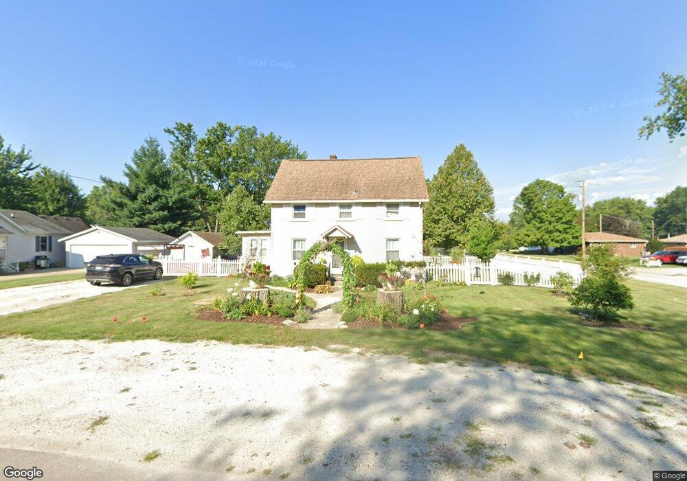
290 N Irving St Coal City, IL 60416
Estimated Value: $189,000 - $286,000
3
Beds
2
Baths
1,800
Sq Ft
$136/Sq Ft
Est. Value
About This Home
This home is located at 290 N Irving St, Coal City, IL 60416 and is currently estimated at $245,204, approximately $136 per square foot. 290 N Irving St is a home located in Grundy County with nearby schools including Coal City Intermediate School, Coal City Elementary School, and Coal City Middle School.
Create a Home Valuation Report for This Property
The Home Valuation Report is an in-depth analysis detailing your home's value as well as a comparison with similar homes in the area
Home Values in the Area
Average Home Value in this Area
Tax History Compared to Growth
Tax History
| Year | Tax Paid | Tax Assessment Tax Assessment Total Assessment is a certain percentage of the fair market value that is determined by local assessors to be the total taxable value of land and additions on the property. | Land | Improvement |
|---|---|---|---|---|
| 2024 | $4,724 | $64,367 | $13,641 | $50,726 |
| 2023 | $4,420 | $60,218 | $12,762 | $47,456 |
| 2022 | $3,726 | $56,410 | $11,955 | $44,455 |
| 2021 | $3,542 | $53,318 | $11,300 | $42,018 |
| 2020 | $3,459 | $52,247 | $11,073 | $41,174 |
| 2019 | $3,204 | $49,289 | $10,446 | $38,843 |
| 2018 | $3,166 | $49,382 | $10,466 | $38,916 |
| 2017 | $2,961 | $47,597 | $10,088 | $37,509 |
| 2016 | $2,914 | $47,252 | $10,015 | $37,237 |
| 2015 | $3,062 | $45,690 | $9,684 | $36,006 |
| 2014 | $3,011 | $44,962 | $9,530 | $35,432 |
| 2013 | $3,020 | $45,810 | $9,710 | $36,100 |
Source: Public Records
Map
Nearby Homes
- 295 N Lincoln St
- 395 N Kankakee St
- 105 N Kankakee St
- Lot 2 Mcardle Rd
- Lot 6 Mcardle Rd
- Lot 1 Mcardle Rd
- Lot 3 Mcardle Rd
- Lot 5 Mcardle Rd
- Lot 4 Mcardle Rd
- 540 N 1st Ave
- 385 S Kankakee St
- 310 W Oak St
- 573-585 S Mazon St
- 1060 Regent Ct
- 0 E Division St Unit MRD12083414
- 595 W Rathburn St
- 120 E Elm St
- 485 Trotter Dr
- 495 Trotter Dr
- 120 Kevin Dr