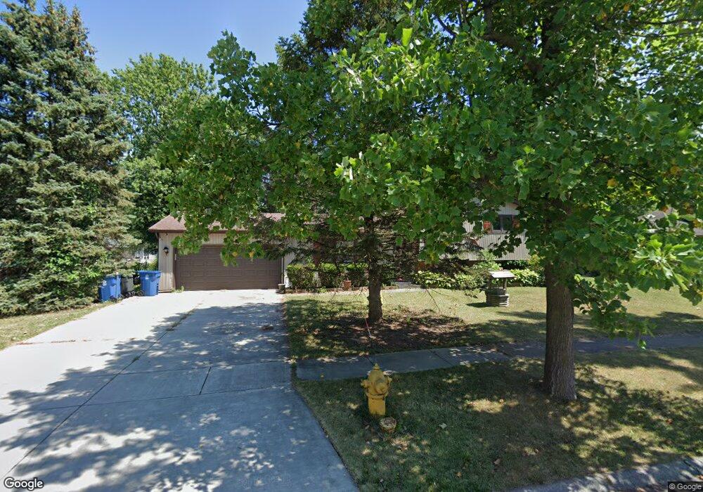
290 Navajo Trail Unit 10 Lowell, IN 46356
West Creek NeighborhoodEstimated Value: $249,998 - $277,000
3
Beds
2
Baths
1,532
Sq Ft
$173/Sq Ft
Est. Value
About This Home
This home is located at 290 Navajo Trail Unit 10, Lowell, IN 46356 and is currently estimated at $265,000, approximately $172 per square foot. 290 Navajo Trail Unit 10 is a home located in Lake County with nearby schools including Lowell Middle School and Lowell Senior High School.
Ownership History
Date
Name
Owned For
Owner Type
Purchase Details
Closed on
May 18, 2015
Sold by
Ruley Robert D and Ruley Barbara
Bought by
Ruley Barbara
Current Estimated Value
Home Financials for this Owner
Home Financials are based on the most recent Mortgage that was taken out on this home.
Original Mortgage
$85,000
Interest Rate
3.82%
Mortgage Type
New Conventional
Create a Home Valuation Report for This Property
The Home Valuation Report is an in-depth analysis detailing your home's value as well as a comparison with similar homes in the area
Home Values in the Area
Average Home Value in this Area
Purchase History
| Date | Buyer | Sale Price | Title Company |
|---|---|---|---|
| Ruley Barbara | -- | Chicago Title Insurance Co |
Source: Public Records
Mortgage History
| Date | Status | Borrower | Loan Amount |
|---|---|---|---|
| Previous Owner | Ruley Barbara | $85,000 |
Source: Public Records
Tax History Compared to Growth
Tax History
| Year | Tax Paid | Tax Assessment Tax Assessment Total Assessment is a certain percentage of the fair market value that is determined by local assessors to be the total taxable value of land and additions on the property. | Land | Improvement |
|---|---|---|---|---|
| 2024 | $5,123 | $204,200 | $41,000 | $163,200 |
| 2023 | $1,546 | $194,700 | $41,000 | $153,700 |
| 2022 | $1,546 | $182,200 | $41,000 | $141,200 |
| 2021 | $1,478 | $173,800 | $35,700 | $138,100 |
| 2020 | $1,321 | $165,000 | $35,700 | $129,300 |
| 2019 | $1,375 | $156,200 | $35,700 | $120,500 |
| 2018 | $1,298 | $150,500 | $35,700 | $114,800 |
| 2017 | $1,442 | $153,600 | $35,700 | $117,900 |
| 2016 | $1,260 | $150,300 | $35,700 | $114,600 |
| 2014 | $1,655 | $152,100 | $35,700 | $116,400 |
| 2013 | $1,584 | $142,800 | $35,700 | $107,100 |
Source: Public Records
Map
Nearby Homes
- 643 Cheyenne Dr
- 609 Shawnee Dr
- 658 Apache Ln
- 115 N Nichols St
- 288 W Commercial Ave
- 611 Iowa Dr
- 789 W Oakley Ave
- 285 W Commercial Ave
- 617 Fawn Cir
- 532 Timberwood Ln
- 236 W Commercial Ave
- 546 Timberwood Ln
- 124 N Liberty St
- 621 Meadow Brook Dr
- 772 Longwood Dr
- 330 Willow St
- 487 Timber Lake Dr
- The Emma Grace Plan at Sierra Ridge
- The Bristol Plan at Sierra Ridge
- The Kinkaid Plan at Sierra Ridge
- 288 Navajo Trail Unit 10
- 296 Navajo Trail
- 219 Cherokee Dr
- 221 Cherokee Dr Unit 10
- 282 Navajo Trail
- 217 Cherokee Dr Unit 10
- 769 Aztec Ct
- 637 Mohawk Dr Unit 10
- 300 Navajo Trail
- 297 Navajo Trail
- 215 Cherokee Dr
- 283 Navajo Trail Unit 10
- 223 Cherokee Dr Unit 10
- 276 Navajo Trail
- 750 Tonto Ct
- 213 Cherokee Dr
- 301 Navajo Trail
- 775 Aztec Ct Unit 10
- 778 Aztec Ct Unit 10
- 220 Cherokee Dr