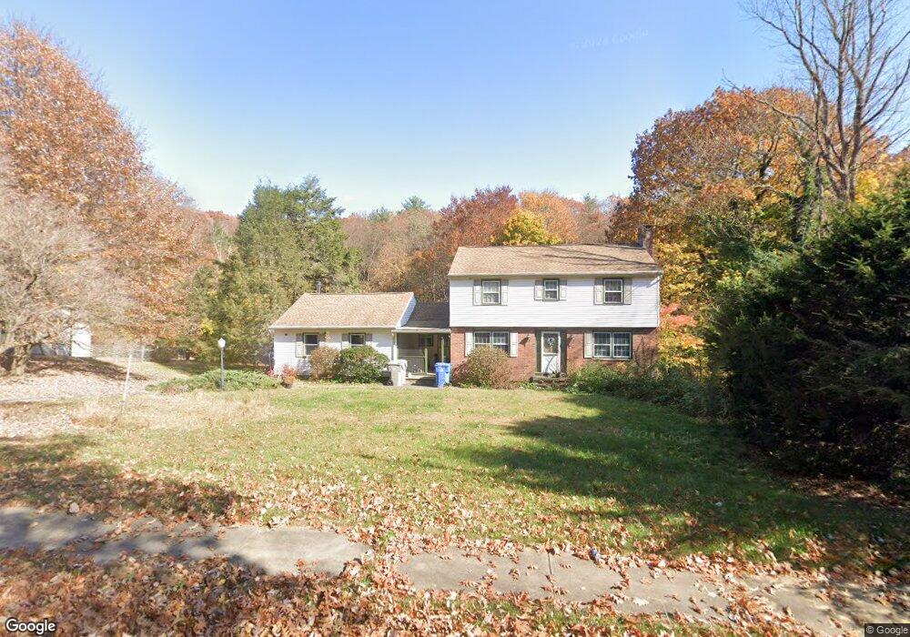
290 Perkins St Bristol, CT 06010
North Bristol NeighborhoodEstimated Value: $433,283 - $470,000
4
Beds
3
Baths
2,264
Sq Ft
$199/Sq Ft
Est. Value
About This Home
This home is located at 290 Perkins St, Bristol, CT 06010 and is currently estimated at $449,571, approximately $198 per square foot. 290 Perkins St is a home located in Hartford County with nearby schools including West Bristol Sch, Bristol Central High School, and Immanuel Lutheran School.
Create a Home Valuation Report for This Property
The Home Valuation Report is an in-depth analysis detailing your home's value as well as a comparison with similar homes in the area
Home Values in the Area
Average Home Value in this Area
Tax History
| Year | Tax Paid | Tax Assessment Tax Assessment Total Assessment is a certain percentage of the fair market value that is determined by local assessors to be the total taxable value of land and additions on the property. | Land | Improvement |
|---|---|---|---|---|
| 2025 | $7,945 | $235,410 | $59,570 | $175,840 |
| 2024 | $7,404 | $232,470 | $59,570 | $172,900 |
| 2023 | $7,055 | $232,470 | $59,570 | $172,900 |
| 2022 | $6,317 | $164,710 | $46,550 | $118,160 |
| 2021 | $6,317 | $164,710 | $46,550 | $118,160 |
| 2020 | $6,317 | $164,710 | $46,550 | $118,160 |
| 2019 | $6,267 | $164,710 | $46,550 | $118,160 |
| 2018 | $6,075 | $164,710 | $46,550 | $118,160 |
| 2017 | $6,086 | $168,910 | $63,350 | $105,560 |
| 2016 | $6,086 | $168,910 | $63,350 | $105,560 |
| 2015 | $5,846 | $168,910 | $63,350 | $105,560 |
| 2014 | $5,846 | $168,910 | $63,350 | $105,560 |
Source: Public Records
Map
Nearby Homes
- 439 James P Casey Rd
- 35 James P Casey Rd
- 1970 Perkins St
- 62 (Lot 13-1) James P Casey Rd
- 40 Matthews St Unit 30
- 40 Matthews St Unit TRLR 19
- 83 Lardner Rd
- 38 Eastwood Rd
- 0 Hart St Unit 170255530
- 35 Lardner Rd
- 735 Matthews St
- 380 Burlington Ave
- 22 Ingraham St
- 52 Irving St Unit 2
- 820 Matthews St Unit 19
- 2 Gino Dr
- 62 Gino Dr
- 66 Gino Dr
- 65 Gino Dr
- 29 Lincoln Place
Your Personal Tour Guide
Ask me questions while you tour the home.