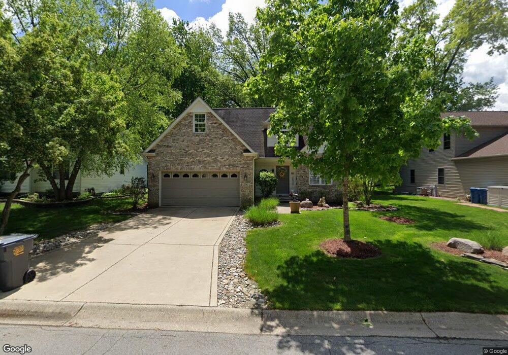
290 Ravinia Dr N Valparaiso, IN 46385
Porter County NeighborhoodEstimated Value: $340,000 - $379,000
3
Beds
3
Baths
2,758
Sq Ft
$132/Sq Ft
Est. Value
About This Home
This home is located at 290 Ravinia Dr N, Valparaiso, IN 46385 and is currently estimated at $362,678, approximately $131 per square foot. 290 Ravinia Dr N is a home located in Porter County with nearby schools including Liberty Elementary School, Liberty Intermediate School, and Chesterton Middle School.
Ownership History
Date
Name
Owned For
Owner Type
Purchase Details
Closed on
Apr 21, 2006
Sold by
Synergy Homes Llc
Bought by
Phillips Edward W and Phillips Joann
Current Estimated Value
Home Financials for this Owner
Home Financials are based on the most recent Mortgage that was taken out on this home.
Original Mortgage
$171,100
Outstanding Balance
$99,005
Interest Rate
6.48%
Mortgage Type
Fannie Mae Freddie Mac
Estimated Equity
$263,673
Purchase Details
Closed on
Oct 17, 2005
Sold by
Ravinia Development Co
Bought by
Synergy Homes Llc
Home Financials for this Owner
Home Financials are based on the most recent Mortgage that was taken out on this home.
Original Mortgage
$168,000
Interest Rate
9%
Mortgage Type
Construction
Create a Home Valuation Report for This Property
The Home Valuation Report is an in-depth analysis detailing your home's value as well as a comparison with similar homes in the area
Home Values in the Area
Average Home Value in this Area
Purchase History
| Date | Buyer | Sale Price | Title Company |
|---|---|---|---|
| Phillips Edward W | -- | Chicago Title Insurance Co | |
| Synergy Homes Llc | -- | Ticor Title Insurance |
Source: Public Records
Mortgage History
| Date | Status | Borrower | Loan Amount |
|---|---|---|---|
| Open | Phillips Edward W | $171,100 | |
| Previous Owner | Synergy Homes Llc | $168,000 |
Source: Public Records
Tax History Compared to Growth
Tax History
| Year | Tax Paid | Tax Assessment Tax Assessment Total Assessment is a certain percentage of the fair market value that is determined by local assessors to be the total taxable value of land and additions on the property. | Land | Improvement |
|---|---|---|---|---|
| 2024 | $2,728 | $341,100 | $59,000 | $282,100 |
| 2023 | $2,402 | $334,600 | $56,400 | $278,200 |
| 2022 | $2,262 | $285,200 | $56,400 | $228,800 |
| 2021 | $2,141 | $269,400 | $56,400 | $213,000 |
| 2020 | $2,135 | $264,400 | $51,300 | $213,100 |
| 2019 | $2,165 | $257,300 | $51,300 | $206,000 |
| 2018 | $2,138 | $258,200 | $51,300 | $206,900 |
| 2017 | $1,956 | $246,500 | $51,300 | $195,200 |
| 2016 | $2,039 | $254,800 | $50,500 | $204,300 |
| 2014 | $1,903 | $241,800 | $47,300 | $194,500 |
| 2013 | -- | $233,300 | $48,300 | $185,000 |
Source: Public Records
Map
Nearby Homes
- 761 Capitol Rd
- 746-1 Capitol Rd
- 776-1 Baltimore Rd
- 249 W 700 N
- 722 Devonshire Rd
- 275 W 700 N
- 715 Eagle Creek Rd
- 794 Eagle Creek Rd
- 781 Governor Rd
- 753 Imperial Rd
- 740 Imperial Rd
- 335 W 700 N
- 244 Falcon Way
- 719 Imperial Rd
- 772 Imperial Rd
- 244 W 700 N
- Vacant Land Heritage Lane Rd
- 240 Southwind Dr
- 229 W 700 N
- 730-1 Juniper Rd
- 290 Ravinia Dr S
- 288 Ravinia Dr S
- 294 Ravinia Dr S
- 286 Ravinia Dr S
- 296 Ravinia Dr S
- 289 Ravinia Dr S
- 295 Ravinia Dr S
- 297 Ravinia Dr S
- 297 Ravinia Dr N
- 285 Ravinia Dr S
- 753 Ravinia Dr E
- 290 Dawn Dr
- 299 Ravinia Dr S
- 292 Dawn Dr
- 286 Dawn Dr
- 294 Dawn Dr
- 752 Ravinia Dr W Unit B
- 752 Ravinia Dr W Unit A
- 752A Ravinia Dr W
- 752 Ravinia Dr W