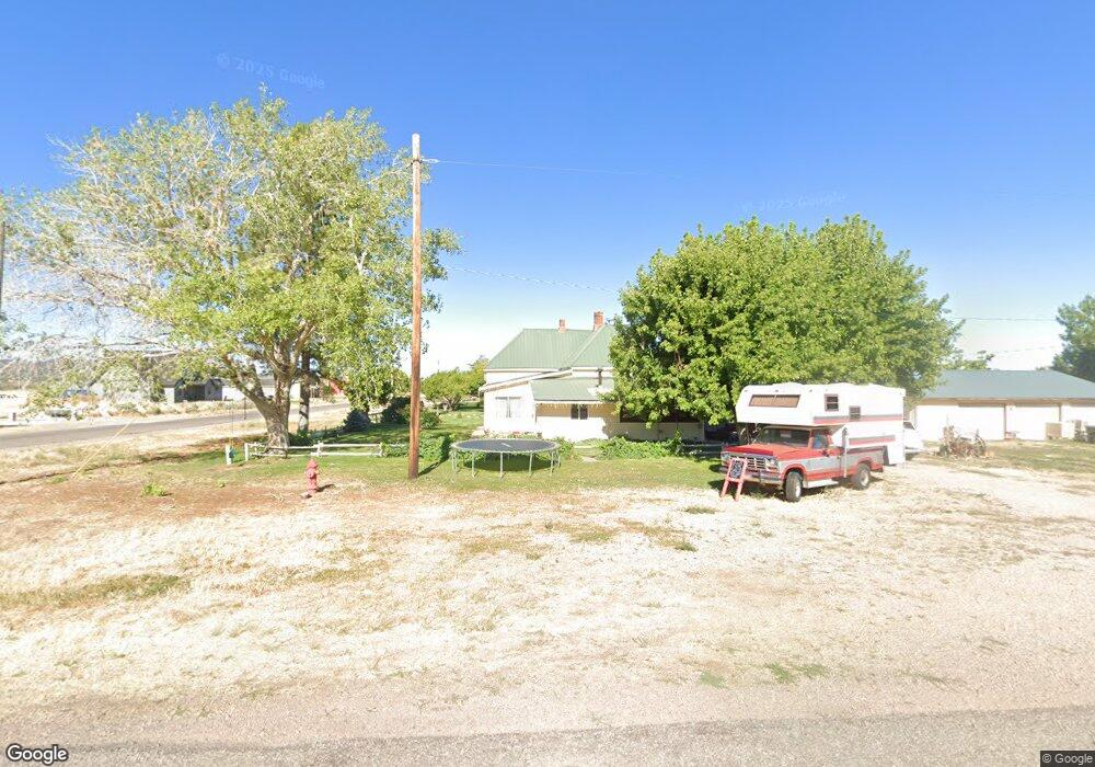
290 S 100 E Kanosh, UT 84637
Estimated Value: $280,000 - $352,000
Studio
--
Bath
--
Sq Ft
27,443
Sq Ft Lot
About This Home
This home is located at 290 S 100 E, Kanosh, UT 84637 and is currently estimated at $321,000. 290 S 100 E is a home.
Ownership History
Date
Name
Owned For
Owner Type
Purchase Details
Closed on
May 3, 2022
Sold by
Davis Helen F
Bought by
Davis Paula E and Davis Peter A
Current Estimated Value
Home Financials for this Owner
Home Financials are based on the most recent Mortgage that was taken out on this home.
Original Mortgage
$106,000
Outstanding Balance
$100,264
Interest Rate
5.1%
Mortgage Type
New Conventional
Estimated Equity
$220,736
Purchase Details
Closed on
Jun 29, 2016
Sold by
Davis William A and Davis Helen F
Bought by
Davis William A and Davis Helen F
Home Financials for this Owner
Home Financials are based on the most recent Mortgage that was taken out on this home.
Original Mortgage
$254,999
Interest Rate
3.58%
Mortgage Type
New Conventional
Purchase Details
Closed on
Jun 22, 2016
Sold by
Davis William Arland and Davis Helen F
Bought by
Davis William A and Davis Helen F
Home Financials for this Owner
Home Financials are based on the most recent Mortgage that was taken out on this home.
Original Mortgage
$254,999
Interest Rate
3.58%
Mortgage Type
New Conventional
Purchase Details
Closed on
Mar 27, 2015
Sold by
Arland William Arland William and Davis Helen F
Bought by
Davis William Arland and Davis Helen F
Create a Home Valuation Report for This Property
The Home Valuation Report is an in-depth analysis detailing your home's value as well as a comparison with similar homes in the area
Purchase History
| Date | Buyer | Sale Price | Title Company |
|---|---|---|---|
| Davis Paula E | -- | First American Title | |
| Davis William A | -- | First American Title | |
| Davis William A | -- | First American Title | |
| Davis William Arland | -- | First American Title Insur |
Source: Public Records
Mortgage History
| Date | Status | Borrower | Loan Amount |
|---|---|---|---|
| Open | Davis Paula E | $106,000 | |
| Previous Owner | Davis William A | $254,999 |
Source: Public Records
Tax History
| Year | Tax Paid | Tax Assessment Tax Assessment Total Assessment is a certain percentage of the fair market value that is determined by local assessors to be the total taxable value of land and additions on the property. | Land | Improvement |
|---|---|---|---|---|
| 2025 | $919 | $120,388 | $32,981 | $87,407 |
| 2024 | $919 | $116,949 | $19,709 | $97,240 |
| 2023 | $1,130 | $116,949 | $19,709 | $97,240 |
| 2022 | $831 | $78,018 | $15,766 | $62,252 |
| 2021 | $0 | $75,613 | $13,710 | $61,903 |
| 2020 | $280 | $66,324 | $12,464 | $53,860 |
| 2019 | $280 | $60,177 | $11,435 | $48,742 |
| 2018 | $280 | $59,137 | $10,395 | $48,742 |
| 2017 | $656 | $59,137 | $10,395 | $48,742 |
| 2016 | $180 | $61,318 | $7,796 | $53,522 |
| 2015 | $181 | $61,318 | $7,796 | $53,522 |
| 2014 | -- | $61,318 | $7,796 | $53,522 |
| 2013 | -- | $61,318 | $7,796 | $53,522 |
Source: Public Records
Map
Nearby Homes
- 58 E 300 South St
- 115 W 200 S
- 135 E 200 N
- 0 County Road 4616
- Parcel # 8816
- 145 N 200 E
- 80 W 470 N
- 50 N 100 Rd E
- 479 E 100 N
- 1565 W Sunflower Ln Unit 3
- 1615 W Sunflower Ln
- 1615 W Sunflower Ln Unit 4
- 1565 W Sunflower Ln
- 0 Tbd Black Rock Rd Unit LotWP001
- 2000 N West Frontage I-15
- 1100 S 725 Rd W
- 310 S 500 West Rd
- 465 S 100 W
- 760 E 700 St S
- 155 E 500 St S
Your Personal Tour Guide
Ask me questions while you tour the home.