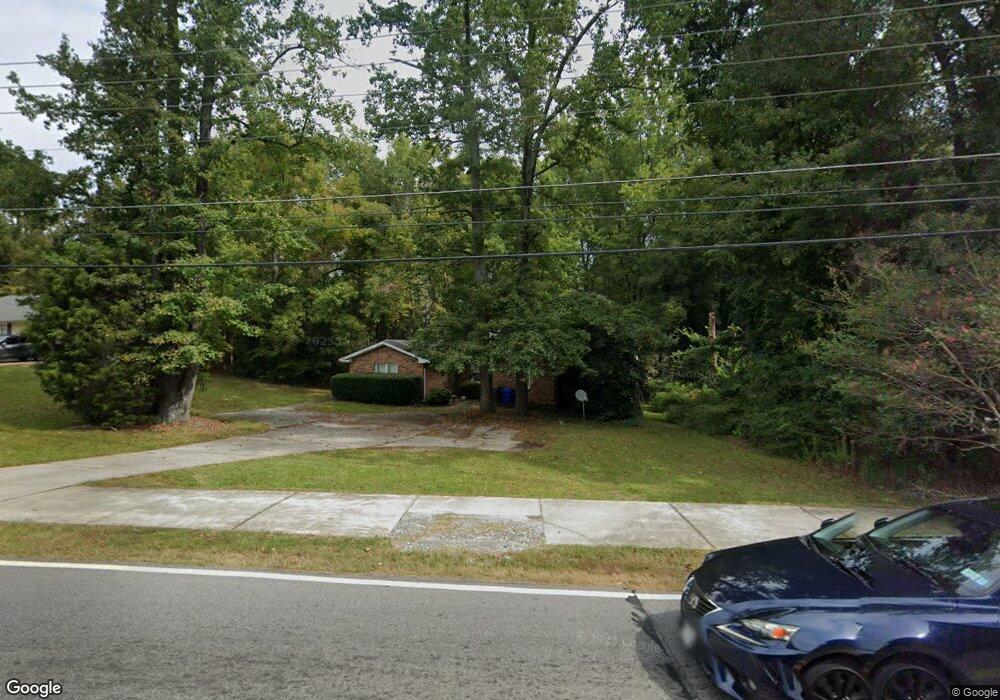
290 S Jeff Davis Dr Fayetteville, GA 30215
Estimated Value: $238,000 - $333,000
--
Bed
2
Baths
1,830
Sq Ft
$165/Sq Ft
Est. Value
About This Home
This home is located at 290 S Jeff Davis Dr, Fayetteville, GA 30215 and is currently estimated at $301,404, approximately $164 per square foot. 290 S Jeff Davis Dr is a home located in Fayette County with nearby schools including Spring Hill Elementary School, Bennett's Mill Middle School, and Fayette County High School.
Ownership History
Date
Name
Owned For
Owner Type
Purchase Details
Closed on
Feb 5, 2021
Sold by
Ellis Steven and Ellis Steven K
Bought by
South Jeff Davis Llc
Current Estimated Value
Purchase Details
Closed on
Jun 27, 2013
Sold by
Clarke Barbara
Bought by
Stephenson Handel
Purchase Details
Closed on
Jul 30, 2010
Sold by
Deutsche Bk Trust Co Americas
Bought by
Ellis Steven and Ellis Ileana
Purchase Details
Closed on
Mar 2, 2010
Sold by
Clarke Barbara
Bought by
Deutsche Bk Trust Co Americas
Create a Home Valuation Report for This Property
The Home Valuation Report is an in-depth analysis detailing your home's value as well as a comparison with similar homes in the area
Home Values in the Area
Average Home Value in this Area
Purchase History
| Date | Buyer | Sale Price | Title Company |
|---|---|---|---|
| South Jeff Davis Llc | -- | None Listed On Document | |
| South Jeff Davis Llc | -- | -- | |
| Stephenson Handel | -- | -- | |
| Ellis Steven | $82,000 | -- | |
| Deutsche Bk Trust Co Americas | $110,000 | -- |
Source: Public Records
Tax History Compared to Growth
Tax History
| Year | Tax Paid | Tax Assessment Tax Assessment Total Assessment is a certain percentage of the fair market value that is determined by local assessors to be the total taxable value of land and additions on the property. | Land | Improvement |
|---|---|---|---|---|
| 2024 | $2,829 | $95,188 | $24,160 | $71,028 |
| 2023 | $2,829 | $91,720 | $24,160 | $67,560 |
| 2022 | $2,359 | $77,640 | $17,600 | $60,040 |
| 2021 | $1,969 | $63,960 | $14,000 | $49,960 |
| 2020 | $1,787 | $57,800 | $14,000 | $43,800 |
| 2019 | $1,727 | $55,320 | $14,000 | $41,320 |
| 2018 | $1,650 | $52,280 | $14,000 | $38,280 |
| 2017 | $1,392 | $46,560 | $14,000 | $32,560 |
| 2016 | $1,356 | $44,360 | $12,800 | $31,560 |
| 2015 | $1,295 | $41,640 | $12,800 | $28,840 |
| 2014 | $1,214 | $38,320 | $12,800 | $25,520 |
| 2013 | -- | $37,800 | $0 | $0 |
Source: Public Records
Map
Nearby Homes
- 415 Williamsburg Way
- 150 Reese St
- 140 Reese St
- 130 Reese St
- The Mildred Plan at Mitchell Estates
- The Bradford Plan at Mitchell Estates
- 115 Linda Way
- 4010 Diane Ln
- 4080 Diane Ln
- 310 Autumn Glen Cir
- 315 Enchanted Ct
- 235 Woodstream Way
- 170 Woodstream Way Unit B
- GA 85 S GA Highway 85
- 210 Pecan Ridge Dr Unit 2
- 305 Cobalt Dr
- 295 Cobalt Dr
- 315 Cobalt Dr
- 110 Sparrows Cove
- 130 Thrushwood Dr
- 280 S Jeff Davis Dr Unit A
- 300 S Jeff Davis Dr Unit B
- 300 S Jeff Davis Dr Unit C
- 300 S Jeff Davis Dr Unit A
- 300 S Jeff Davis Dr Unit D
- 300 S Jeff Davis Dr Unit C
- 270 S Jeff Davis Dr
- 310 S Jeff Davis Dr Unit 4
- 310 S Jeff Davis Dr Unit 2
- 310 S Jeff Davis Dr Unit 3
- 310 S Jeff Davis Dr Unit DAVIS
- 0 Jimmie Mayfield Blvd
- 0 Jimmie Mayfield Blvd Unit 8067650
- 0 Jimmie Mayfield Blvd Unit 8508744
- 100 Meadowbrook Ct
- 100 Meadowbrook Ct Unit 25
- 90 Meadowbrook Ct
- 110 Meadowbrook Ct
- 110 Meadowbrook Ct Unit A
- 110 Meadowbrook Ct Unit B