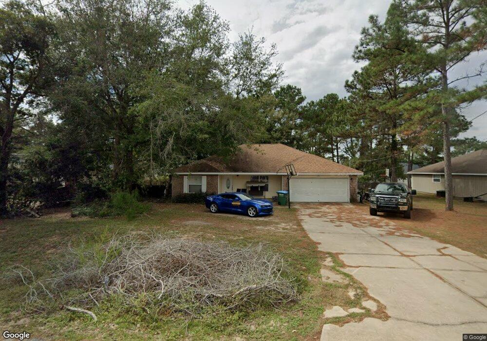
290 Sand Pine Dr Midway, FL 32343
Midway AreaEstimated Value: $237,000 - $262,000
About This Home
This home is located at 290 Sand Pine Dr, Midway, FL 32343 and is currently estimated at $251,357, approximately $169 per square foot. 290 Sand Pine Dr is a home located in Gadsden County.
Ownership History
We collect this data history from publicly available records. To have your information removed, we recommend requesting removal directly through your county’s website.
Purchase Details
Purchase Details
Home Financials for this Owner
Home Financials are based on the most recent Mortgage that was taken out on this home.Purchase Details
Purchase Details
Home Financials for this Owner
Home Financials are based on the most recent Mortgage that was taken out on this home.Home Values in the Area
Average Home Value in this Area
Purchase History
We collect this data history from publicly available records. To have your information removed, we recommend requesting removal directly through your county’s website.
| Date | Buyer | Sale Price | Title Company |
|---|---|---|---|
| $100 | -- | ||
| $120,000 | Attorney | ||
| -- | None Available | ||
| $176,000 | Attorney |
Mortgage History
We collect this data history from publicly available records. To have your information removed, we recommend requesting removal directly through your county’s website.
| Date | Status | Borrower | Loan Amount |
|---|---|---|---|
| Previous Owner | $33,915 | ||
| Previous Owner | $116,958 | ||
| Previous Owner | $103,000 |
Tax History
We collect this data history from publicly available records. To have your information removed, we recommend requesting removal directly through your county’s website.
| Year | Tax Paid | Tax Assessment Tax Assessment Total Assessment is a certain percentage of the fair market value that is determined by local assessors to be the total taxable value of land and additions on the property. | Land | Improvement |
|---|---|---|---|---|
| 2025 | $2,219 | $160,661 | ||
| 2024 | $2,141 | $156,134 | ||
| 2023 | $2,084 | $151,587 | $0 | $0 |
| 2022 | $2,273 | $149,812 | $0 | $0 |
| 2021 | $1,418 | $114,907 | $0 | $0 |
| 2020 | $1,386 | $113,321 | $0 | $0 |
| 2019 | $1,363 | $110,773 | $0 | $0 |
| 2018 | $1,360 | $108,708 | $0 | $0 |
| 2017 | $1,320 | $106,472 | $0 | $0 |
| 2016 | $1,294 | $104,282 | $0 | $0 |
| 2015 | $1,281 | $103,557 | $0 | $0 |
| 2014 | $1,246 | $102,735 | $0 | $0 |
Map
- 122 Loblolly Cir
- 332 Sand Pine Cir
- 336 Delores Madison Dr
- 633 Rustling Pines Blvd
- 604 Rustling Pines Blvd
- 496 Rustling Pines Blvd
- 34 Frank Run
- 0 High Bridge Rd Unit 27837681
- 1444 Rustling Pines Blvd
- 94 Deloris Madison Dr
- 21 Stevens Dr
- 315 Mae Cato Dr
- 119 Francis Harrell Way
- 407 Mae Cato Dr
- 0 Central Rd Unit 381525
- 668 M l King Blvd
- 8877 High Bridge Rd
- 8873 High Bridge Rd
- 295 Sumpter Ridge Rd
- 274 Forest Cir S
- 272 Sand Pine Dr
- 310 Sand Pine Dr
- 53 Loblolly Ln
- 67 Loblolly Ln
- 35 Loblolly Ln
- 260 Sand Pine Dr
- 330 Sand Pine Dr
- 299 Sand Pine Dr
- 85 Loblolly Ln
- 283 Sand Pine Dr
- 313 Sand Pine Dr
- 21 Loblolly Ln
- 265 Sand Pine Dr
- 103 Loblolly Ln
- 340 Sand Pine Dr
- 333 Sand Pine Dr
- 97 Loblolly Cir
- 63 Pine Straw Dr
- 62 Loblolly Ln
- 251 Sand Pine Dr
Ask me questions while you tour the home.