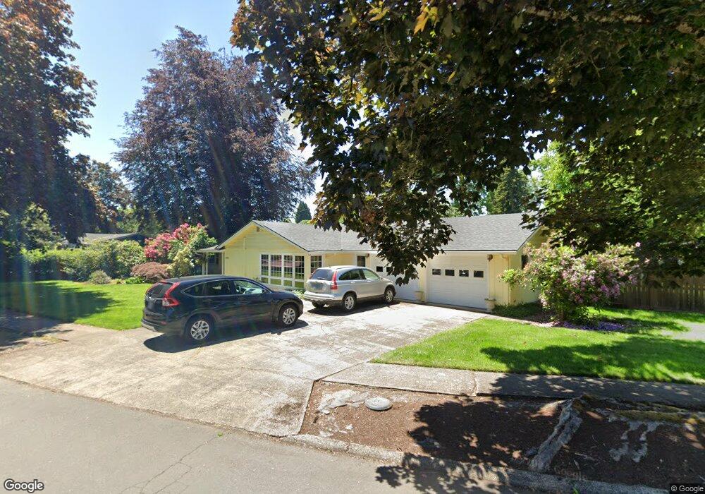
290 Walnut Ln Eugene, OR 97401
Harlow NeighborhoodEstimated Value: $709,599 - $831,000
4
Beds
2
Baths
2,309
Sq Ft
$332/Sq Ft
Est. Value
About This Home
This home is located at 290 Walnut Ln, Eugene, OR 97401 and is currently estimated at $767,650, approximately $332 per square foot. 290 Walnut Ln is a home located in Lane County with nearby schools including Holt Elementary School, Monroe Middle School, and Sheldon High School.
Ownership History
Date
Name
Owned For
Owner Type
Purchase Details
Closed on
Oct 29, 2008
Sold by
Thomas Donn C
Bought by
Thomas Donn C and Thomas Janice L
Current Estimated Value
Purchase Details
Closed on
Oct 21, 2005
Sold by
Thomas Donn C and Thomas Millie E
Bought by
Thomas Donn C
Purchase Details
Closed on
Jun 3, 2002
Sold by
Bull David S and Bull Ann L
Bought by
Thomas Donn C and Thomas Millie E
Home Financials for this Owner
Home Financials are based on the most recent Mortgage that was taken out on this home.
Original Mortgage
$218,900
Outstanding Balance
$90,874
Interest Rate
6.83%
Estimated Equity
$676,776
Create a Home Valuation Report for This Property
The Home Valuation Report is an in-depth analysis detailing your home's value as well as a comparison with similar homes in the area
Home Values in the Area
Average Home Value in this Area
Purchase History
| Date | Buyer | Sale Price | Title Company |
|---|---|---|---|
| Thomas Donn C | -- | None Available | |
| Thomas Donn C | -- | -- | |
| Thomas Donn C | $273,625 | Cascade Title Co |
Source: Public Records
Mortgage History
| Date | Status | Borrower | Loan Amount |
|---|---|---|---|
| Open | Thomas Donn C | $218,900 |
Source: Public Records
Tax History
| Year | Tax Paid | Tax Assessment Tax Assessment Total Assessment is a certain percentage of the fair market value that is determined by local assessors to be the total taxable value of land and additions on the property. | Land | Improvement |
|---|---|---|---|---|
| 2025 | $7,330 | $376,198 | -- | -- |
| 2024 | $7,239 | $365,241 | -- | -- |
| 2023 | $7,239 | $354,603 | $0 | $0 |
| 2022 | $6,781 | $344,275 | $0 | $0 |
| 2021 | $6,369 | $334,248 | $0 | $0 |
| 2020 | $6,392 | $324,513 | $0 | $0 |
| 2019 | $6,153 | $315,062 | $0 | $0 |
| 2018 | $5,767 | $296,977 | $0 | $0 |
| 2017 | $5,456 | $296,977 | $0 | $0 |
| 2016 | $5,263 | $288,327 | $0 | $0 |
| 2015 | $5,092 | $279,929 | $0 | $0 |
| 2014 | $4,924 | $271,776 | $0 | $0 |
Source: Public Records
Map
Nearby Homes
- 280 Regal Ct
- 341 Ransom Ct
- 2994 Dapple Way
- 347 Rustic Place Unit 14
- 600 Cherry Dr Unit 8
- 2872 Suffolk Ct
- 2355 Pioneer Pike
- 3460 Oxbow Way
- 950 Coburg Rd
- 3579 Oxbow Way
- 820 Lariat Dr
- 825 Waverly St
- 2036 Eastwood Ln
- 446 Kodiak St
- 3360 Chevy Chase St
- 1038 President St
- 2150 Greenview St
- 3025 Bailey Ln
- 375 Mia Ln
- 863 Fairway View Dr
- 2798 Norbert Ln
- 210 Walnut Ln
- 2785 Sorrel Way
- 293 Walnut Ln
- 269 Walnut Ln
- 2782 Norbert Ln
- 2793 Norbert Ln
- 2777 Sorrel Way
- 305 Walnut Ln
- 2805 Sorrel Way
- 2785 Norbert Ln
- 274 Regal Ct
- 2746 Norbert Ln
- 2751 Sorrel Way
- 2837 Sorrel Way
- 325 Walnut Ln
- 320 Walnut Ln
- 250 Regal Ct
- 2788 Sorrel Way
- 2747 Norbert Ln
Your Personal Tour Guide
Ask me questions while you tour the home.
