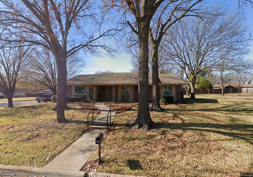
2900 Anthony Dr Sherman, TX 75092
Estimated Value: $289,261 - $321,000
3
Beds
3
Baths
1,953
Sq Ft
$156/Sq Ft
Est. Value
About This Home
This home is located at 2900 Anthony Dr, Sherman, TX 75092 and is currently estimated at $305,131, approximately $156 per square foot. 2900 Anthony Dr is a home located in Grayson County with nearby schools including Fairview Elementary School, Piner Middle School, and Dillingham Intermediate School.
Ownership History
Date
Name
Owned For
Owner Type
Purchase Details
Closed on
Dec 12, 2019
Sold by
Church George F and Church George Frank
Bought by
Bean Michael Paul and Bean Cynthia Curtis
Current Estimated Value
Home Financials for this Owner
Home Financials are based on the most recent Mortgage that was taken out on this home.
Original Mortgage
$90,000
Outstanding Balance
$75,971
Interest Rate
3.7%
Mortgage Type
New Conventional
Estimated Equity
$229,160
Create a Home Valuation Report for This Property
The Home Valuation Report is an in-depth analysis detailing your home's value as well as a comparison with similar homes in the area
Home Values in the Area
Average Home Value in this Area
Purchase History
| Date | Buyer | Sale Price | Title Company |
|---|---|---|---|
| Bean Michael Paul | -- | First Western Title |
Source: Public Records
Mortgage History
| Date | Status | Borrower | Loan Amount |
|---|---|---|---|
| Open | Bean Michael Paul | $90,000 |
Source: Public Records
Tax History Compared to Growth
Tax History
| Year | Tax Paid | Tax Assessment Tax Assessment Total Assessment is a certain percentage of the fair market value that is determined by local assessors to be the total taxable value of land and additions on the property. | Land | Improvement |
|---|---|---|---|---|
| 2025 | $6,179 | $276,199 | $84,630 | $191,569 |
| 2024 | $6,179 | $281,701 | $83,360 | $198,341 |
| 2023 | $6,129 | $279,160 | $51,704 | $227,456 |
| 2022 | $5,755 | $245,572 | $65,633 | $179,939 |
| 2021 | $5,570 | $222,221 | $65,633 | $156,588 |
| 2020 | $5,185 | $197,557 | $40,308 | $157,249 |
| 2019 | $5,329 | $206,108 | $39,960 | $166,148 |
| 2018 | $4,554 | $181,513 | $39,960 | $141,553 |
| 2017 | $4,231 | $169,951 | $39,960 | $129,991 |
| 2016 | $3,960 | $159,085 | $39,960 | $119,125 |
| 2015 | $2,157 | $148,049 | $39,960 | $108,089 |
| 2014 | $2,264 | $143,209 | $39,960 | $103,249 |
Source: Public Records
Map
Nearby Homes
- 3001 Redbud Trail
- 3116 Anthony Dr
- 3201 Anthony Dr
- 2514 Canyon Creek Dr
- 3205 Mimosa Dr
- 2909 Canyon Creek Dr
- 3001 Canyon Creek Dr
- 2505 San Miguel St
- 2512 Sherwood Dr
- 1610 Idlewood Dr
- 2911 Butterfield Trail
- 3217 Redbud Trail
- 000 W Lamberth Rd
- 2921 Sedalia Trail
- 1514 Andy Dr
- 2320 San Miguel St
- 1418 Lexington Dr
- 1507 Greenbrier Dr
- 1820 Jamaica Ln
- 162 Shady Oaks Cir
- 2908 Anthony Dr
- 2901 Mimosa Dr
- 2909 Mimosa Dr
- 2901 Anthony Dr
- 2912 Anthony Dr
- 2809 Mimosa Dr
- 2907 Anthony Dr
- 2913 Mimosa Dr
- 1812 Redbud Trail
- 1816 Redbud Trail
- 2916 Anthony Dr
- 1808 Redbud Trail
- 2900 Redbud Trail
- 2900 Mimosa Dr
- 2904 Mimosa Dr
- 2913 Anthony Dr
- 2917 Mimosa Dr
- 1804 Redbud Trail
- 2908 Mimosa Dr
- 2613 Mimosa Dr