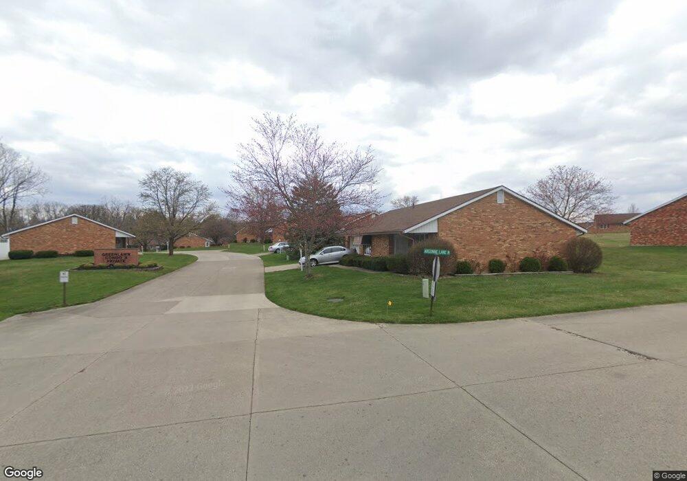
2900 Avery Cir Springfield, OH 45503
Estimated Value: $176,927 - $212,000
2
Beds
2
Baths
1,176
Sq Ft
$162/Sq Ft
Est. Value
About This Home
This home is located at 2900 Avery Cir, Springfield, OH 45503 and is currently estimated at $190,482, approximately $161 per square foot. 2900 Avery Cir is a home located in Clark County with nearby schools including Kenton Elementary School, Roosevelt Middle School, and Springfield High School.
Ownership History
Date
Name
Owned For
Owner Type
Purchase Details
Closed on
Dec 16, 2024
Sold by
Pitstick Fred L and Pitstick Teresa M
Bought by
Fred L Pitstick Revocable Living Trust and Pitstick
Current Estimated Value
Purchase Details
Closed on
Nov 18, 1994
Sold by
Compton Arthur B
Bought by
Fred L Pitstick and Fred Teresa M
Create a Home Valuation Report for This Property
The Home Valuation Report is an in-depth analysis detailing your home's value as well as a comparison with similar homes in the area
Home Values in the Area
Average Home Value in this Area
Purchase History
| Date | Buyer | Sale Price | Title Company |
|---|---|---|---|
| Fred L Pitstick Revocable Living Trust | -- | None Listed On Document | |
| Fred L Pitstick Revocable Living Trust | -- | None Listed On Document | |
| Fred L Pitstick | $65,000 | -- |
Source: Public Records
Tax History
| Year | Tax Paid | Tax Assessment Tax Assessment Total Assessment is a certain percentage of the fair market value that is determined by local assessors to be the total taxable value of land and additions on the property. | Land | Improvement |
|---|---|---|---|---|
| 2025 | $1,586 | $45,420 | $6,130 | $39,290 |
| 2024 | $1,546 | $31,300 | $5,380 | $25,920 |
| 2023 | $1,546 | $31,300 | $5,380 | $25,920 |
| 2022 | $1,584 | $31,300 | $5,380 | $25,920 |
| 2021 | $1,519 | $27,640 | $4,380 | $23,260 |
| 2020 | $1,522 | $27,640 | $4,380 | $23,260 |
| 2019 | $1,526 | $27,640 | $4,380 | $23,260 |
| 2018 | $1,433 | $24,920 | $3,820 | $21,100 |
| 2017 | $1,432 | $24,301 | $3,815 | $20,486 |
| 2016 | $1,434 | $24,301 | $3,815 | $20,486 |
| 2015 | $1,326 | $23,986 | $3,500 | $20,486 |
| 2014 | $1,320 | $23,986 | $3,500 | $20,486 |
| 2013 | $1,306 | $23,986 | $3,500 | $20,486 |
Source: Public Records
Map
Nearby Homes
- 3021 Argonne Ln N
- 3027 Argonne Ln N Unit 3027
- 2951 Archer Ln
- 732 Grandview Dr Unit 732
- 516 Rensselaer St
- 2824 Balsam Dr
- 3135 Imperial Blvd
- 958 Torrence Dr
- 224 Roscommon Dr
- 366 Northfield Blvd Unit 1C
- 3124 El Camino Dr
- 2540 Rebecca Dr
- 2553 Derr Rd
- 1032 Armsgate Rd
- 1046 Fruitland Rd
- 3031 Bradford Dr Unit 47
- 0 E Home Rd
- 1136 Foxboro Rd Unit 202
- 1149 Foxboro Rd
- 2002 N Fountain Blvd
- 548 Argonne Ave Unit 548
- 548 Argonne Ave
- 2904 Avery Cir
- 2901 Avery Cir Unit 2901
- 2908 Avery Cir Unit 2908
- 550 Argonne Ave
- 2905 Avery Cir
- 540 Argonne Ave Unit 540
- 541 Argonne Ave
- 541 Argonne Ave
- 541 Argonne Ave
- 2909 Avery Cir
- 2912 Avery Cir Unit 2912
- 2912 Avery Cir
- 538 Argonne Ave
- 2916 Avery Cir
- 536 Argonne Ave
- 2920 Avery Cir Unit 2920
- 539 Argonne Ave
- 539 Argonne Ave
Your Personal Tour Guide
Ask me questions while you tour the home.