Estimated Value: $779,872 - $912,000
Studio
--
Bath
2,574
Sq Ft
$330/Sq Ft
Est. Value
About This Home
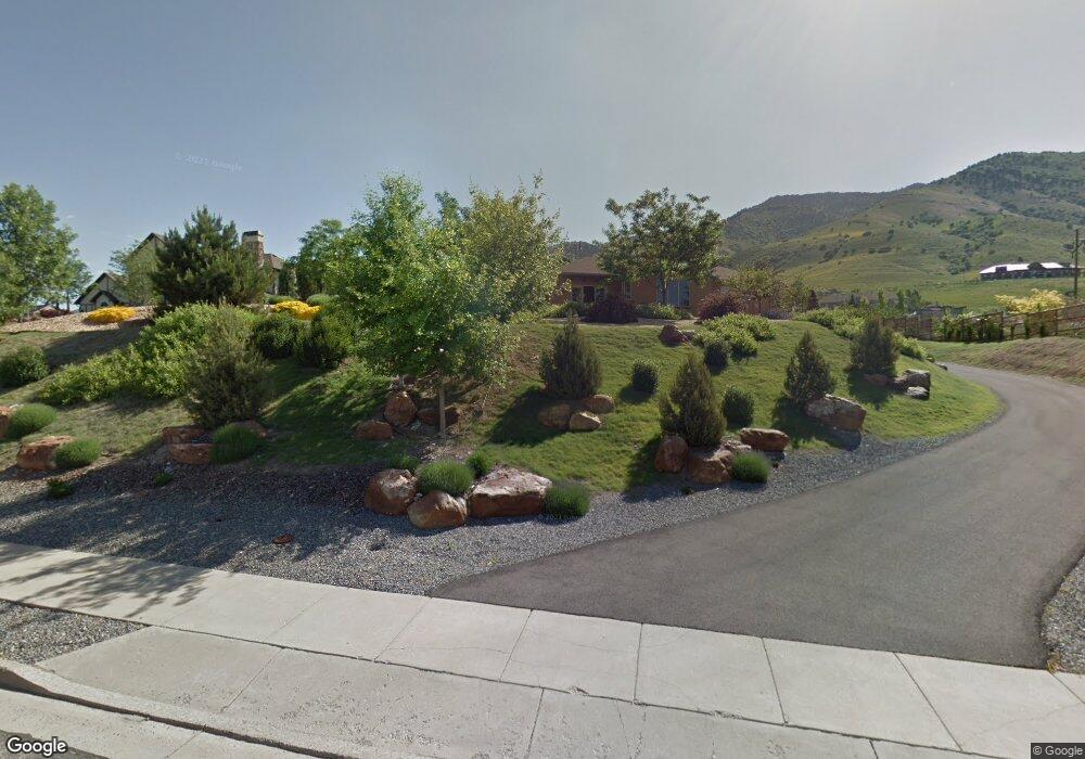
This home is located at 2900 N 2050 E, Logan, UT 84341 and is currently estimated at $849,218, approximately $329 per square foot. 2900 N 2050 E is a home with nearby schools including Greenville School, Cedar Ridge School, and North Cache Middle School.
Ownership History
Date
Name
Owned For
Owner Type
Purchase Details
Closed on
Oct 27, 2010
Sold by
Dyson Thomas A and Dyson Helga A
Bought by
Dyson Thomas A and Dyson Helga A
Current Estimated Value
Home Financials for this Owner
Home Financials are based on the most recent Mortgage that was taken out on this home.
Original Mortgage
$256,900
Interest Rate
4.33%
Mortgage Type
New Conventional
Purchase Details
Closed on
Jul 13, 2005
Sold by
Dyson Thomas A and Dyson Helga A
Bought by
Dyson Thomas A and Dyson Helga A
Home Financials for this Owner
Home Financials are based on the most recent Mortgage that was taken out on this home.
Original Mortgage
$272,000
Interest Rate
5.55%
Mortgage Type
New Conventional
Create a Home Valuation Report for This Property
The Home Valuation Report is an in-depth analysis detailing your home's value as well as a comparison with similar homes in the area
Home Values in the Area
Average Home Value in this Area
Purchase History
| Date | Buyer | Sale Price | Title Company |
|---|---|---|---|
| Dyson Thomas A | -- | Northern Title Company | |
| Dyson Thomas A | -- | Northern Title Company | |
| Dyson Thomas A | -- | Northern Title Company | |
| Dyson Thomas A | -- | Northern Title Company |
Source: Public Records
Mortgage History
| Date | Status | Borrower | Loan Amount |
|---|---|---|---|
| Closed | Dyson Thomas A | $256,900 | |
| Closed | Dyson Thomas A | $272,000 |
Source: Public Records
Tax History
| Year | Tax Paid | Tax Assessment Tax Assessment Total Assessment is a certain percentage of the fair market value that is determined by local assessors to be the total taxable value of land and additions on the property. | Land | Improvement |
|---|---|---|---|---|
| 2025 | $3,290 | $460,580 | $0 | $0 |
| 2024 | $3,069 | $399,790 | $0 | $0 |
| 2023 | $3,269 | $398,480 | $0 | $0 |
| 2022 | $3,421 | $398,480 | $0 | $0 |
| 2021 | $3,329 | $601,105 | $107,500 | $493,605 |
| 2020 | $3,412 | $577,701 | $107,500 | $470,201 |
| 2019 | $3,573 | $577,700 | $107,500 | $470,200 |
| 2018 | $3,150 | $493,870 | $85,000 | $408,870 |
| 2017 | $3,044 | $251,185 | $0 | $0 |
| 2016 | $3,091 | $189,130 | $0 | $0 |
| 2015 | $2,336 | $189,130 | $0 | $0 |
| 2014 | $2,281 | $189,130 | $0 | $0 |
| 2013 | -- | $188,580 | $0 | $0 |
Source: Public Records
Map
Nearby Homes
- 2827 E Viewcrest Cir
- 1990 E Canyon Ridge Dr
- 2275 E Meadow Lark Ln N
- 2573 N 2300 E Unit 45
- 2517 N 2050 E
- 2516 N 2300 E Unit 63
- 105 E 3100 N
- 1495 E 2300 N
- 78 S 1000 E Unit 115
- 94 S 950 E
- 108 S 900 E
- 86 S 950 E
- 1335 E 2300 N
- 1185 E 2500 N
- 124 N 1140 E
- 1128 E 50 N Unit 81
- 2025 N 1550 E
- 1810 N 2070 E Unit 10
- 894 E 130 N Unit 17
- 866 E 130 N
- 2930 Ridge View Dr
- 2870 N 2050 E
- 2970 Ridge View Dr Unit 2
- 2096 E 2850 N
- 2895 N 2050 E
- 2935 Ridge View Dr
- 2948 N 2050 E Unit 35
- 2948 Ridgeview Dr
- 2865 Ridge View Dr
- 2865 Ridge View Dr
- 2060 E 2850 N
- 2945 N 2050 E
- 2835 N 2050 E
- 2885 N 2100 E
- 2835 Ridge View Dr
- 2915 Mahogony Valley Rd
- 2885 Mahogony Valley Rd Unit 1
- 2885 Mahogony Valley Rd
- 2960 Ridge View Dr
- 2907 Viewcrest Cir
Your Personal Tour Guide
Ask me questions while you tour the home.