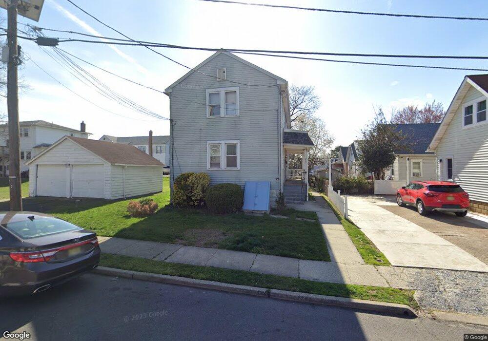
2901 Calvert Ave Haddon Township, NJ 08107
Estimated Value: $372,416 - $462,000
--
Bed
--
Bath
2,080
Sq Ft
$206/Sq Ft
Est. Value
About This Home
This home is located at 2901 Calvert Ave, Haddon Township, NJ 08107 and is currently estimated at $428,354, approximately $205 per square foot. 2901 Calvert Ave is a home located in Camden County with nearby schools including William G. Rohrer Middle School and Haddon Township High School.
Ownership History
Date
Name
Owned For
Owner Type
Purchase Details
Closed on
May 6, 2022
Sold by
Scott Hoisington
Bought by
182 Paulsboro Llc
Current Estimated Value
Purchase Details
Closed on
Jul 27, 2000
Sold by
Branin Howard
Bought by
Hoisington Scott
Home Financials for this Owner
Home Financials are based on the most recent Mortgage that was taken out on this home.
Original Mortgage
$84,356
Interest Rate
8.18%
Mortgage Type
FHA
Create a Home Valuation Report for This Property
The Home Valuation Report is an in-depth analysis detailing your home's value as well as a comparison with similar homes in the area
Home Values in the Area
Average Home Value in this Area
Purchase History
| Date | Buyer | Sale Price | Title Company |
|---|---|---|---|
| 182 Paulsboro Llc | $300,000 | Foundation Title | |
| 182 Paulsboro Llc | $300,000 | Foundation Title | |
| Hoisington Scott | $85,000 | -- |
Source: Public Records
Mortgage History
| Date | Status | Borrower | Loan Amount |
|---|---|---|---|
| Previous Owner | Hoisington Scott | $84,356 |
Source: Public Records
Tax History Compared to Growth
Tax History
| Year | Tax Paid | Tax Assessment Tax Assessment Total Assessment is a certain percentage of the fair market value that is determined by local assessors to be the total taxable value of land and additions on the property. | Land | Improvement |
|---|---|---|---|---|
| 2025 | $7,610 | $361,300 | $87,600 | $273,700 |
| 2024 | $7,388 | $193,300 | $42,600 | $150,700 |
| 2023 | $7,388 | $193,300 | $42,600 | $150,700 |
| 2022 | $7,307 | $193,300 | $42,600 | $150,700 |
| 2021 | $7,372 | $193,300 | $42,600 | $150,700 |
| 2020 | $7,330 | $193,300 | $42,600 | $150,700 |
| 2019 | $7,059 | $193,300 | $42,600 | $150,700 |
| 2018 | $7,023 | $193,300 | $42,600 | $150,700 |
| 2017 | $6,918 | $193,300 | $42,600 | $150,700 |
| 2016 | $6,789 | $193,300 | $42,600 | $150,700 |
| 2015 | $6,570 | $193,300 | $42,600 | $150,700 |
| 2014 | $6,454 | $193,300 | $42,600 | $150,700 |
Source: Public Records
Map
Nearby Homes
- 1315 Grant Ave
- 1210 Eldridge Ave
- 1112 Grant Ave
- 1623 Olympia Rd
- 3069 S Congress Rd
- 1662 Minnesota Rd
- 1325 Walnut Ave
- 3120 S Constitution Rd
- 3204 Alabama Rd
- 1113 Newton Ave
- 1224 Walnut Ave
- 3044 N Merrimac Rd
- 424 Sloan Ave
- 2930 N Merrimac Rd
- 3156 Alabama Rd
- 1433 N Chesapeake Rd
- 2931 N Constitution Rd
- 331 Sloan Ave
- 1333 Argus Rd
- 3079 Alabama Rd
- 1304 Grant Ave
- 1300 Grant Ave
- 1303 Collings Ave
- 1308 Grant Ave
- 1307 Collings Ave
- 1220 Grant Ave
- 1220 Grant Ave Unit A
- 1220 Grant Ave Unit B
- 1220 Grant Ave Unit 2
- 1220 Grant Ave Unit 1
- 1312 Grant Ave
- 1309 Collings Ave
- 1311 Collings Ave
- 1218 Grant Ave
- 1303 Grant Ave
- 1301 Grant Ave
- 1216 Grant Ave Grant Ave
- 1216 Grant Ave
- 1221 Grant Ave
- 1307 Grant Ave