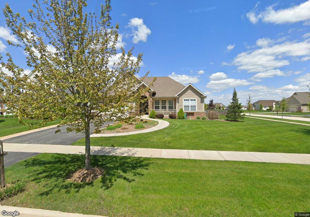
2901 Carlisle Ln North Aurora, IL 60542
Nelson Lake NeighborhoodEstimated Value: $521,416 - $563,000
--
Bed
--
Bath
2,463
Sq Ft
$219/Sq Ft
Est. Value
About This Home
This home is located at 2901 Carlisle Ln, North Aurora, IL 60542 and is currently estimated at $540,604, approximately $219 per square foot. 2901 Carlisle Ln is a home located in Kane County with nearby schools including Fearn Elementary School, Herget Middle School, and West Aurora High School.
Ownership History
Date
Name
Owned For
Owner Type
Purchase Details
Closed on
Dec 17, 2007
Sold by
Remington Landing Llc
Bought by
Weldon William W and Weldon Sharon B
Current Estimated Value
Home Financials for this Owner
Home Financials are based on the most recent Mortgage that was taken out on this home.
Original Mortgage
$217,000
Interest Rate
6.27%
Mortgage Type
Purchase Money Mortgage
Create a Home Valuation Report for This Property
The Home Valuation Report is an in-depth analysis detailing your home's value as well as a comparison with similar homes in the area
Home Values in the Area
Average Home Value in this Area
Purchase History
| Date | Buyer | Sale Price | Title Company |
|---|---|---|---|
| Weldon William W | $437,000 | Chicago Title Insurance Co |
Source: Public Records
Mortgage History
| Date | Status | Borrower | Loan Amount |
|---|---|---|---|
| Closed | Weldon William W | $217,000 |
Source: Public Records
Tax History Compared to Growth
Tax History
| Year | Tax Paid | Tax Assessment Tax Assessment Total Assessment is a certain percentage of the fair market value that is determined by local assessors to be the total taxable value of land and additions on the property. | Land | Improvement |
|---|---|---|---|---|
| 2024 | $10,990 | $159,217 | $12,735 | $146,482 |
| 2023 | $10,606 | $143,698 | $11,494 | $132,204 |
| 2022 | $9,686 | $125,774 | $10,549 | $115,225 |
| 2021 | $9,492 | $120,381 | $10,097 | $110,284 |
| 2020 | $9,849 | $117,559 | $9,860 | $107,699 |
| 2019 | $10,176 | $115,833 | $9,715 | $106,118 |
| 2018 | $10,375 | $114,413 | $9,715 | $104,698 |
| 2017 | $10,544 | $113,113 | $9,605 | $103,508 |
| 2016 | $10,963 | $114,158 | $9,352 | $104,806 |
| 2015 | -- | $111,069 | $8,987 | $102,082 |
| 2014 | -- | $102,372 | $10,000 | $92,372 |
| 2013 | -- | $102,372 | $10,000 | $92,372 |
Source: Public Records
Map
Nearby Homes
- 2772 Berman Rd Unit 1A
- 483 Glover Dr
- 512 Bennett Dr
- 2045 Bartram Rd
- 921 N Deerpath Rd
- 876 Fair Meadow Ct
- 868 Fair Meadow Ct
- 916 Fair Meadow St
- 867 Fair Meadow Ct
- 909 Fair Meadow St
- 875 Fair Meadow Ct
- Maxfield Plan at Autumn Ridge
- Morgan Plan at Autumn Ridge
- Newbury Plan at Autumn Ridge
- Quinn Plan at Autumn Ridge
- Paxton Plan at Autumn Ridge
- Leyden Plan at Autumn Ridge
- 1799 Breton Ave
- 917 Fair Meadow St
- 2S720 Nelson Lake Rd
- 2909 Carlisle Ln
- 2902 Hampton Ave
- 2917 Carlisle Ln
- 2910 Hampton Ave
- 668 Western Dr
- 685 Western Dr
- 693 Western Dr
- 677 Western Dr
- 2925 Carlisle Ln
- 2918 Hampton Ave
- 701 Western Dr
- 669 Western Dr
- 2926 Hampton Ave
- 660 Western Dr
- 709 Western Dr
- 2933 Carlisle Ln
- 661 Western Dr
- 2914 Sterkel Rd
- 2934 Hampton Ave
- 652 Western Dr